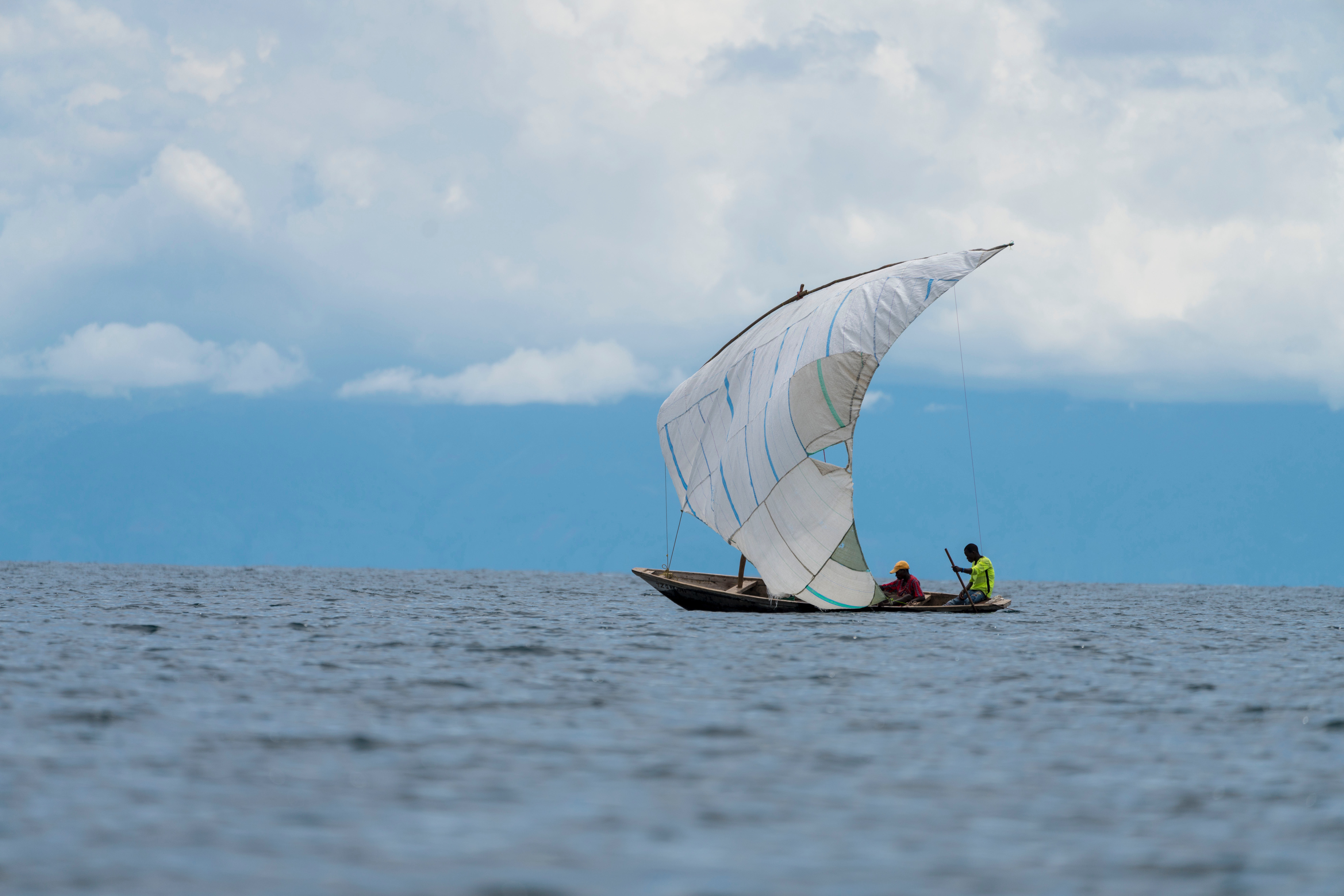
I’m proud to report that I’ve completed the second lake on my African trifecta, Lake Tanganyika. Lake Tanganyika is the longest lake in the world, the second largest by volume, the second deepest, and is known for its diversity of fish species.
 Before I go on about this leg of the expedition, I’d like to give an update on expedition ethics. When I came up with the idea of this trip, I decided that I wanted to do it in the best style possible. To me, that meant solo, human powered, and without a support team. I intended to carry all of my equipment along with me, resulting in no reliance on others – truly unsupported.
Unfortunately, I found that the weight of my equipment made it impossible to bicycle between lakes considering the topography along my route. So, begrudgingly, I made the decision to send the kayak ahead to Lake Tanganyika where I met up with it after about a week of bicycling. I’m still going strong on the other aspects that I am striving for: solo, human powered, and without a support team. But I can’t claim entirely unsupported anymore. Perhaps someone will come along in the future and improve on my style.
I started Lake Tanganyika at Kasanga, near the Tanzanian border with Zambia. From there, the lake stretches out as far as you can see to the north. It’s rather narrow there though, so you can see across to Zambia and the DRC.
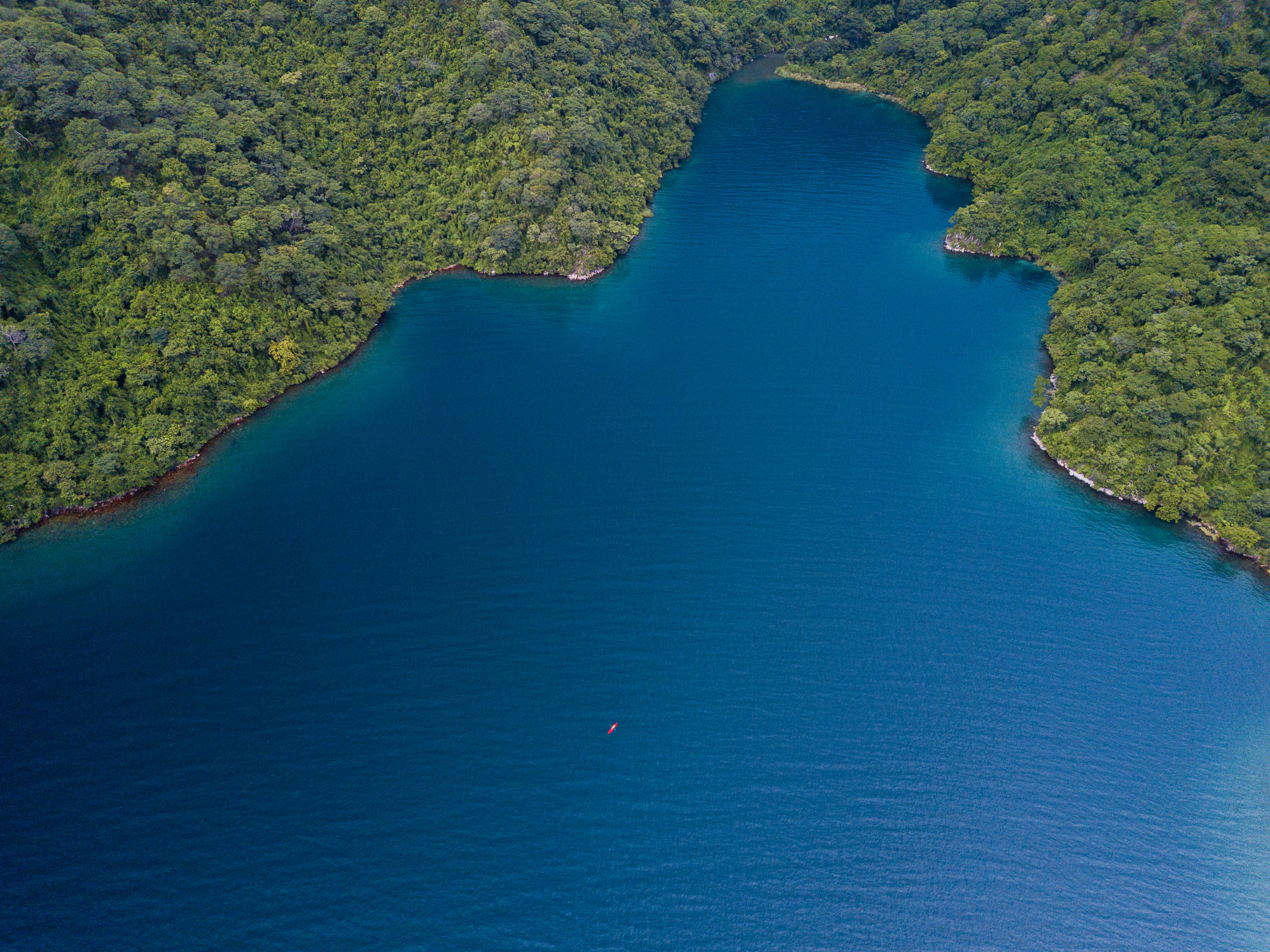
The southern portion of the lake, between Kasanga and Kipili is extraordinarily beautiful. The lake is deep, with clear, blue water and a dramatic shoreline of mountains and large boulders – many larger than a house. With the exception of one day, the weather was calm and I made good time of about 25 miles a day.
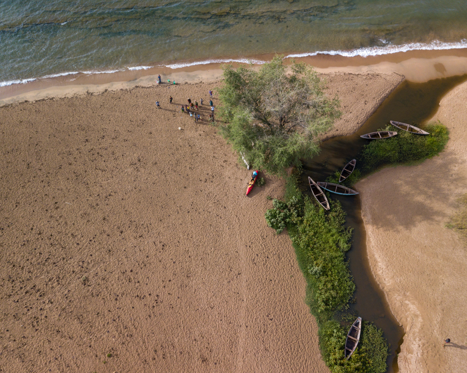
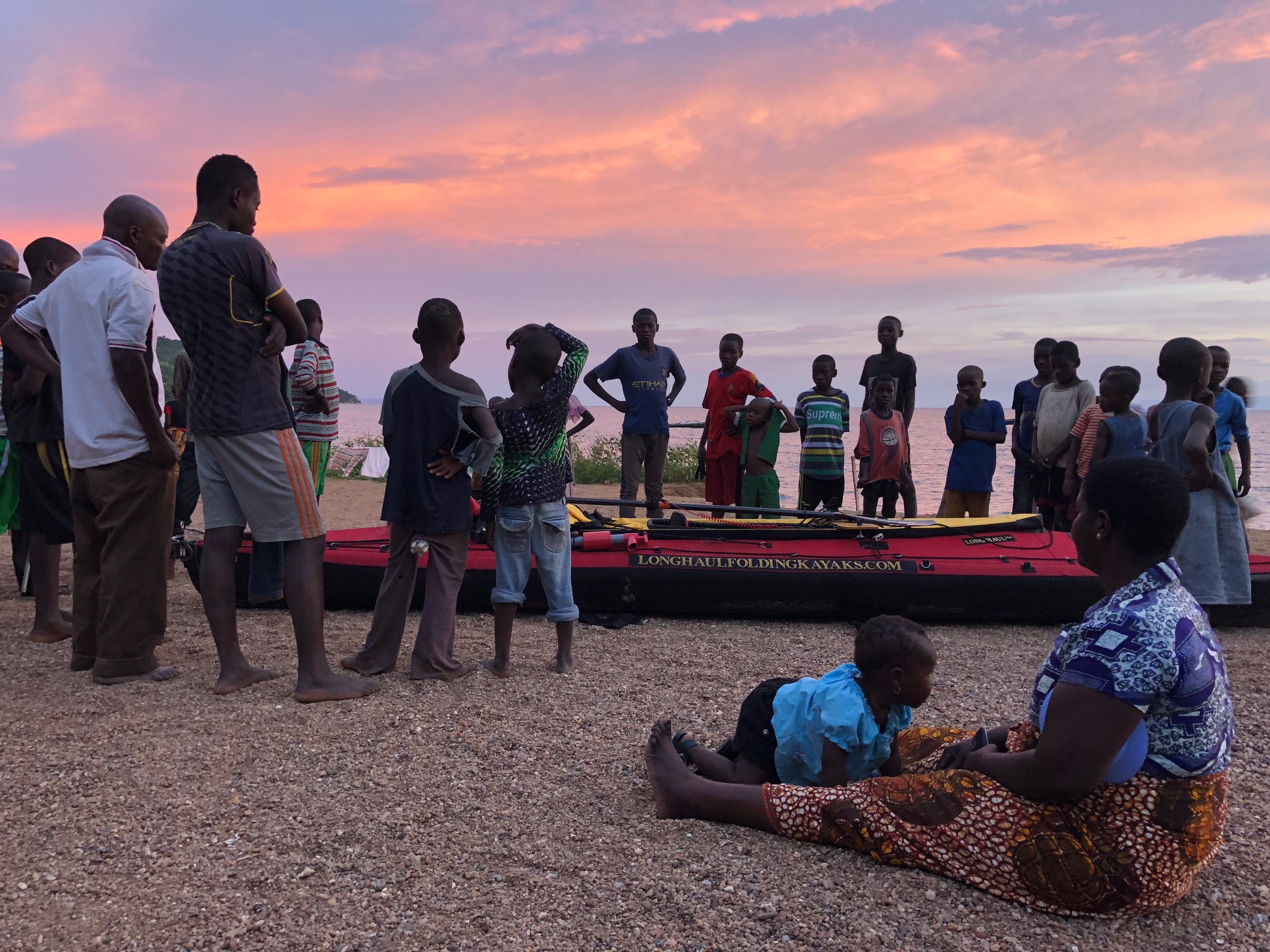
This area is not very populated, so I split my time between “bush” camping on wild beaches and staying in small fishing villages. Staying in the fishing villages was a similar experience to Lake Malawi, except that very few people in this region speak English, so communication was more difficult.
 With the benefit of having experienced two full lakes, I can confidently say that this southern section, as well as Mahale Mountain National Park, are the most beautiful paddling segments so far. I think that any paddler would find Kasanga to Kipili to be extraordinarily rewarding, and worthy of consideration as a world class sea kayaking destination.
This section ended at Lake Shore Lodge in Kipili. It’s a really cool place that must feel like the end of the Earth to most guests arriving there, but to me it felt more like going back into civilization. The two South African owners, Louise and Chris, hosted me and provided luxuries that I had grown unaccustomed to on the water. They have vast experience on the lake, including long sea kayaking trips and a fleet of boats (even equipped with a compressor for SCUBA), so I greatly enjoyed sharing my experiences with them and soliciting as much advice as possible.
I headed out from Kipili feeling good, and completely unaware of the challenge that I was going to face.
If you had asked me before this lake what I was most concerned about, I would’ve probably said crocodiles or hippos or maybe getting sick in such a remote area. As it turns out, something called Rukuga was going to be my biggest obstacle.
That first day out of Kipili, I enjoyed calm weather until late afternoon. At that point, a strong north wind started blowing and I headed to a beach to see if it would stop. After about an hour, I decided to spend the night there. The beach was only about 10 feet wide and before a steep sand bank went up about another ten feet. I set up my tent up on the bank, but something seemed ominous about my boat below, so I decided that I needed to bring it up also.
This wasn’t so easy because I’m paddling a tandem Long Haul Folding Kayak – a capable, but not light, boat. What I ended up doing was flipping it several times, basically rolling it up the hill. It worked, and I made dinner and went to bed.
In the night, an extremely powerful storm came through. It was one of those storms that pulls the tent stakes out of the ground immediately and makes you sit up and brace the tent for fear that the poles will snap.
In the morning, much to my surprise, the beach below was completely gone and there were only jagged rocks present. The waves from the storm has pounded the beach and removed all of the sand. The lake itself seemed angry, with serious wind chop and about a 15 knot north wind. Still, I felt that it would likely pass by midday and I might as well head out.
I paddled north and made very poor progress due to the north wind. It formed rolling waves of 6-9 feet and required power to overcome. In 10 hours of paddling, I managed a measly 19 miles. That certainly didn’t match the effort that I had expended.
I stopped in a village for the night. Here, I was actually able to connect to the Internet and look at the weather forecast. It’s hard to explain how it felt to see that the forecast called for 10-15 knot north winds for at least the next week. It seemed that there was a point, basically the northern terminus of Mahale Mountain National Park, where a west wind from the Congo would split north and south. It was about 100 miles away, and I didn’t see any alternative to just forcing my way through it, as unappealing as that seemed. I certainly couldn’t wait for a week and hope that it would stop.
I’d later find out that this wind is called Rukuga, and it’s a seasonal north wind that brings rain. It usually only lasts 2-3 days, but occasionally lasts longer. In this case, it seemed like I’d need to pass it myself rather than wait for it to end.
The next few days were difficult. I’d paddle for about 10 hours and only manage 17-20 miles a day. The topography of the shoreline didn’t give me much shelter, and because of the strength of the wind, I was forced to paddle consistently for fear of being blown backwards and losing ground.
Eventually, I made it to where the land mass juts out into the lake and forms Mahale Mountain National Park. I planned on paddling around a point and then camping just outside the southern boundary of the park. From there, I’d have to cover 30 miles on the following day to make it to a lodge, Greystoke Camp, where I would spend the night. Although I had been averaging under 20 miles a day, I was still hopeful that I could make it to Greystoke in one day. This was especially true because Mahale has a large hippo and crocodile population and poor beaches for landing and camping safely.
As I paddled out to the point, I was still heading into the wind. I wasn’t sure if it was wrapping around the land, or truly blowing from the west, but when I turned the corner it was extremely rough and the wind was blowing furiously from the north. Although the waves were close to 10 feet, they were rolling waves and weren’t dangerous to me, but I quickly realized that I couldn’t make progress in those conditions so I turned back around for the shelter of the point.
I went back out twice more, but found that the conditions hadn’t improved and realized that I would need to camp there for the night. This was a low point, as I was 6 miles south of the park boundary and certainly 36 miles made Greystoke out of reach. I assumed that I’d need two days of struggling against headwinds to make it to camp, which meant a night alone in the National Park.
In the morning I paddled out and, shockingly, found a south wind! By 1230, I reached the best looking landing site from the satellite maps and had to make a decision – stop here for the day or push on to Greystoke. If I went forward, I probably had to make it because it didn’t seem like there were any other good places to pull out in the next 15 miles.
But it was only 12:30, and despite an uneasy feeling that the wind would turn, I headed north. Amazingly, the wind did not turn, and after a week of brutal north winds, on the day that I really needed help, the winds completely changed direction and helped me paddle my new one day record, 36 miles.
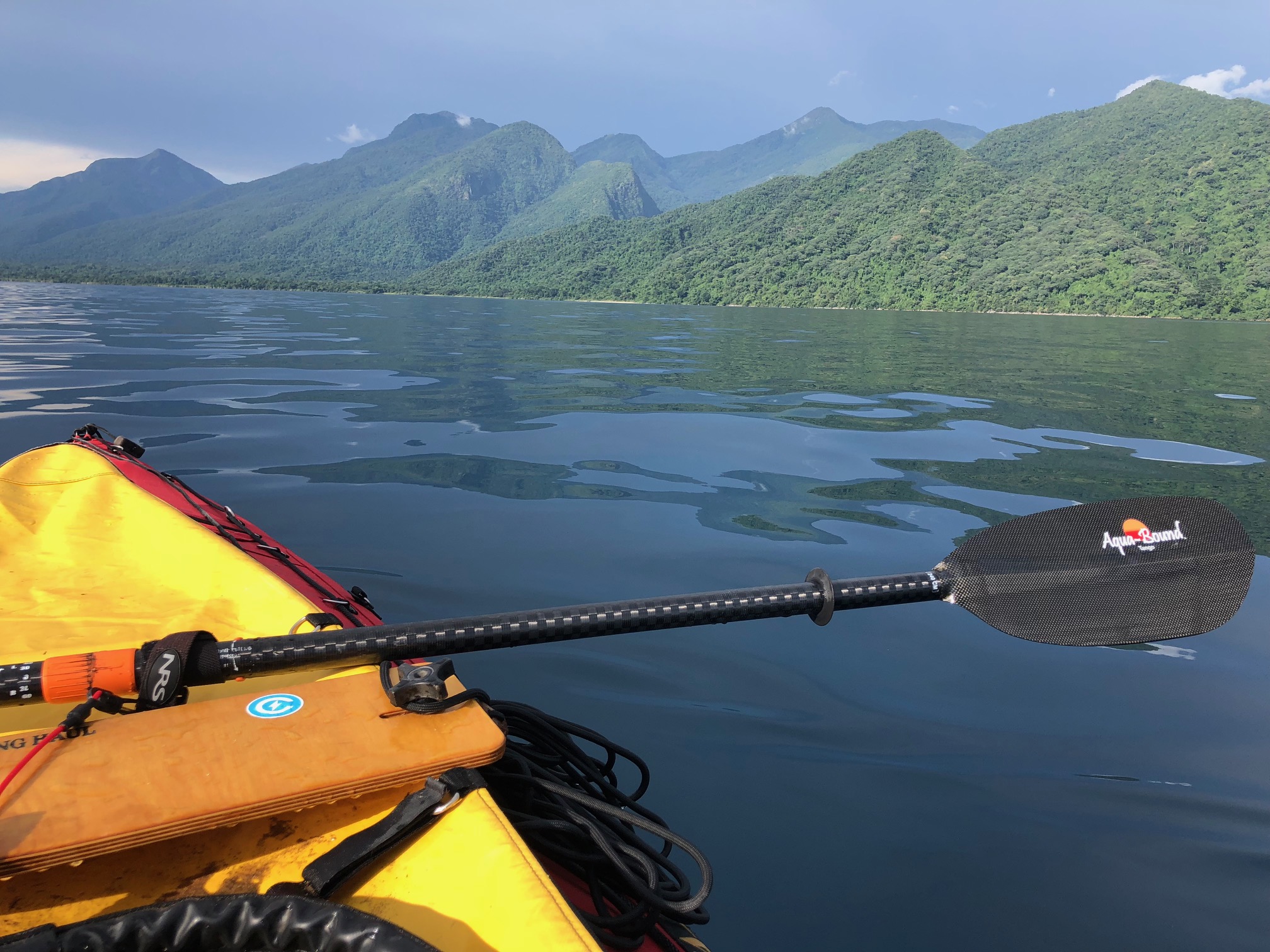 Mahale Mountain National Park is an incredible landscape of several thousand foot mountains, covered in thick tropical jungle, abruptly falling down into the blue lake below. When I was paddling south of Greystoke, I started to hear this loud series of noises emanating from the forest above. There was no question what it was: a community of chimpanzees were warning about my presence.
Arriving at Greystoke was such a remarkable feeling. I felt proud to arrived there in the manner that I had and so grateful for their warm welcome. Greystoke is a remote, luxury camp which rivals any camp in Africa. It’s only accessible by water and air, and has direct access to semi-habituated communities of chimpanzees.
The architecture of the main building immediately signaled what this place was like: open air, constructed of natural and local materials, but exquisite and immaculate. That night I had dinner with the other guests and the managers, Fabio and Barbara, and regaled them stories of my current expedition, as well as some older classics. I told my Amazon pirate story, as I do whenever it seems marginally relevant. I went to sleep happy.
The company and hospitality of everyone at Greystoke, the creature comforts of the camp, and the knowledge that I had made it to within a stone’s throw of the dividing line of the Rukuga wind, only a few miles to my north, had resulted in a foundational change in my attitude. My faith that I would succeed on this lake was renewed.
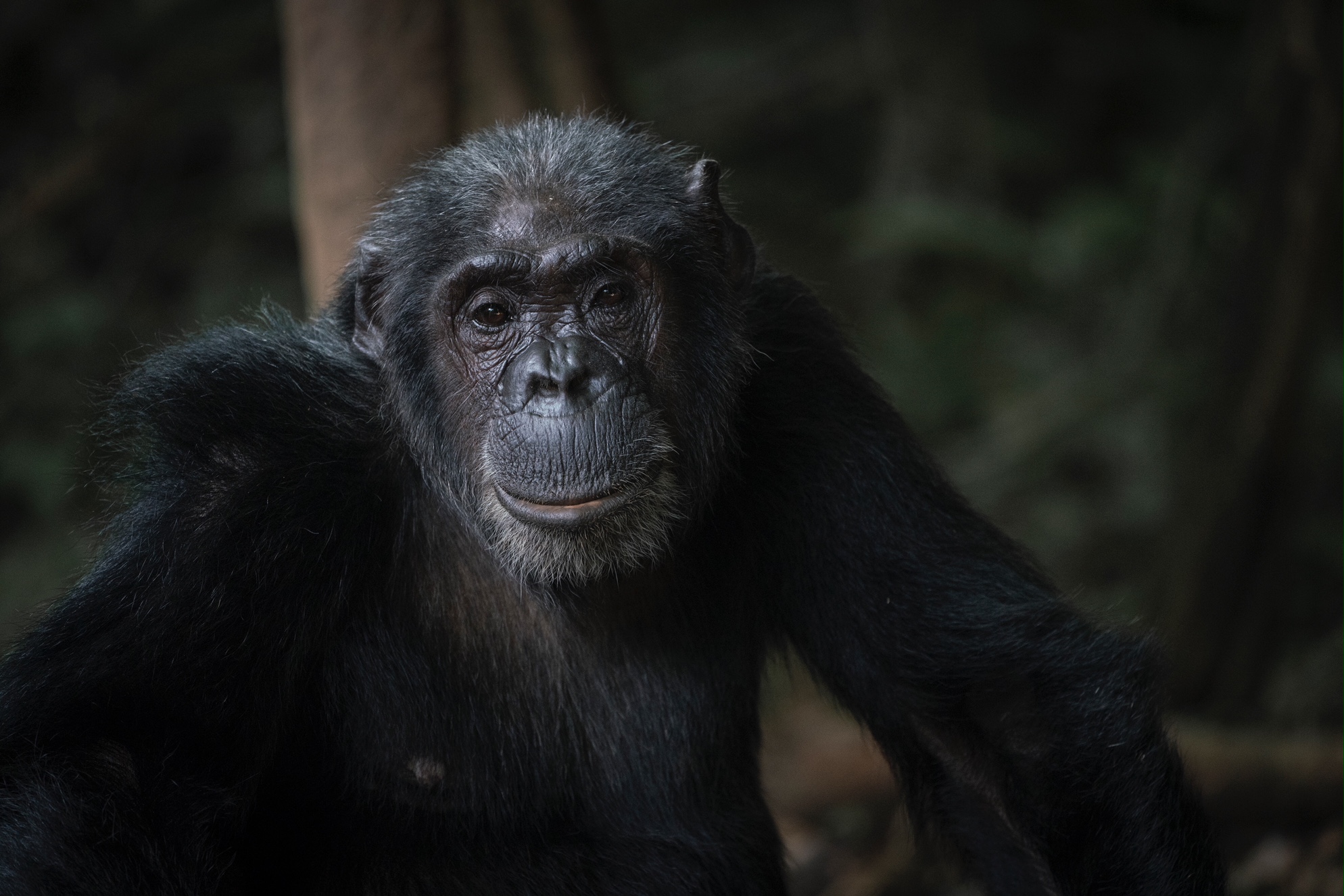 The next day was a blur of pleasure. I went out and observed a group of chimpanzees, 14 in total including multiple babies. Although Mahale Mountain National Park’s sister park, Gombe Stream National Park is perhaps more famous due to the fact that it was the location of Jane Goodall’s work, Mahale is larger, wilder, and contains many times more chimpanzees. It has also hosted researchers since the 1960s. This has resulted in communities of semi-habituated chimpanzees that will allow you to observe them at close range without aggression. At times, I was within a few feet of them. Without overly anthropomorphizing our close relatives, they really did seem to have interesting, human like behaviors. At times there were disputes within the group and they would make noises and scatter. Then they would draw back in to a tighter unit. Mothers cared for the babies, who played and explored. It was magical.
The next morning I was of course sad to go, but my psyche was entirely different than it had been before Mahale and Greystoke. I enthusiastically paddled north out of the park and towards my last scheduled stop on the lake: The Nature Conservancy’s (TNC) Tuungane Project office in Buhingu.
In Buhingu, I met with TNC resident experts who were working at the Buhingu office. They graciously allowed me to spend 2 nights there, and observe some of the work that they were doing. Just by chance, I was there during a training session of people from the different communities. Each of the 16 villages had sent their two best people to be trained on climate smart agriculture by their instructor, Apollinaire Williams. In the morning there was a classroom session, and in the afternoon we went out to the field, where Apollinaire instructed them on how to collect field data, identify suitable agricultural areas, and appropriate planning for sustainable agriculture. I think that TNC is unique in that it has the capacity and expertise to train people to contribute to the project.
After that, I went and met with Jeremiah Daffa, who is the Governance and Gender Officer at the Buhingu office. We attended a practice of the Mahale Youth Drummer Group, who have been organized under the Tuungane Project’s “model household” initiative. The members of the group were educated on family planning, gender equity, and environmental sustainability, and then they have written their own songs which they perform in different villages to educate other people. Jeremiah’s other work include initiatives to prevent early pregnancies, address the problem of girls not reaching secondary school, preventing the production of bush charcoal (a job predominantly carried out by women), and working to make sure that there are beneficial relationships between the Tuungane Project and other stakeholder, partner, and related organizations, such as the local, regional, and national governments, Pathfinder International, the Jane Goodall Institute, and the Frankfurt Zoological Society.
Again, I left there in high spirits. The Tuungane is doing good work, and their Population, Health, and Environment approach to conservation has me very optimistic about the region.
The remaining portion of the lake was unremarkable. The weather was good and I was able to make swift progress, paddling 75 miles in my final 2 days. I did start to meet Congolese and Burundian people, who had come to Tanzania to escape the turmoil of their own countries. The population closer to Kigoma is larger and the lake is more obviously impacted.
I reached Kigoma, the most remote large town in Tanzania, about 3 weeks after I set out from Kasanga. Despite the challenges, my time on Tanganyika was incredibly special, and I urge others to go visit. It’s world class.
Right now I’m biking between Lake Tanganyika and Lake Victoria, and I’ll check back in with updates soon.

