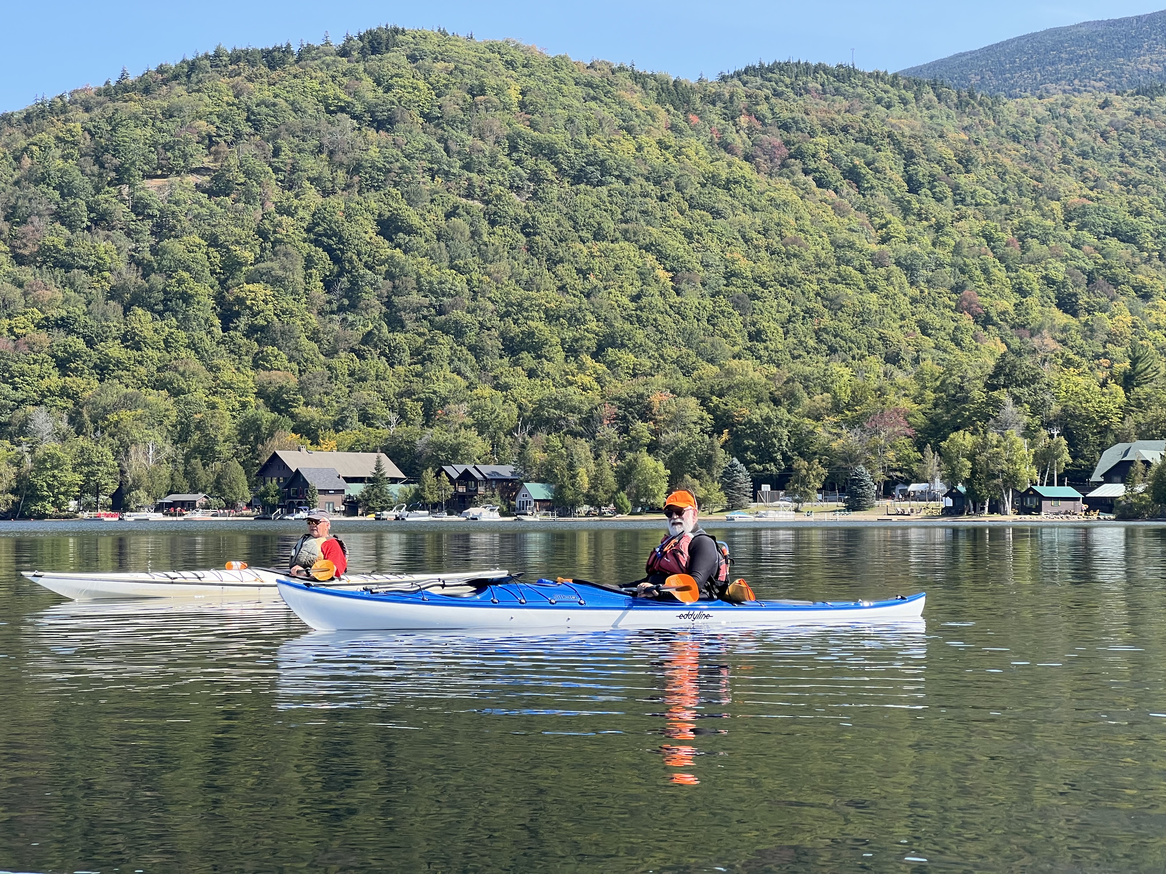
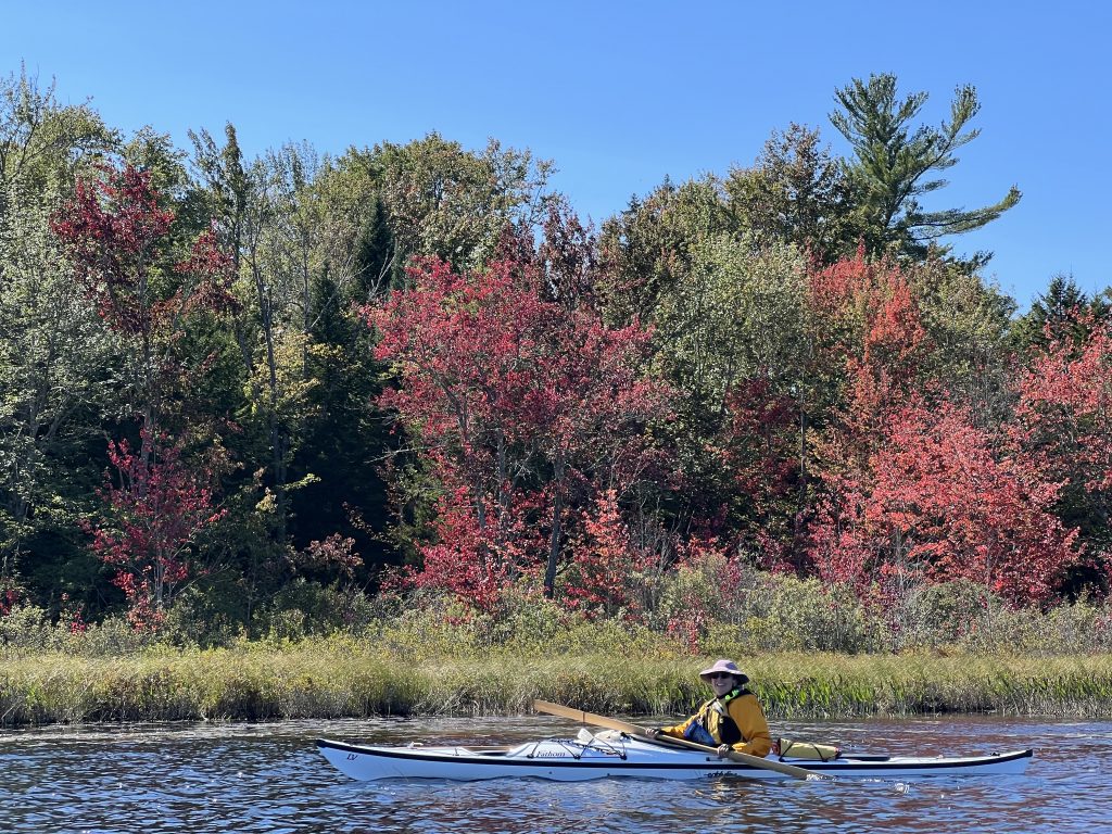
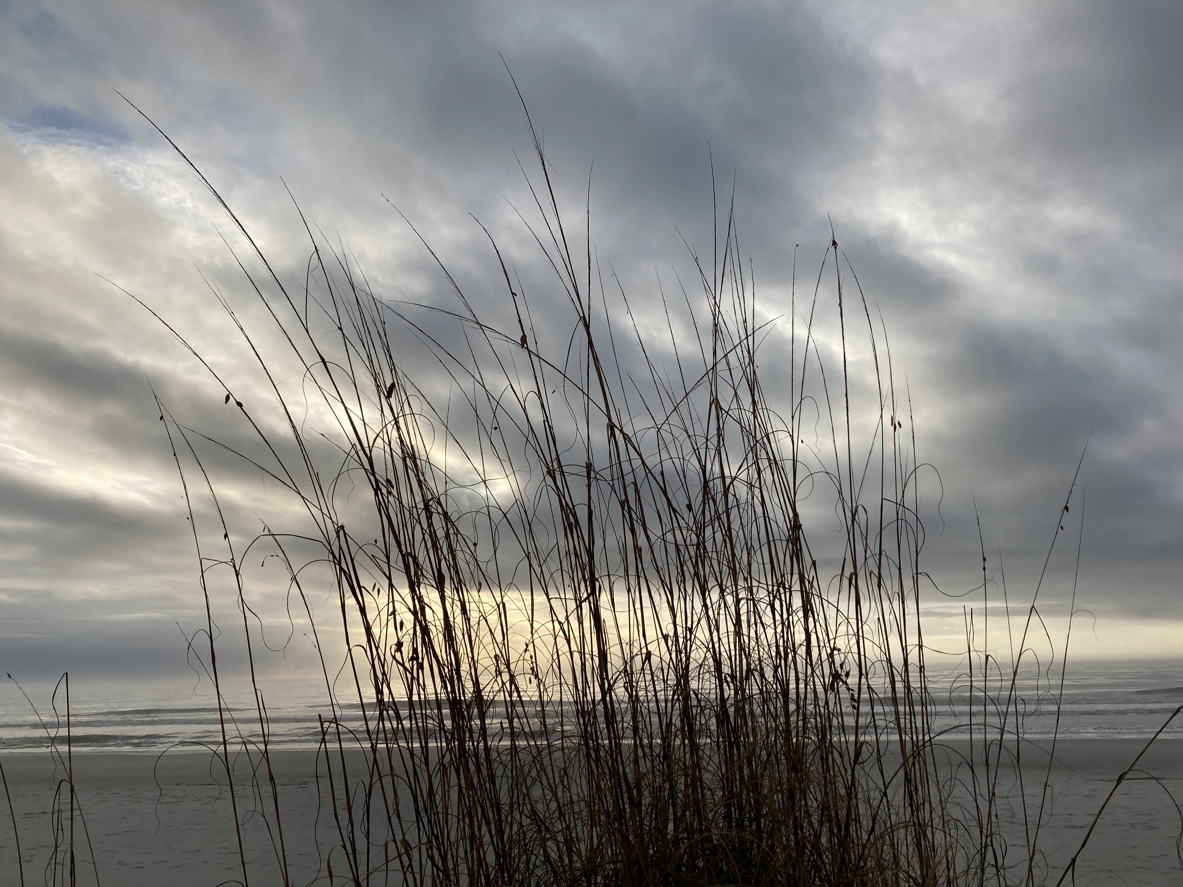
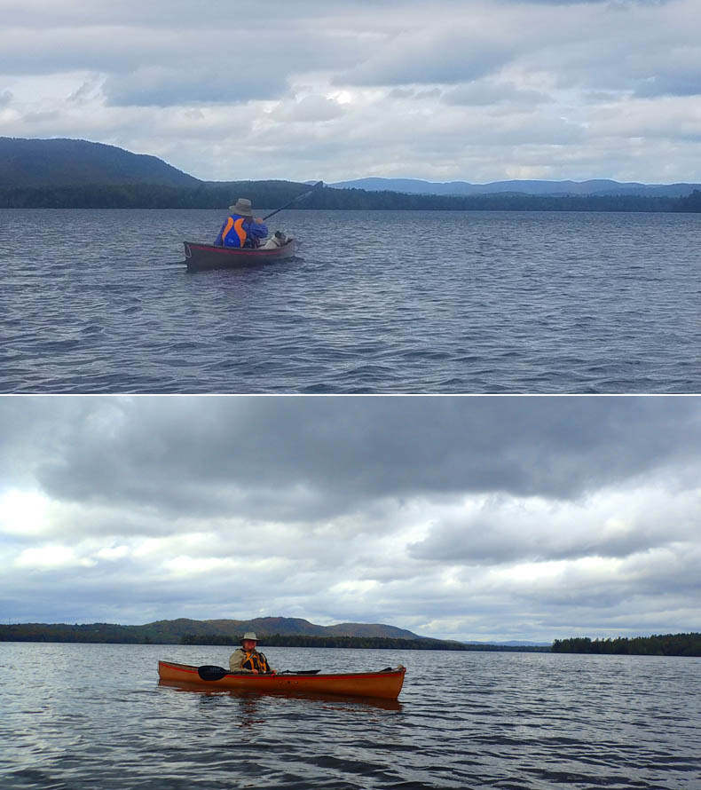
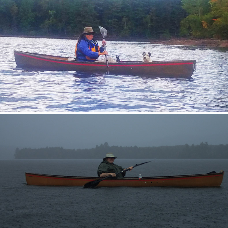
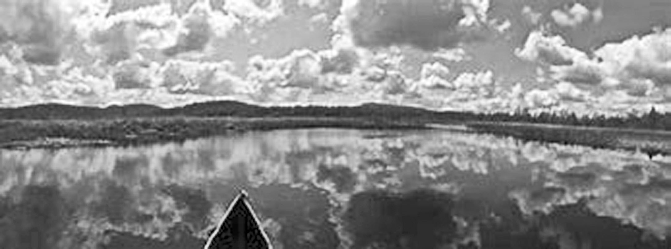
Bill Luther and Peter Hill paddle Blue Mountain Lake.
By Bill Luther
Why do RICKA paddlers have to travel 250 miles to get together to have a good time? It’s a long way from home. You have to stay overnight. They don’t serve hot wieners or coffee milk in this part of the world. The State police do stop you for running stop signs. I don’t know. I guess it’s just one thing. We’re on vacation and like to have FUN!
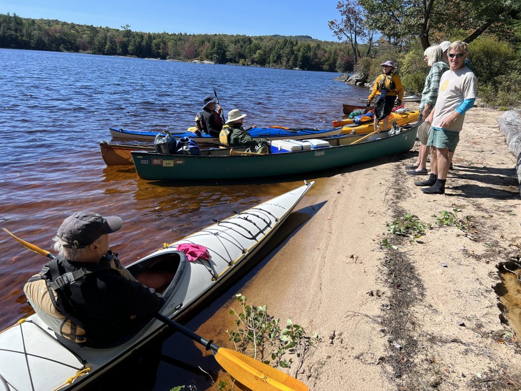
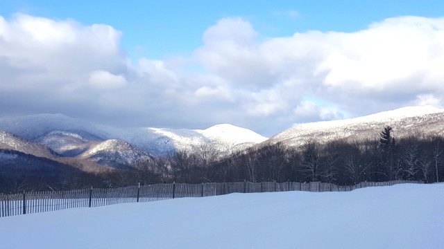
Henry Dziadosz, Barbara August and I were on the first RICKA trip on the Chain of Lakes in 1983 and discovered the joys of portaging over a seven-day period. Since then we’ve had a new approach and just do short day trips like sane people do. Besides Henry, no one has made the trip every year. Much has changed. Now we bring sea kayaks and mobile camping trailers and more than 30 people go every year. I guess it must have become big time fun, this Adirondack Week of Paddling.
This year, Peter Hill and I arrived at Lake Eaton Campground on Sunday at 2:00. The first two days were not summer-like with highs in the 50’s and dampness in the air. We kept telling each other that it would be nice after that. It was but that didn’t help with our “What have we got ourselves into” attitudes.
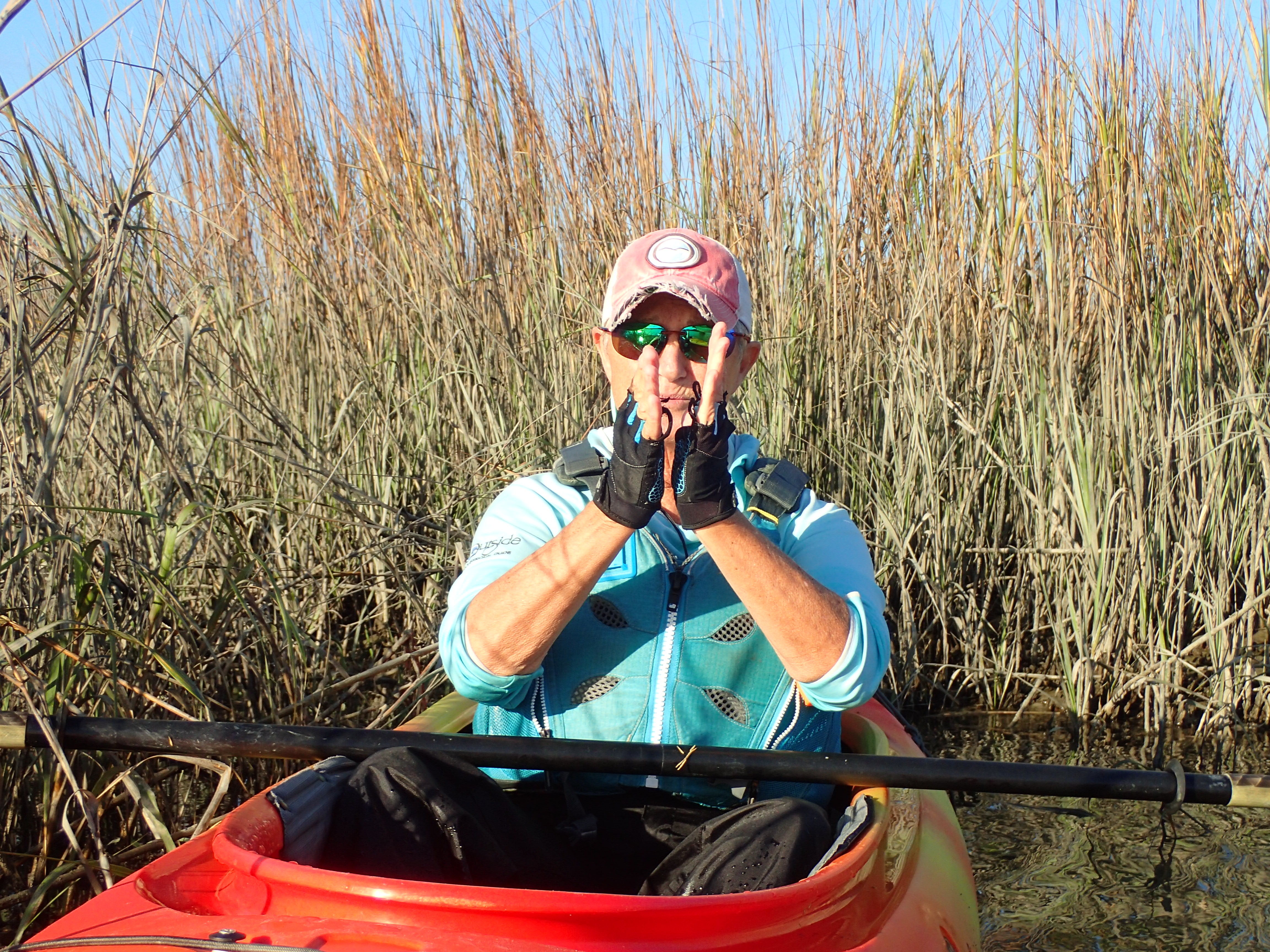
On Monday we did a short 6-mile, up-and-back paddle on Long Lake from the town beach. We did our “Monsters on Main Street’ pose for the camera on entry. Others were eager. I was not chipper. I didn’t feel warm until I crawled into the sleeping bag later that night. I wanted to talk to the leaders to see if I could leave summer camp early this year.
It was 38 degrees when we woke on Tuesday morning. Like a fool, I had forgotten my cooking gear, but was lucky enough to scrounge a cup of coffee. This was not going well. So I sucked it up and got ready to paddle nearby Round Lake.
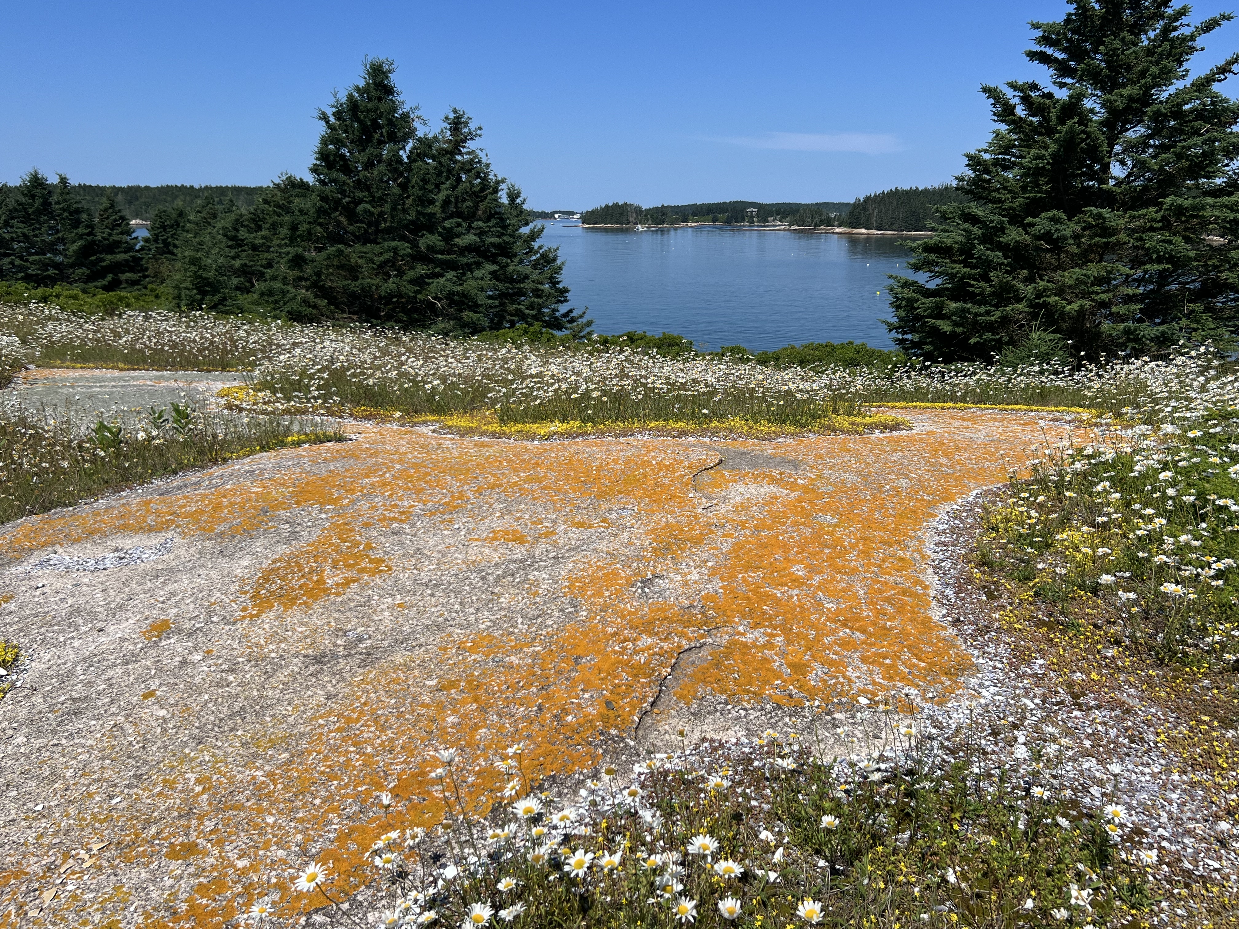
At first 15 of us paddled up to a small beaver dam and looked at the trees along the shore that were turning crimson red. The wind was picking up to 15 mph as we entered the lake. Some of the solo boaters in canoes and short kayaks turned around to return.
Five of us continued to the beach area and talked to a small group from out of state who were camping for the night. These were primitive sites and had gorgeous views for those who dared to venture. On our return leg, the wind had abated and become almost glass-like for us to enjoy and engage in easy chit chat talk.
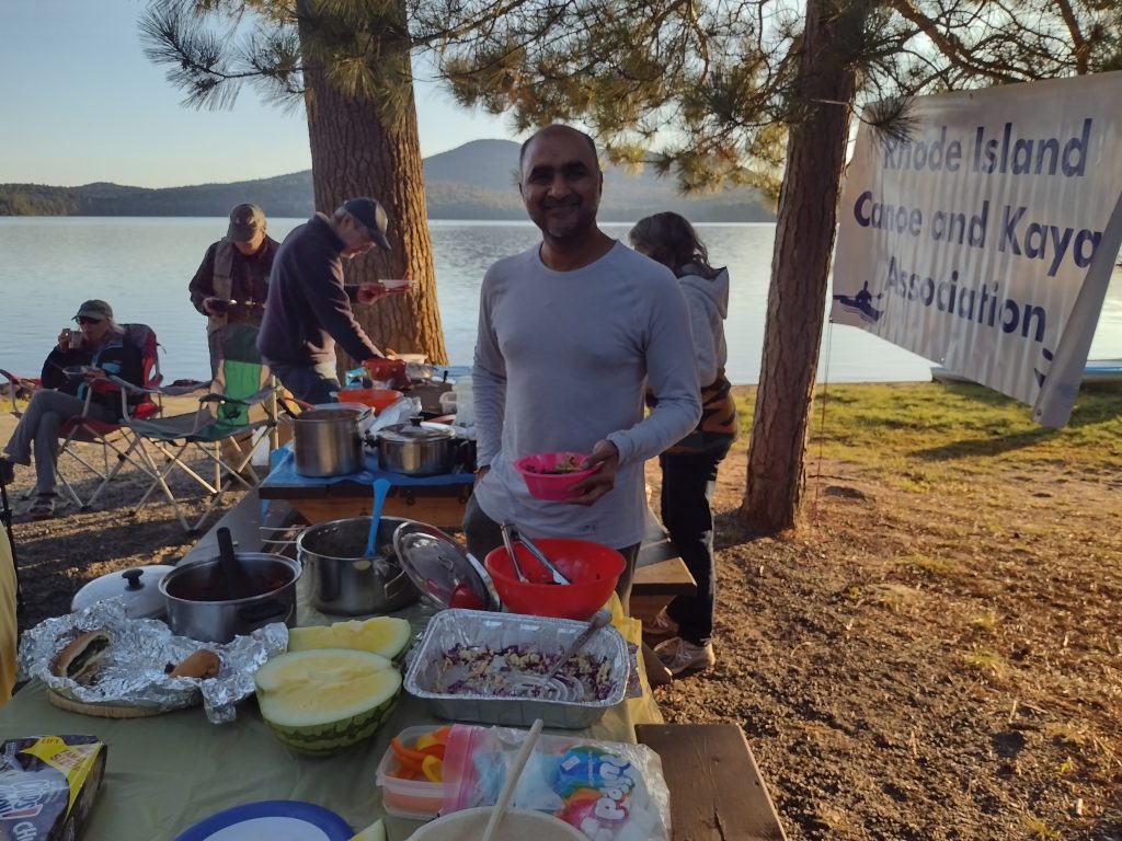
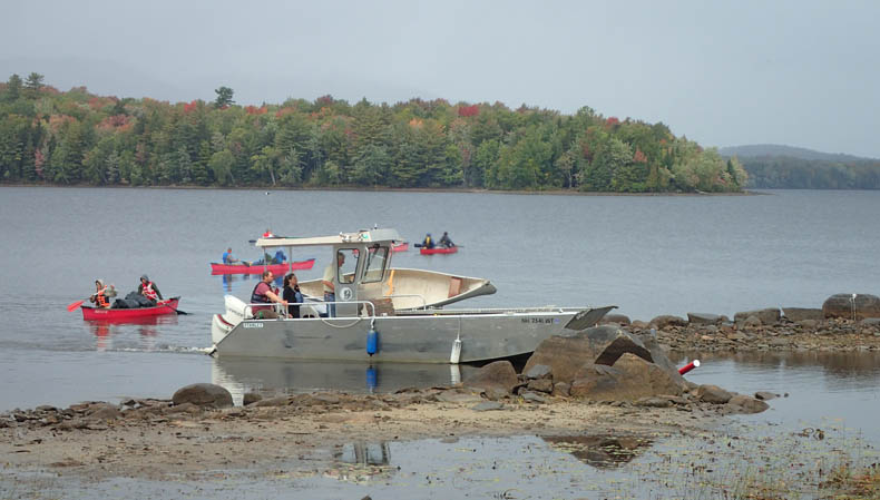
The real fireworks and sense of happiness did not arrive until the night of the Pot Luck Dinner on Tuesday night. Almost 34 people individually brought more than 1 person could eat at one serving so there was plenty to go around. It was a smorgasbord of delight. So much good food to please the gods. You saw people that you hadn’t seen in a year’s time and it evolved into small talk and laughter.
Hey where’s your dog? Hey, are you still paddling that ratty old boat? Where did you get the bucks to buy that luxury liner? Remember the time we almost tipped over? Matter of fact we did tip over. Yes, it was a pleasure to see so many of your old friends in one place at one time.
Later that night we were elated to hear that the Northern Nights would appear. The rumor was later amended and persisted through the week.
Chuck Horbert had asked that we should break up into smaller groups to maintain safety and to respect parking privileges. Thus there were as many as four trips to different places going on any given day.
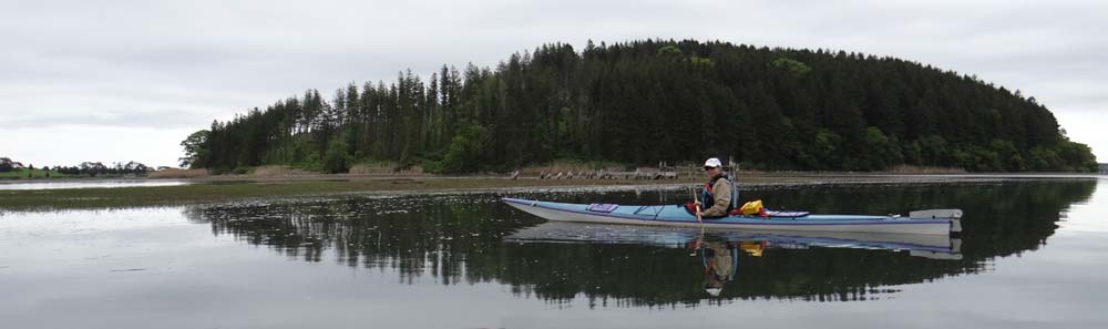
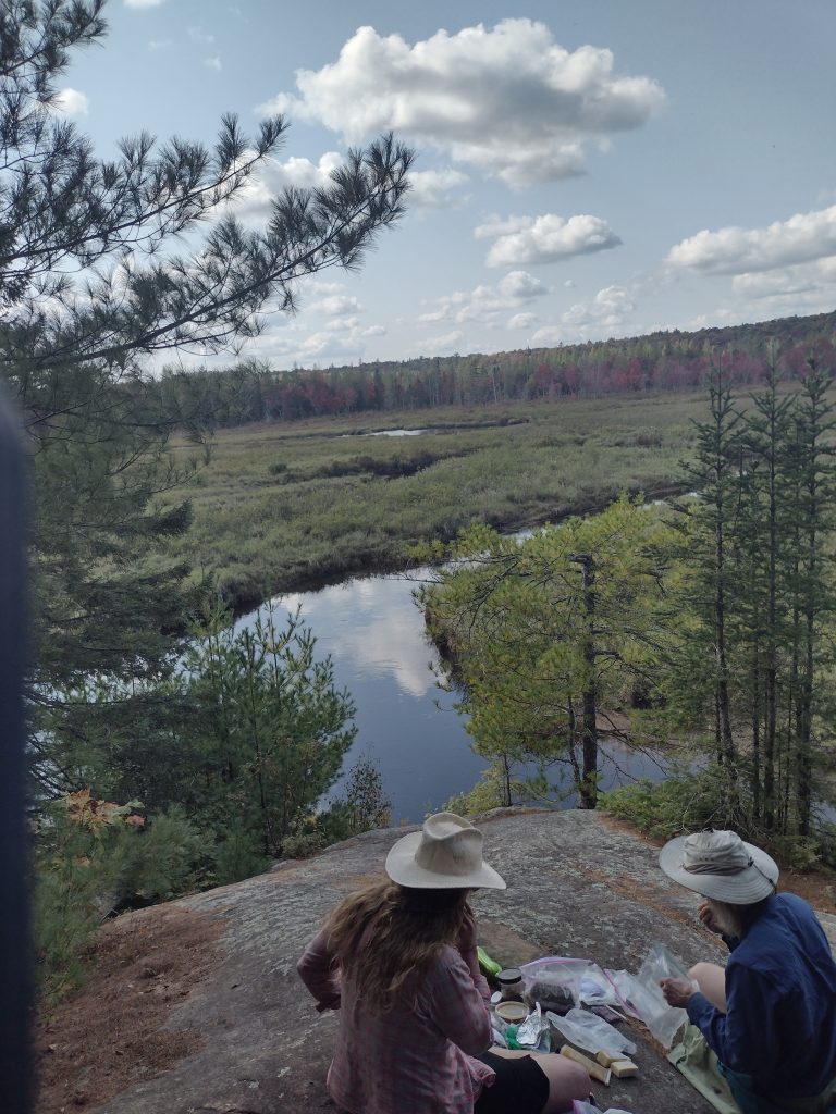
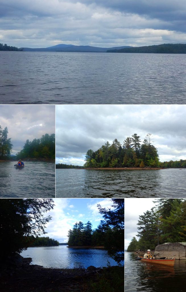
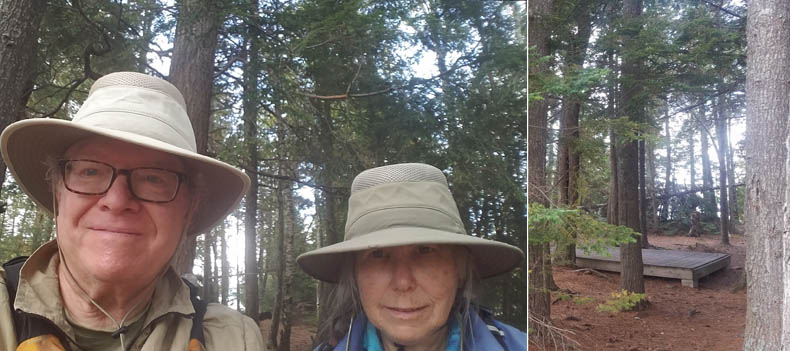
On the 3rd day, five of us decided to paddle on Blue Mountain Lake, a short 20 miles away from our campsite. It was Peter, JeanMarie, Tammy, David and I who set out from the town landing that was manicured with flowers.
It was a glass mirror day on the lake with barely a breeze. We paddled through a corner of Blue Mountain into a stream and then into Eagle Lake and then into Utawama Lake where we looked for a lunch spot. This as I’m told is a traditional way for Scout troops to enter Long Lake and avoid some nasty long portage spots.
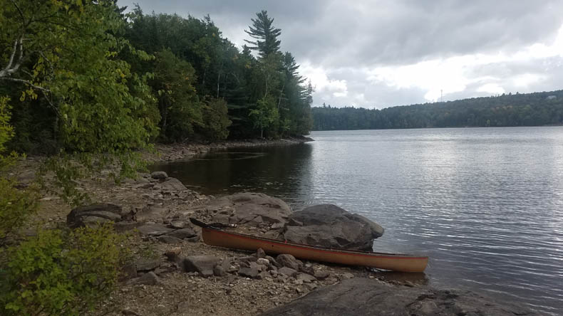
Failing to find a nice beach spot and after being on the water for over three hours, we made a beeline back to the launch beach and had lunch there. So day three was over and we went back to our sites and had a nice campfire with over 20 people telling their day’s adventure stories.
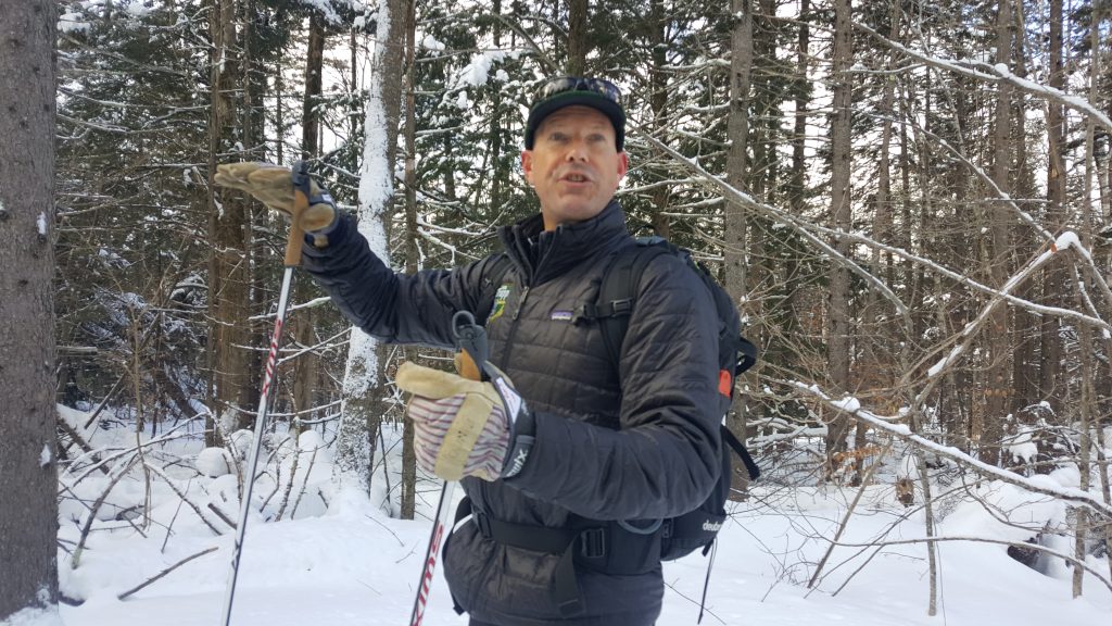
On the 4th day, Thursday, I set out on my own to find the elusive Adirondack Bike Rail Trail from Lake Placid to Saranac Lake and beyond. I had read about it and now I had to find an access point. On the way, I was passed by every motor vehicle on the road. I did not know where I was going and my “get-up-and-go” had “got-up-and-left”. Finally I found a bicycle shop that clued me into the start point.
I was the one cyclist in this canoe group and I was determined to find other sources of recreation. What I found was wonderful a flat gravel crushed stone bike path that had been completed in recent years. The trail was tree-lined in most places and had spectacular views of bodies of water that rival just about every bike trail that I have gone on. I rode over 45 miles that day and I was glad that I did it. In 2025, it will extend to 34 miles total and reach Tupper Lake and Rollins Pond Campground.
On the 5th day, Friday, Peter and I had teamed up with Hyman and Sandy Spekman to paddle the Oswegatchie River. Others had gone there and we were fortunate to have the last remaining day available. It was in St Lawrence County, close to the Tug Plateau where they often receive 200 inches of snow per year.
It was a treasure. I had wanted to visit two new places this year and I was rewarded. The Oswegatchie is about 20’ wide and 3’ deep and has a few rocks and blowdowns but it is not difficult to paddle a few upstream miles. We did and reached an overlook on a high rock outcrop that surveyed the entire upland marsh area.
This was the Campsite #45 that others had described with glowing words. We did not see any wildlife but if you used your imagination, you could picture moose and beaver roaming free. It was a spectacular view that remains with you forever.
We quickly returned downstream, loaded boats on to cars and later dined at the Adirondack Hotel as it was now late and getting dark.
The 6th day, Saturday, was going home day for most people. Four of us remained. We promised to keep in touch with each other and to share photos. It felt as if we were leaving summer camp and going back to school. For adults who refuse to grow up, some of us could relate to this feeling.
Three of us, Peter, Kim, and I decided to hike the local Buck Hill Fire Tower trail. We took the slow and easy approach and had fun on the way. We chatted to people coming down the hill. There was the couple from France who spoke to us in their native tongue to test us, the guy who knew every episode of Yellowstone by heart and the 7 member team of Hiking Grandmas with 28 grandchildren amongst them who entertained us along the way.
We reached the top and climbed the fire tower whose exterior structure was fenced with chicken wire to make it seem safer. We had another spectacular 100-mile view of forests and lakes on this clear end of summer day. We descended quickly and just for the hell of it we had dinner at the Adirondack Hotel again. Tomorrow, Sunday was packing time and we left at 10:00 for the long, 6-hour trip home.
I wanted to thank Hyman and Sandy for the meals we shared together and others who I shared a drink with or a snack together. It was my third consecutive year and I’m planning a 4th year even now. Thanks, Cindy and Chuck, RICKA paddlers and my travel mate, Peter Hill.
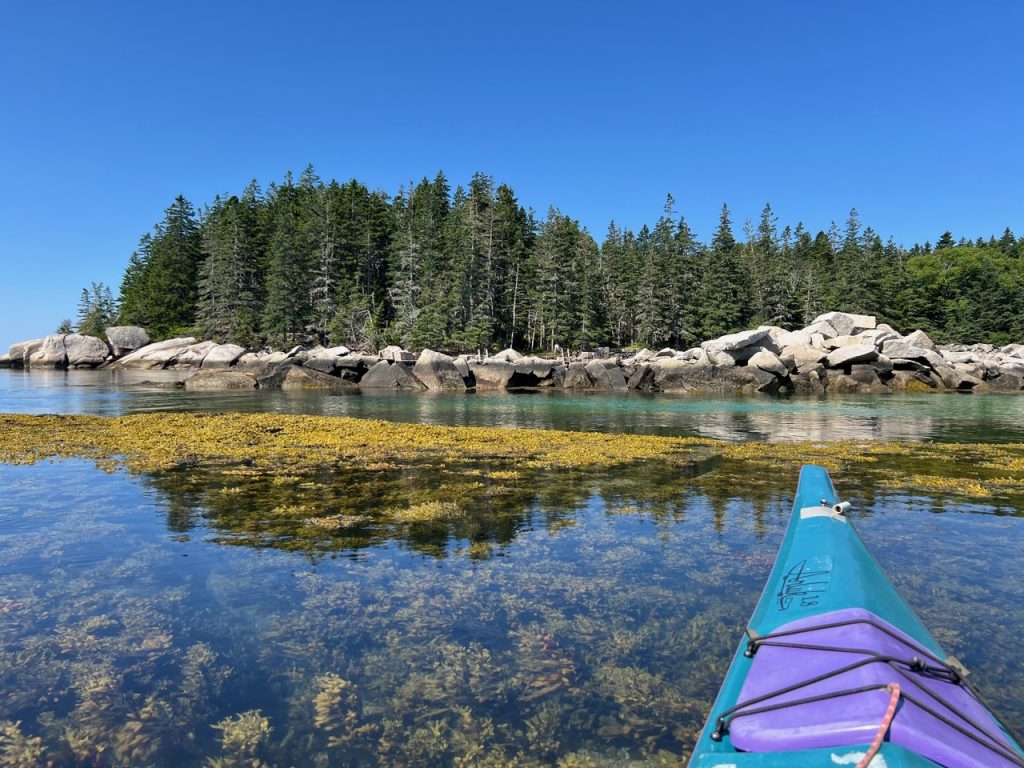
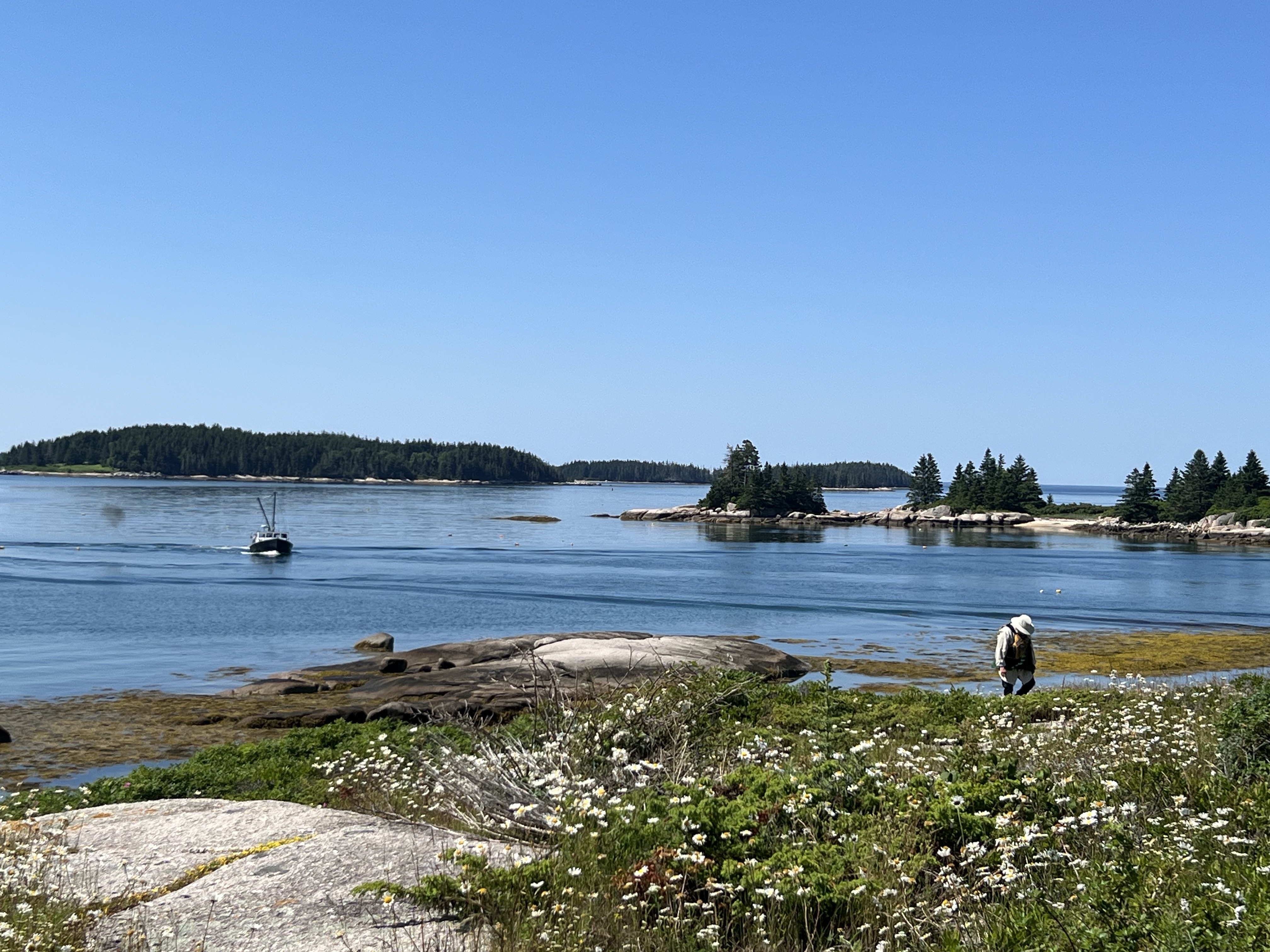
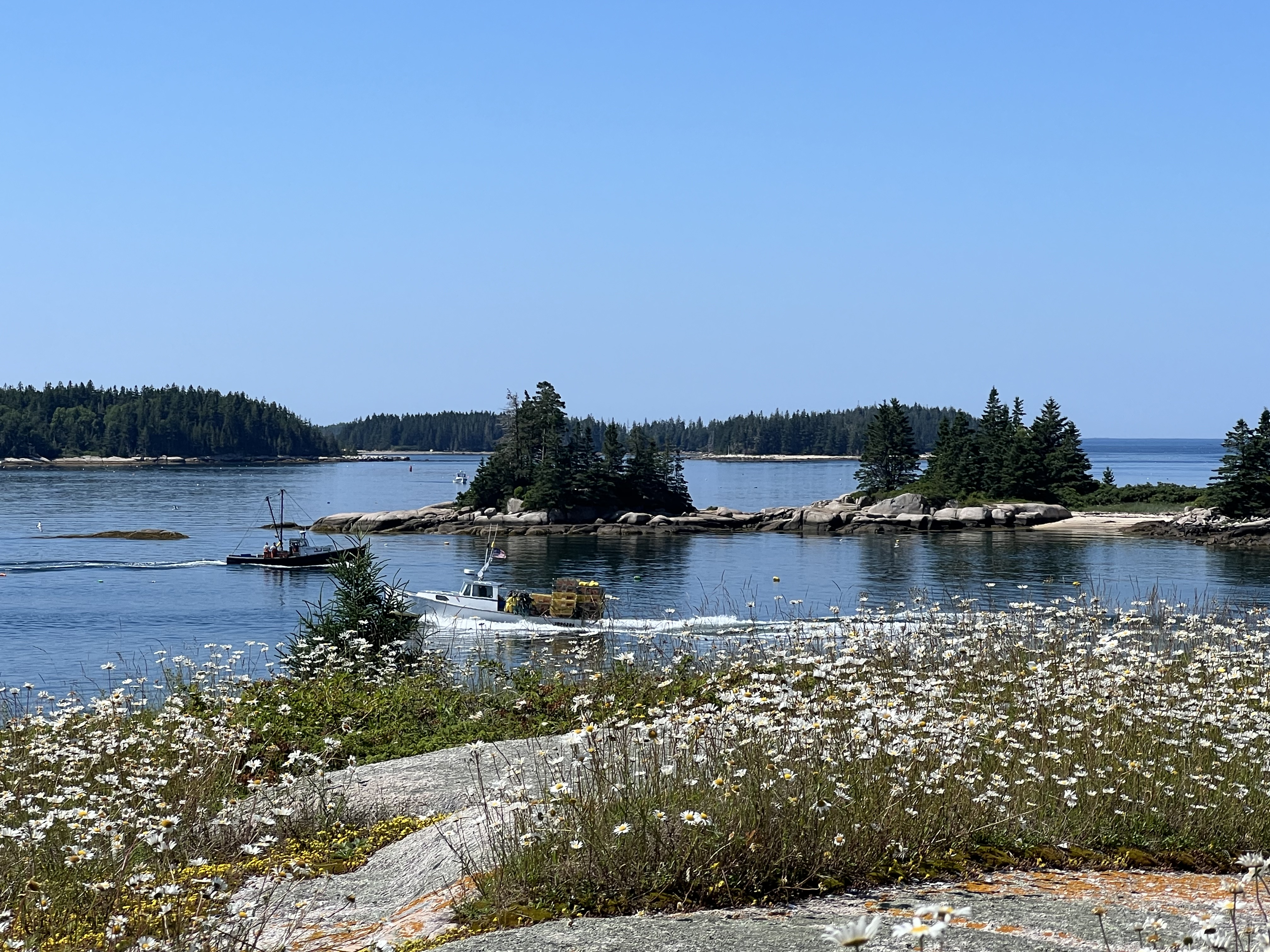
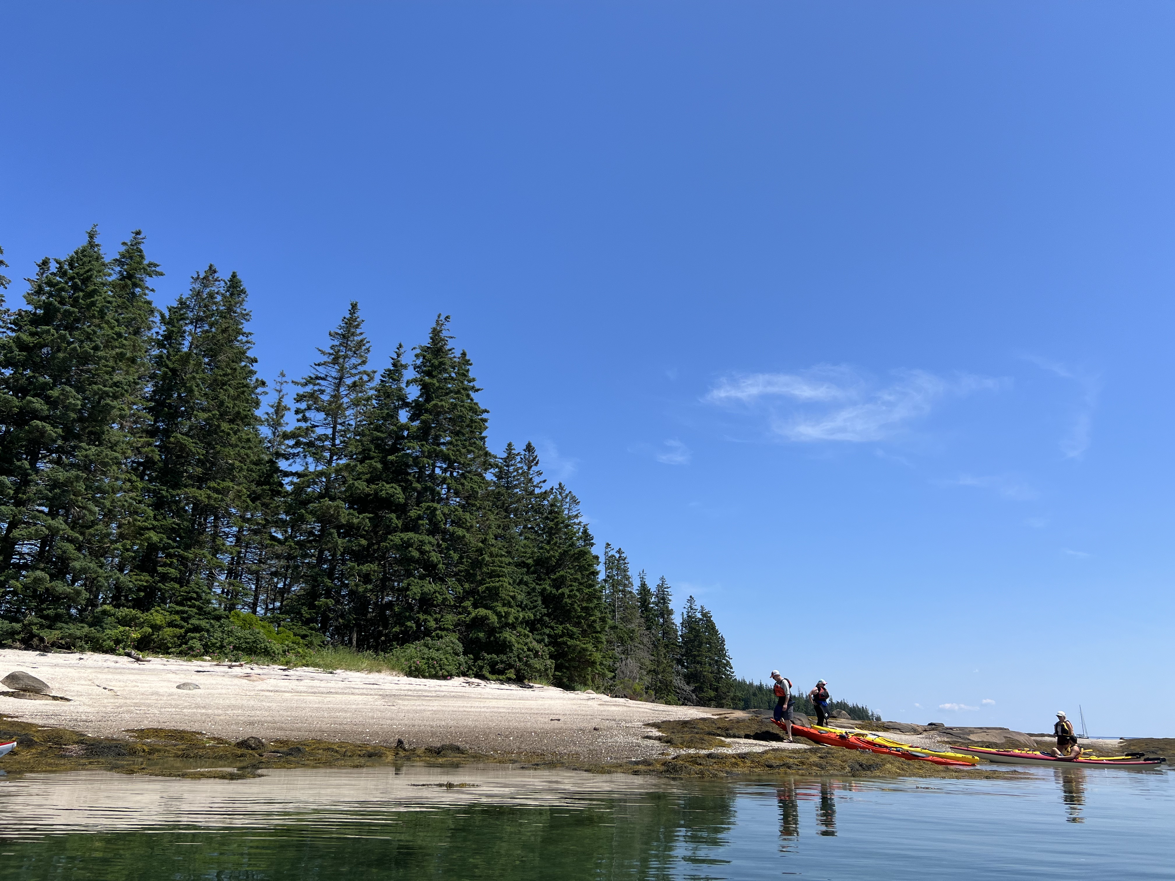
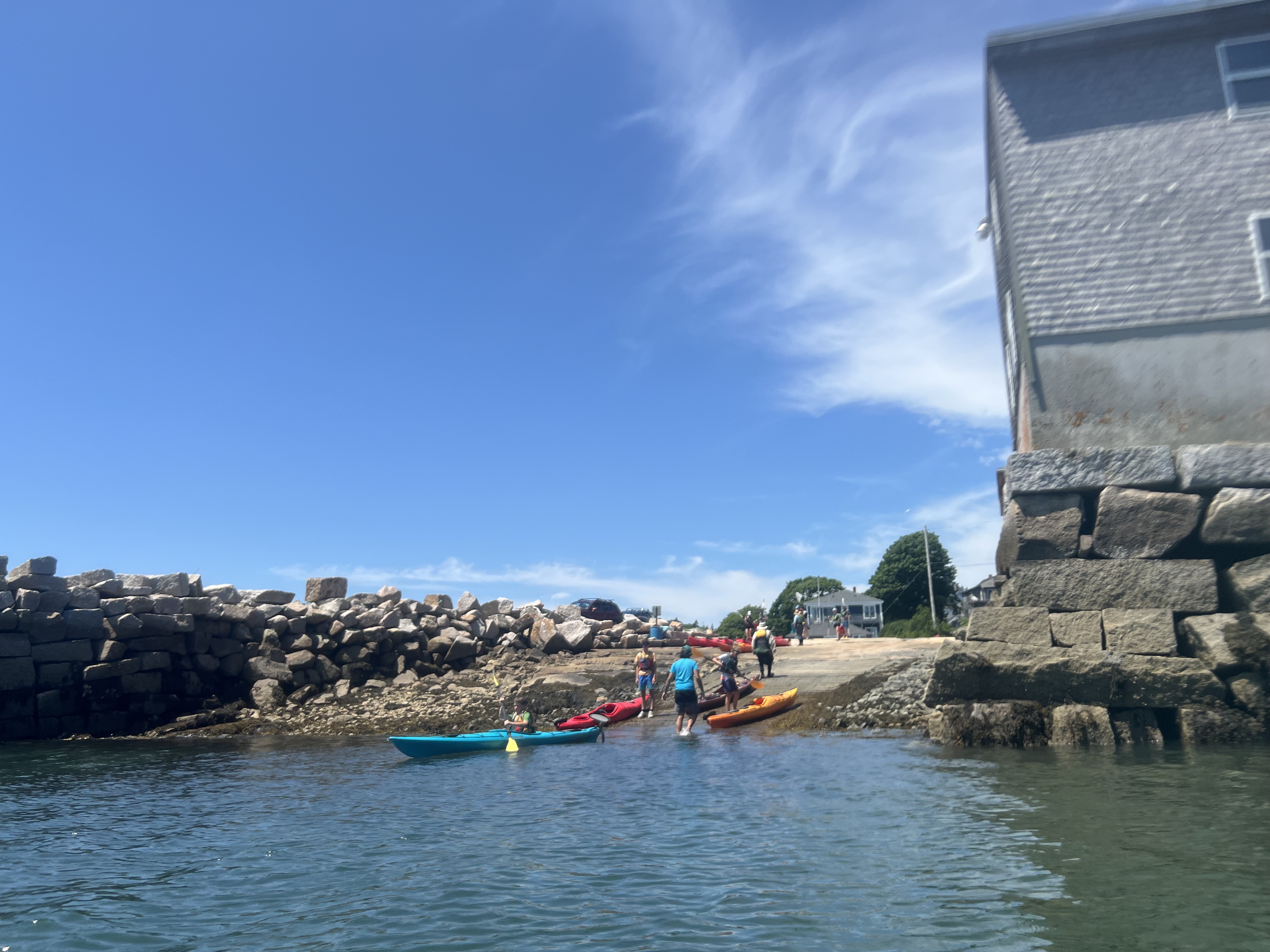
We put in at Stonington town landing at 9 a.m. into quiet water, 5 knot north winds, predicted to turn south in the afternoon. We went to see all our favorite spots from past paddles over the years, with different friends and family, weather, beaches, passages, tides, blooms, birds, schooners: so much memorable kayaking laid down here, on these waves and winds.
We followed a group from Stonington Paddle south briefly to see where they were headed and then broke off on our own. Passing islands: Scott, Green (a popular stop for fresh-water quarry), Potato, Camp, Hell’s Half Acre, Bold, Devil.
Hell’s Half Acre
Then we kayaked back along south side of Camp, Russ, Scott, with views to Millet, Spruce, split Coombs, and Ram to the south, then back across the Deer Island Thorofare and to put in, now very busy with launching kayakers. It was a splendid bright day, blue sky, light wind. We saw at least 25 other kayakers in various groups.
Stonington town launch
Lots of people landed on Hell’s Half Acre. The only downside was almost getting swamped by huge waves from very powerful lobsterboats going very fast, just after noon, racing to get home for lunch. Otherwise kayaking doesn’t get much more magical than paddling off Deer Isle. Dinner that night? Lobsters! – Tamsin Venn
The author at the overlook to back side of Locke Mountain. Photo David Eden.
By Tamsin Venn
Trails in Maine, New Hampshire, and Vermont all beckon this time of year.
Many of us kayakers give up ocean in winter but not our desire to wander in the great outdoors, trading paddles for Nordic skis or snowshoes. Instead of crossing a tranquil sea or bouncing waves, we glide through forest, hill, and meadow. Not all who wander are lost, says J. R. R. Tolkien, and here are three favorite places to do that, grateful for public access.
The Inland Woods + Trails at the Bethel Inn in Maine has 15 miles of XC trails and nine miles of snowshoe/fat bike trails. At the end of last January, we skied crisp, fast trails. Post-rain, groomers had broken the icy crust and left a light, snowy trail, optimal conditions.
Some of the trail network here is newly located in the Chadbourne Forestlands, managed for timber harvesting, multi-use public recreation, and wildlife habitat, in the interest of preserving Western Maine’s timberland. Inland Woods has partnered with the Conservation Fund and the landowner, White Pine Forest LLC to manage the trails for the public and you are asked to respect private property plus timber operations.
Other trail users include moms with kids, speedy XC skaters, and snowshoers. Dogs are allowed on all snowshoe and fat-tire bike trails but only the Dog Days Nordic ski trail. Start at the Nordic center in the back of the Bethel Inn, take Tibbetts Loop and connectors out to the overlook at the upper reaches of Grover’s Grind, with a great view to the north to the back side of Locke Mountain at Sunday River. You can proceed to the end of Grover’s Grind, and then head back. Bonus, the Millbrook Tavern back at the inn has nightly winter specials. Wednesday is $10 burger night plus trivia. The rambling 18th century Bethel Inn is a short stroll down Main Street to the Maine Mineral & Gem Museum, which has Earth’s largest chunk of Mars in its collection.
Northern Vermont Landscape on way to Slayton Pasture Cabin. Photo Tamsin Venn
Another favorite wander is Trapp Family Lodge in Stowe, Vt. Last Easter we skied up to the Slayton Pasture Cabin, a three-mile steady climb from the Nordic Center. The pasture is named after the farming family that once owned this hill-top acreage, a corner of the 2,600 acres of woods, rolling hills and meadows owned by the Trapp Family Lodge.
Normally, after a rest, hot stew and cocoa at the cabin, you scream back down back to the lodge but in the corn snow, we were on red alert to avoiding a sudden stop and launching like an un-guided missle. That did not happen. Johannes Trapp, with a degree from Yale Forestry School, cut the rolling loops through the woods and fields and created the first commercial Nordic center in the country in 1968.
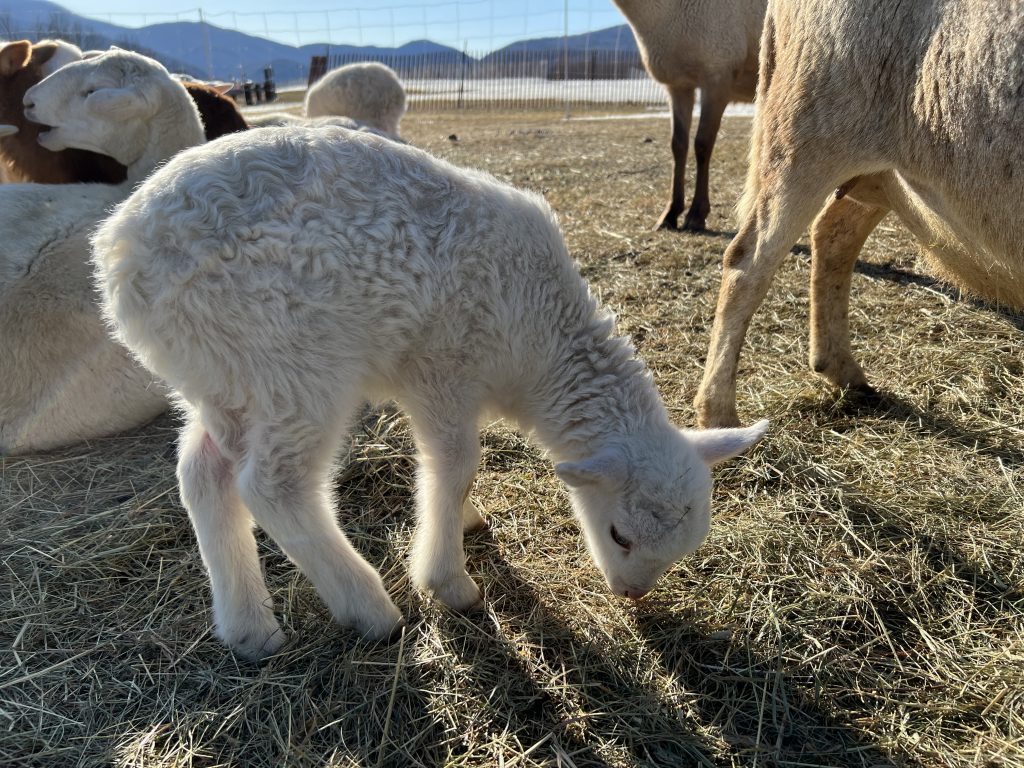
Sam von Trapp, scion of the famous singing family, on the trail. Photo Tamsin VennAs the snow melts, the baby lambs come out. Photo Tamsin Venn.
Since it was Easter, Trapps brought out its lambs to entertain the children. Yes Rosemary Crusted Rack of Lamb was on the lodge menu.
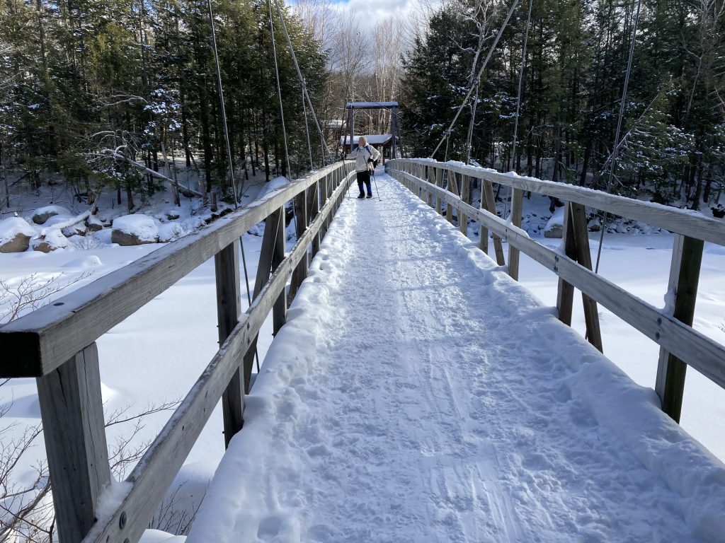
Skiers take the suspension bridge over the Pemigewasset River. Photo by Tamsin Venn.
Over in Lincoln, N.H., we enjoy the Lincoln Woods Trail on the Kancamagus Highway, a few miles down the road from Loon Mountain Resort. The dog-friendly trail starts at a large parking area, Lincoln Woods, follows the East Branch of the Pemigewasset River into the woods of the White Mountain National Forest. That leads into one of the largest roadless areas in the eastern US known as the Pemigewasset Wilderness.
Leaving the parking lot on skis or showshoes, you cross the East Branch of the Pemigewasset River on a 160-foot suspension bridge, then make a sharp right turn. Follow the river and the Lincoln Railroad’s old route, up to the Osseo trail juncture (1.4 miles) or the Black Pond trail juncture (2.8 miles). You can also hike to Franconia Falls, a favorite summer swimming spot.
An alternative is to follow the East Branch Road on the river’s other side, which may be less crowded. It is basically a flat easy run through the woods, just turn around when you feel like it. As with many wilderness trails, the farther out you go, the better the tracks. You pay a recreational user fee at the parking lot.
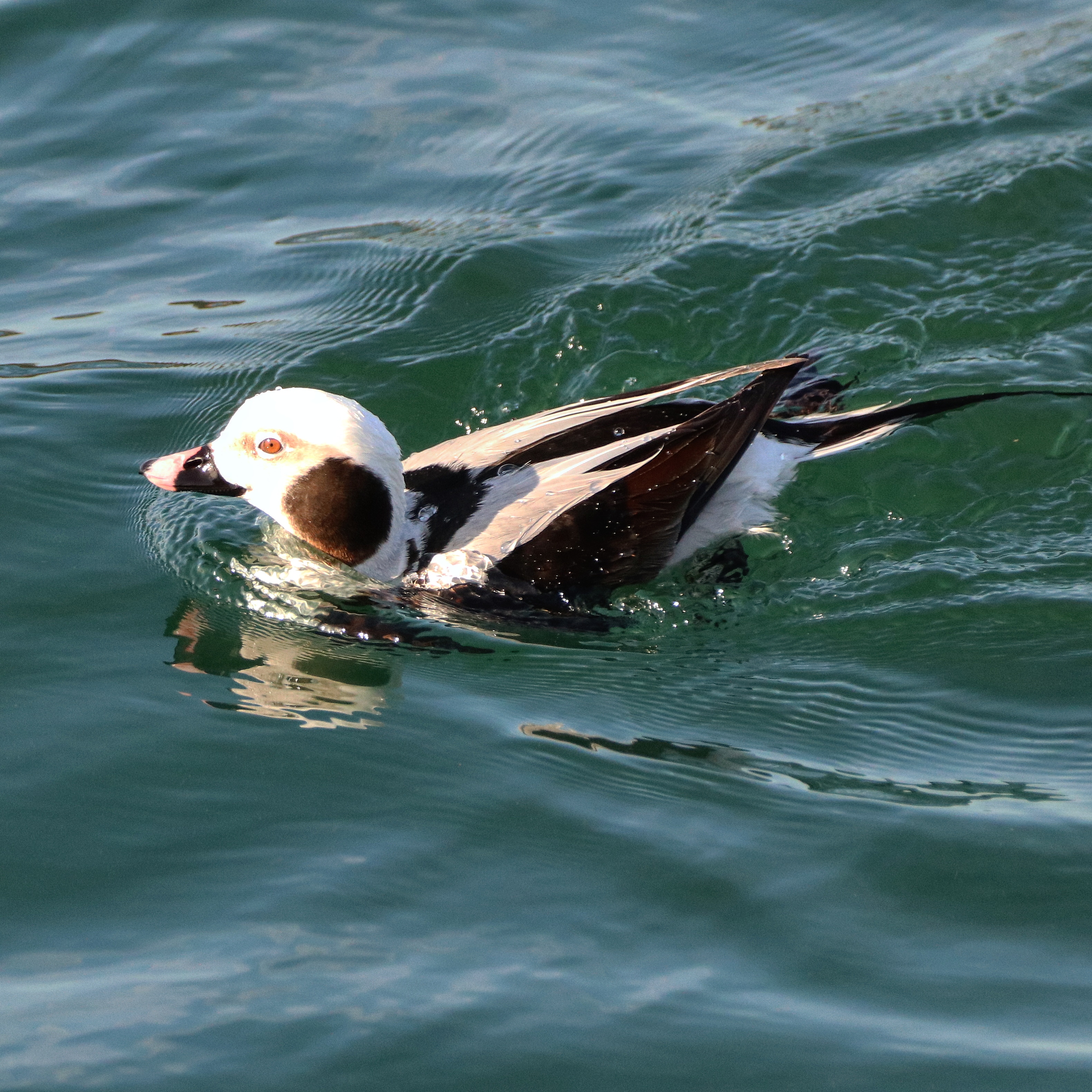
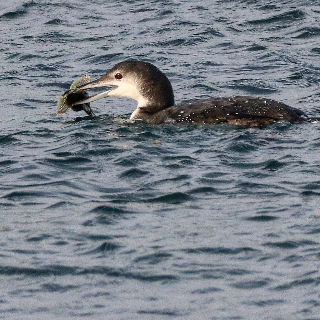
On a settled winter day, a trip along the east coast of Cape Ann, Mass., putting in at Rockport, will give you a sight of one of the most striking winter sea ducks along the Essex County coast, the Long-tailed Duck (Clangula hyemalis).
The ducks (formerly known as Old Squaw) summer and breed in the Arctic tundra in Canada but spend winters on open ocean here. You might see them in the company of eiders, scoters, Harlequin Ducks, Northern Pintails, loons, and Buffleheads. They tend to swim farther offshore so best to have your binoculars handy.
Seen up close, in non-breeding plumage, the male has two long slender black tail feathers, curling upwards, a white head with a large black smudge on its cheek, colors are black and white, with a brownish tan face. From the distance in a kayak, they will present mostly as black and white. The female has brown back and wings with a white head and smudgy brown cheek, the tail feathers are shorter than the male’s.
They may be easier to recognize in flight with a long tail, white collar, dark breast, and white belly. You can also recognize them while on the water by their distinct nasal yodel sound (their Latin name means wintry trumpets). While solitary and territorial in the arctic breeding grounds, they congregate, sometimes in great numbers in their winter habitat.
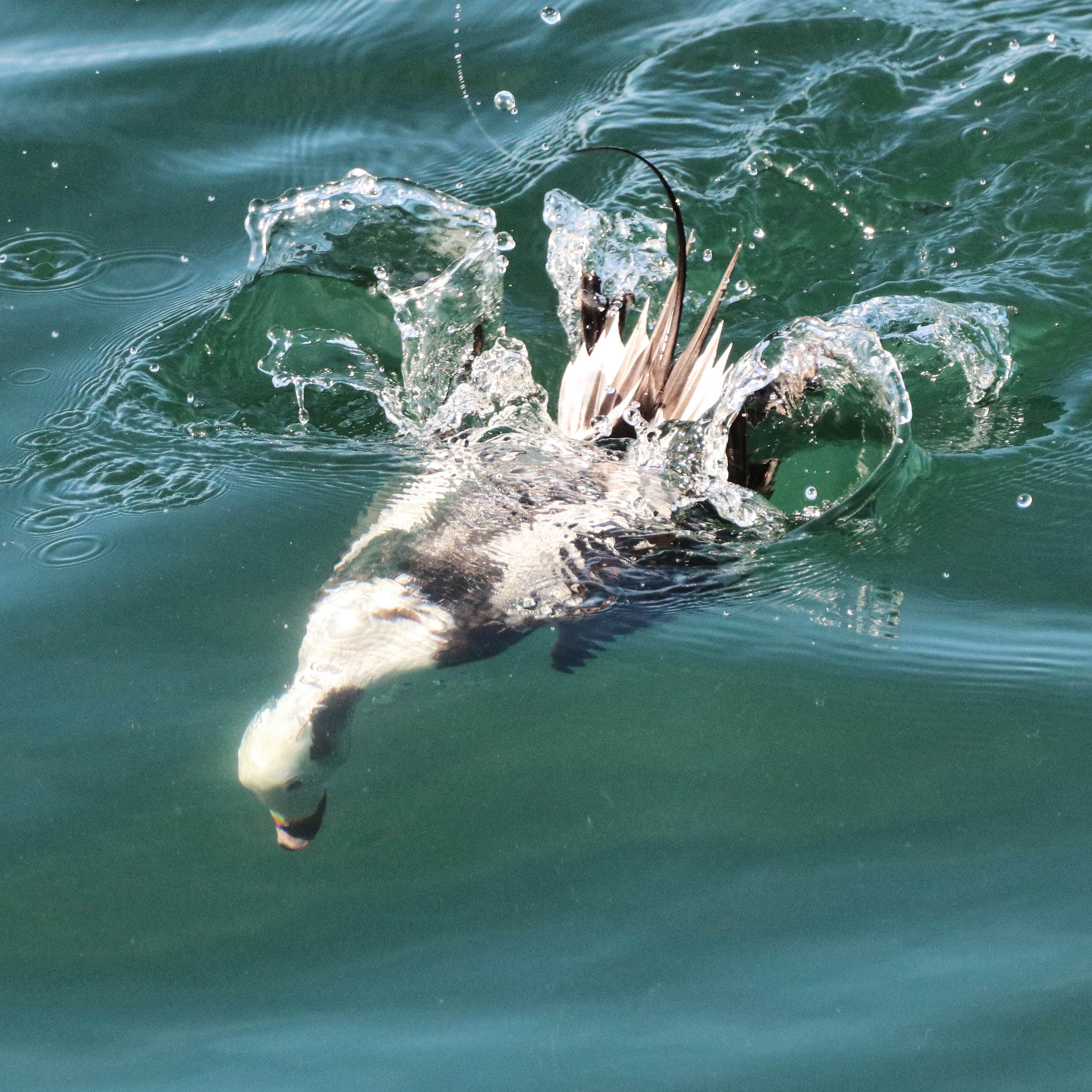
They fly low over the water, land, float on the surface, then dive and disappear for a long time. They are in search of food near the sea bottom. They eat their prey underwater before popping back up. What makes them unique among the winter ducks is that they are the deepest diving sea ducks. They feed mostly within 30 feet of the surface but are known to dive to depths of 200 feet. Count the time you see them underwater. They are known to hold their breath for 25-60 seconds.
Of the diving ducks, Long-tailed Ducks log the most time underwater. During foraging excursions, they spend three or four times as long underwater as on the surface, according to Cornell Labs.
Unlike other sea ducks, the Long-tailed Ducks flap their partly opened wings to propel downwards, in addition to paddling with their webbed feet. They also propel themselves actively back up to the surface.
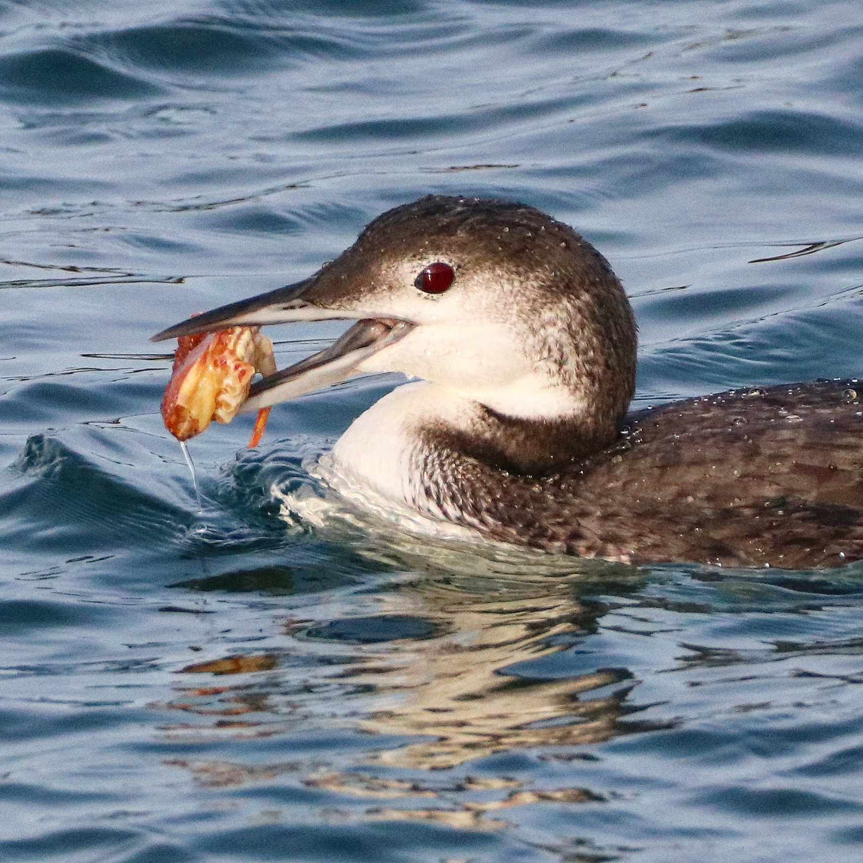
They dive to the lower depths of the water column in search of crustaceans, mostly amphipods; or mollusks (blue mussels, clams, periwinkles); also a few small fish. In the summer breeding grounds on the tundra they eat mostly aquatic insects, crustaceans, mollusks, fish eggs, and plant material like grasses and pondweeds.
When observing them from shore around Bass Rocks in Gloucester, Mass., looking at a NOAA chart, I estimated the ducks were out in the 20-foot depth zone, or maybe the 40-foot zone, but a pair was near a depth transition zone of 5-15 feet closer to shore, which could imply an upwelling or disturbance of sea critters to feed on.
They may have been foraging on arthropods, small fish, or perhaps plucking mollusks off the rocky bottom with the use of chisel-shaped bills that curve up at the tip. flat, upturned bills.
While the ducks around Cape Ann like the bold, rocky shore, they also like sandy shoals. A study in Nantucket in 2009 observed that Long-tailed Ducks foraged over shallow depths (less than 65 feet) up to 43 miles offshore on the Nantucket Shoals. The study showed they ate primarily Gammarus annulatus, a pelagic crustacean amphipod, which is common, congregates in big groups, and is eaten by many fish and sea mammals.
In all, they look very much at home in this great expanse of the Atlantic just off the rocky shoreline at Bass Rocks.
Tips: Winter paddling is one of the most enjoyable activities. You have the quiet winter world to yourself and being able to observe sea ducks right from the water. But on a cautionary note, this east side of Cape Ann is wild and rocky, with open ocean, you will be dealing with refracting waves off the rocks, few landing spots, and no other boats around. As always when winter paddling, wear a wetsuit or drysuit and pick a settled day, listen to your weather radio to make sure no high winds are expected.
Put-in: Good Harbor Beach, Gloucester. Labor Day to Memorial Day you can launch a kayak from the beach. Plenty of public parking. From here it’s a short paddle south to Bass Rocks, and about 1.5 miles to the Ocean House Hotel. Another put-in to observe winter ducks along this coast is at Granite Pier in Rockport.
You can also see Long-tailed Ducks closer to shore along the Merrimack River near the Route 1 bridge in Newburyport, which makes for a less exposed paddle. You can put in at Cashman Park, in Newburyport, then turn right and take a short paddle down the river toward downtown. At the Route 1 Bridge, you may see the pair of Peregrine Falcons that have been nesting in a man-made box since 2018. From Cashman Park, you can also turn left and follow the Merrimack up to Maudslay State Park, about a 2.5-mile paddle one way, to see the many Bald Eagles that winter here. Try to time these trips with the tides.
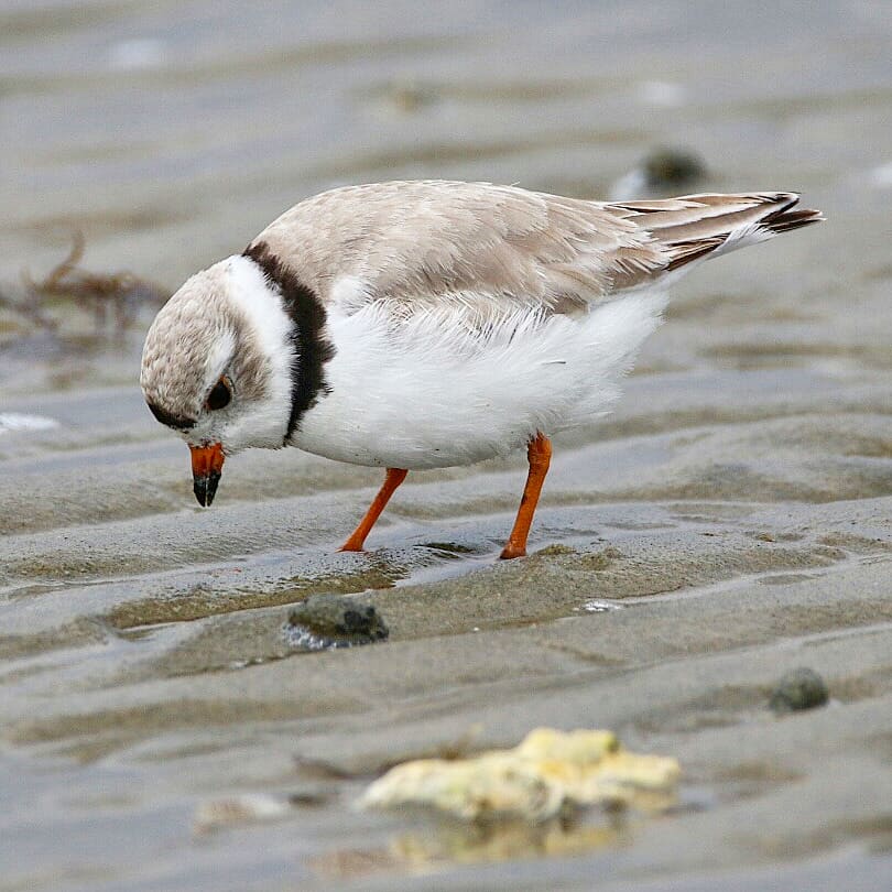
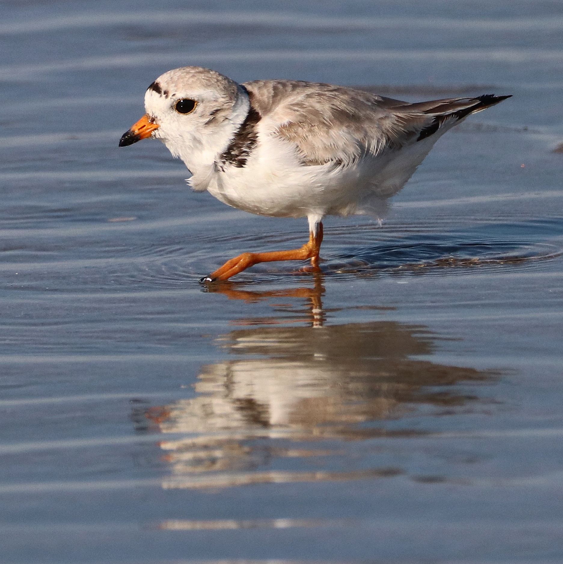
When paddling close to shore along Crane’s Beach in Ipswich in early summer, take note of a small pale shorebird scurrying on little orange legs along the water’s edge like a wind-up toy. You can identify the Piping Plover (Charadrius melodus) by its white breast, grayish back, single black necklace, and orange bill with a black tip.
It can be hard to distinguish the Piping Plover from the Semipalmated Plover (darker with bigger black necklace).
The Piping Plovers’ summer breeding habitat spreads out along a couple of miles of shore, where lower dune habitat close to shore is optimal. They dash from the tideline to their shallow nest scrapes on the dunes’ edges above the high tide line. They forage alone or in small groups sticking to higher part of the shoreline compared to other shorebirds. They stand on one foot and stir the other foot in the sand to scare up prey, according to ornithologist David Sibley.
Crane’s Beach, like many other beaches along the Massachusetts coast, have roped off areas to protect nesting plovers and terns from beach goers. The aggressive Least Terns aid in plover nest protection by dive bombing passersby.
The Piping Plover peeps loudly, hence its name. It is a visual hunter, and stands alert and upright hunting prey using its large black eyes, then scurries to another spot and abruptly stops again. Sometimes it just stands and waits.
The birds arrive mid-March and choose their nesting site by early April. They make a bunch of scrapes in the sand about four inches in diameter before they settle on one in some kind of debris. The best defense for this vulnerable shallow nest is camouflage of cream-colored eggs with brownish black splotches.
Like many ground-nesting birds, they have a broken-wing display where they feign injury to distract a predator away from a nest or fledgling. They lay one egg, followed by another egg every other day for up to an average of four eggs. The eggs hatch within 25-27 days.
Chicks look like little gray fuzzballs on stilts. They are precocial and are up and running around and looking for food (worms, mollusks, insects) the first day they hatch, led by their parents.
They leave early August, headed back to their winter grounds in the Caribbean.
Next beach north from Crane’s, Plum Island closes its beach entirely starting April 1 and usually reopens around July 1. A small area at Parking Lot #1 stays open.
The small, adorable bird is fighting a beach battle on three fronts: beach goers who by walking by can disturb nesting and feeding (also no kite flying allowed, dog walking, drones); predators including crows, raptors, gulls, coyotes, skunks, racoons, and foxes; and the coastal environment high tides in storm surges that wipe out shallow nests accelerating due to climate change. Low profile beach sends water way back into the primary dune vegetation.
Dave Rimmer, Essex County Greenbelt, describes past efforts. “More than once in my time managing nesting Piping Plovers, a storm surge washed out a nest on the beach, scattering the eggs and obliterating the nest. We would often be able to recover some or all of the undamaged eggs within 12-24 hours and return then to the general area of the old nest, create a small depression in the sand by hand, replace the eggs, and have the pair resume incubation and successfully hatch the eggs. Obviously that extended period of cooling did not ‘kill’ the eggs, but more than likely just put a pause on development.”
Thanks to protection from the Trustees of Reservations, Piping Plovers have managed to thrive at Crane’s Beach. Also a wide beach helps allow wildlife and humans to coexist.
But that proliferation has taken decades.
In 1970, just three pairs nested on the beach. The Trustees initiated a protection program in 1986 when five pairs produced five chicks. From those five pairs, populations increased fairly steadily. Three decades later, Crane’s sees an average of 32 pair nesting each year, but the number can vary widely. In 2019, the Crane’s Beach population had a record year with 49 pairs of plovers, fledging 96 chicks, according to Jeffrey Denoncour, Trustees Coastal Ecologist.
Two other good years were in 1999, when 44 pairs hatched 89 fledglings. The following year, 45 pairs hatched only 12 chicks when the storms were really bad. In 2018 and 2017, the beach saw 30-40 pairs, which is really excellent for these birds. Plum Island (next beach to the north) is also seeing numbers increase.
Beyond Crane’s Beach, the Piping Plover’s plight extends to their winter grounds and migration routes south. Fortunately many countries are working to help sustain and grow populations with various measures.
Along the Atlantic coast the Piping Plover is listed as federally threatened, but conservation efforts have helped stabilize populations.
Tips: To help, limit disturbance, watch the birds from a distance. Your best bet at seeing them is to land your kayak at either ends of the beach beyond the swim zones, then walk along the shore. May, June, and July are prime months for spotting them.
Put-In: To reach Crane’s, you have two launch options. Put in at the Ipswich Town Dock and paddle down the Ipswich River and out the mouth, then turn right. You can also put in at Pavilion Beach, at the end of Jeffrey’s Neck Road on Little Neck. Hand-carried boats are allowed on the beach’s north end. Turn right, paddle across the mouth of the Ipswich River, then keep going along the shore. Continue along the shore beyond the swimming buoys, then make your way close to shore again after the spit. A fun trip is a circumnavigation of Crane’s Beach and Castle Neck, nine miles total, where you paddle along Crane’s Beach, turn into the mouth of the Essex River, and follow the Castle Neck River through the Fox Creek Canal, past Castle Hill and so back to your launch at the town dock or Pavilion Beach.
In summer, beware of motor boats and stay close to shore. The mouth of the Ipswich River can be hard to paddle against the tide and opposing wind and tide will generate waves. Crane’s Beach generally has mild surf, but according to what the sandbar is doing at the spit, you may have to paddle out aways to avoid breaking surf at the end of the spit.
Winter paddling off the shores of Cape Ann can be a solitary affair, so it’s always cheering to share it with the Common Loon (Gavia immer). Loons stay fairly close to shore, so no need to venture far out in your kayak to see them. Like a kayaker, in winter, it tends toward the single individual or small groups.
Most of us are more familiar with the summer loon we see on inland lakes. In winter, instead of heading south, adult, young, and hatch-year birds migrate from open water on balmy inland lakes and ponds to the cold ocean. That is because their freshwater lakes and ponds freeze forcing them elsewhere.
As Mass Audubon trip leader David Moon said in a birding report from Plum Island, Mass., “The falling tide had exposed a bit of Emerson Rocks, and eiders, grebes, scoters, and a couple of loons all performed their remarkable ability to live happily on frigid waters.”
The Common Loon accomplishes the switch from fresh to salt water by the use of a supraorbital gland in its skull between the eyes that removes salt through excretion from ducts in its beak.
In appearance, it molts from its handsome black and white plumage with black head and bill into non-breeding plumage of gray back and head and white throat. The adult looks similar to the juvenile, the difference being the juvenile’s scalloping pattern on the back caused by whitish feather edgings. You will need binoculars for that ID, and close-up you might also spot the bright red eyes (from a pigment in the retina that filters light and allows the bird to see underwater).
As in summer, the male and female look very similar, but the female is slightly smaller. Loons are more silent in winter, and you will not necessarily hear the familiar maniacal laugh or haunting cry associated with their freshwater breeding grounds.
It’s hard to alert your paddling companion to a loon’s presence. It quickly dives, stays underwater for about 40 seconds, and turns up a fair distance from where it dove. Use of a clock face ID helps if you are both pointing in the same general direction. Loon at 3 o’clock!
Photo by Stewart Ting Chong
What are loons doing under there? They are diving sometimes to a depth of 250 feet, to catch fish, crustaceans, and mollusks they often swallow underwater. Like other diving birds, the loons propel themselves underwater with large webbed feet placed well to the rear of their body. Unlike most birds, they have solid bones that make them less buoyant and aid in diving. They can also exhale quickly, emptying their lungs, and flatten their feathers to expel air from their plumage, making them fast and maneuverable. They go after fish whose speed and zig-zagging they can match.
Loons migrate from lakes and ponds in the New England area up to November, though most migrate in October. In Massachusetts, loons returned in 1975 after nearly 100 years of absence, according to the Mass Division of Fisheries and Wildlife. In summer, they nest in great numbers on Quabbin and Wachusett Reservoirs and other lakes in central and western parts of the state.
On inland lakes, some of the parents stay later to help their chicks, especially those born later in the summer. But they leave and let the young find their own way to the ocean a few weeks later, biologists are not sure how. The young will eventually return to their home lakes after swimming about in the ocean for two or three years.
Loons have to migrate. Their bodies are very heavy compared to their wing capacity. They have the second highest wing load of flying birds, after swans. On a windless day, to get enough air under their wings, they can run on water for up to a quarter-mile to get airborne, according to Harry Vogel, Senior Biologist for New Hampshire’s Loon Preservation Committee (LPC). Often on small lakes, people observe loons making one or two circuits around the lake. This is not a scenic tour. Every circuit helps them gain a few feet of altitude. Once up, they fly directly and swiftly, beating wings up to four times a second, and can maintain a speed of 80 mph at level flight. They can’t run on a lake that has frozen for take-off, causing them to become trapped and unable to survive unless they fly to open water, or are rescued, according to Vogel.
Squam Lake in New Hampshire has a robust loon protection program with many stewards. Through banding and satellite tracking, the LPC monitors more than 350 of the state’s lakes and ponds. LPC discovered that the New Hampshire loons winter off the coast of the Atlantic Ocean from Maine to Rhode Island. LPC’s staff and volunteers have been monitoring New Hampshire’s loons for more than 40 years.
Biologists think that loons return to the same general area where they were born, often returning to the same lake. Loons typically arrive in New Hampshire lakes and ponds just after ice-out, sometimes, uncannily, the very next day. There they breed and produce generally two chicks. Loons mate for life.
On lakes and ponds, they face a host of perils: lead poisoning from fishing tackle; mercury poisoning from coal fire powered plants and municipal incinerators (loons in the northeast have the highest levels of mercury in the U.S. as measured by eggshells and blood samples); shoreline development in popular summer retreats. Add to those dangers, predation from critters whose populations have exploded from access to human waste like raccoons, gulls, crows; boat wakes that swamp nests (loons have to nest on water’s edge because they can’t walk well on land with feet placed well to the rear of their bodies); boats that scare a loon off its nest subjecting the eggs to heat or cold; and raising and lowering of lake levels, either by natural or human forces, according to LPC. Fortunately loons have some seriously dedicated stewards.
Winter paddlers can also be on the lookout for the less common Red-throated loon, distinguished from the Common Loon by a whiter neck and face, a slightly upturned bill, and smaller body and weight. The Pacific Loon is a smaller bird with a smaller bill and a chin line, best ID’ed by the head. It is a rare winter visitor in the eastern U.S. and is the most commonly misidentified bird in Massachusetts, according to local ornithologist Dave Larson.
In early April offshore, some adult loons have already developed their black and white breeding plumage from their grey and white winter colors. Any day now, ice out arrives and we will have to travel to inland lakes to see these winter friends.
Tips: A word about binoculars: A monocle is a good tool to use for a kayaker, so you can keep one hand on your paddle. Loop the strap around your PFD and keep it in the pocket when not in use. Bouncing around in waves, even wavelets, can make it hard to get a bird settled in the scope. Wind can also push you past the viewing point. Here a double kayak is useful where one paddler holds the kayak in place or swings it into position, while the other uses the binoculars. It also provides a more stable, less bouncy platform. Also, heavier binoculars will steady the view in a bobbing kayak, and a stretchable strap will help take the tension off the neck. Again loop and secure these around your pfd in event of capsize. Meanwhile, go ashore if there is a suitable landing spot for steady ground and better viewing.
Put In: A good protected spot to put in and park is at Pavilion Beach in Gloucester, off Stacy Boulevard, near the Greasy Pole. From here, you can paddle around Gloucester Harbor, including the Jodrey State Fish Pier, a reliable winter birding spot for observing ocean birds, ducks, and gulls. You can also put in at the Gloucester Town Ramp, near the Blynman Canal Bridge, behind Gloucester High School. It has no launch fee for kayakers if you use the small beach to the side of the ramp. That puts you into the Annisquam River, and follows Cape Ann’s western rocky shoreline north up past Lane’s Cove where you can hug the shore on the look-out for loons. In summer, the Double-breasted cormorants take over.
Tamsin Venn wrote this series of sea kayaking and birding articles as a final project for completion of Mass Audubon’s Birder’s Certificate Program.
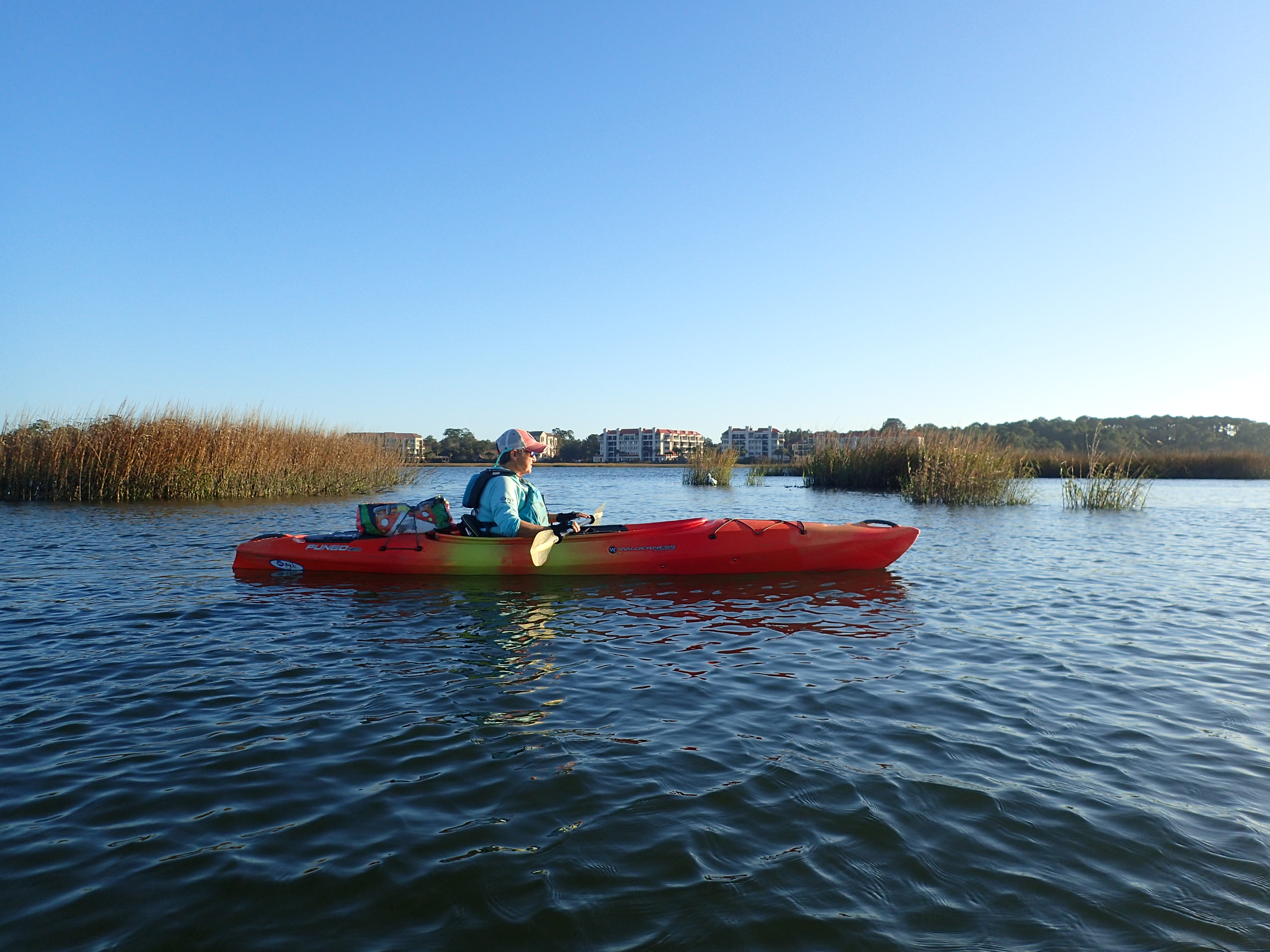
The first thing my kayak guide Paige Grisette from Outside Hilton Head says to me at the Shelter Cove marina in Hilton Head is, “We are on a waxing gibbous moon.”
That is a welcome reset back to nature from all the surrounding resort development at this popular area on the South Carolina coast. The planet-centered focus continues as Grisette checks off tide flow (coming in), wind (8-9 mph), and will continue as we wend our way through Broad Creek.
Outside Hilton Head handily keeps a fleet of boats on the dock, no schlepping. Grisette gives my boat a slight push down the ramp into the cove. We are off. We follow the concrete wall along the harbor, turn right, and turn into … Disney Creek.
How does Disney get to name a creek after itself I ask? Because you are Disney, came the reply. (Disney Hilton Head resort is nearby.)
We move into Broad Creek, which travels through broad tidal marsh and separates the two halves of Hilton Head island. It feeds into Calibogue Sound and the Intracoastal Waterway and on out to Port Royal Sound.
I’m feeling a lot of confidence in my guide. Grisette has been with Outside Hilton Head for four years and likes the change of pace from her very busy job as owner of Red Rover, a dog kennel, doggie day care, and spa. Before that she did business and marketing. Her first boss was Charles Fraser, who founded the eco-planned Sea Pines Resort. He is largely responsible for the proliferation of trees and prohibition of any neon on the island, per town ordinance.
(Continuing in that spirit, to protect loggerhead sea turtles, a town ordinance says that artificial lighting must be shielded so that it cannot be seen from the beach, or it must be turned off by 10:00 p.m. from May 1 to October 31.)
XTRATUF non-slip work boots for larger boats are useful in kayaks.
Grisette was in the midst of getting her captain’s license from the Coast Guard, transitioning into a new career, so she could pilot the larger boats. It’s a good job for older people, she notes.
For a New Englander like me, it is hard to define the geography here because of endless low country and maritime forest which gives way to extensive salt marsh, the carbon sequestering buffer we have all come to newly appreciate.
Water wedged within the bight results in 13-foot tides.
Grisette shares the details. South Carolina comes in second in a lot of ways. It is second largest barrier island (Long Island is the first) on the Atlantic Coast; second largest bight (Bay of Fundy is the first). And here’s a surprising fact. With all this salt marsh where the tide comes in and goes out every 6.18 hours, led by the gravitational pull of the moon, which is literally pulling up the water off the earth, she says, the tides can reach 13 feet (average is eight feet). That is because Hilton Head is in a bight, encompassed by the peninsulas of Florida and Cape Hatteras. The water pours as it is wedged between those land masses.
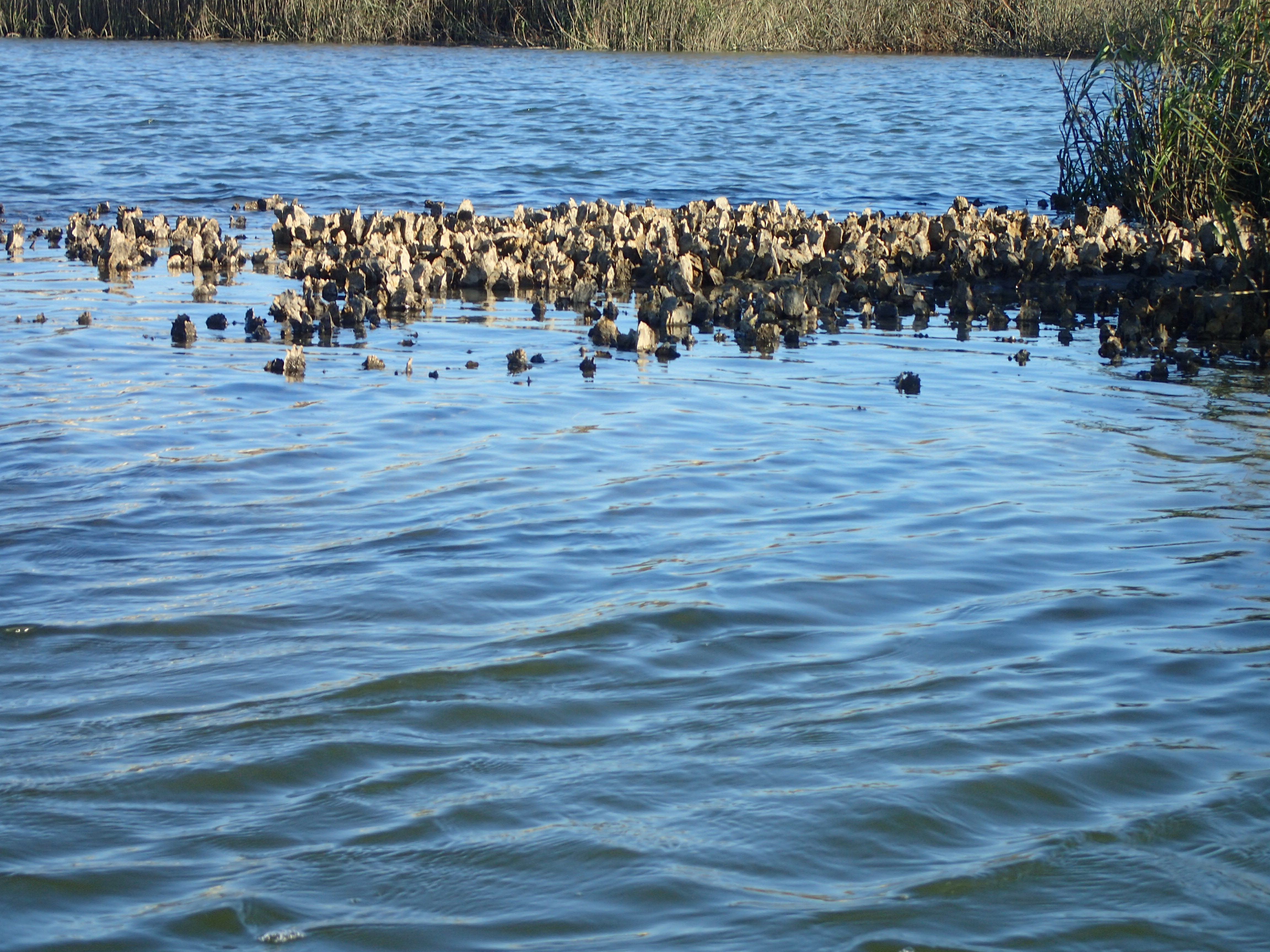
Another major ecological fact: oysters.
As the tide moves in, water will cover the oysters just below the surface as we paddle through. Under no circumstances if you get caught on an oyster bed, use your hands, she warns, they will be cut to shreds. The Eastern oysters here are as sharp as they come, growing long vs. wide. To avoid oyster beds, look for changes in water color.
Can someone come out here and harvest oysters, I ask? The answer is no, not for ecological reasons or town ordinance, but because the Mitchell family, with generational Gullah connections, has had the oyster harvesting rights in Broad Creek for 300 years. Try the oyster menu at Fishcamp, a popular local spot, Grisette advises.
The Gullah people are descended from slaves who cultivated rice and other crops on the coast and the sea islands and stayed here when their owners fled during the Civil War.
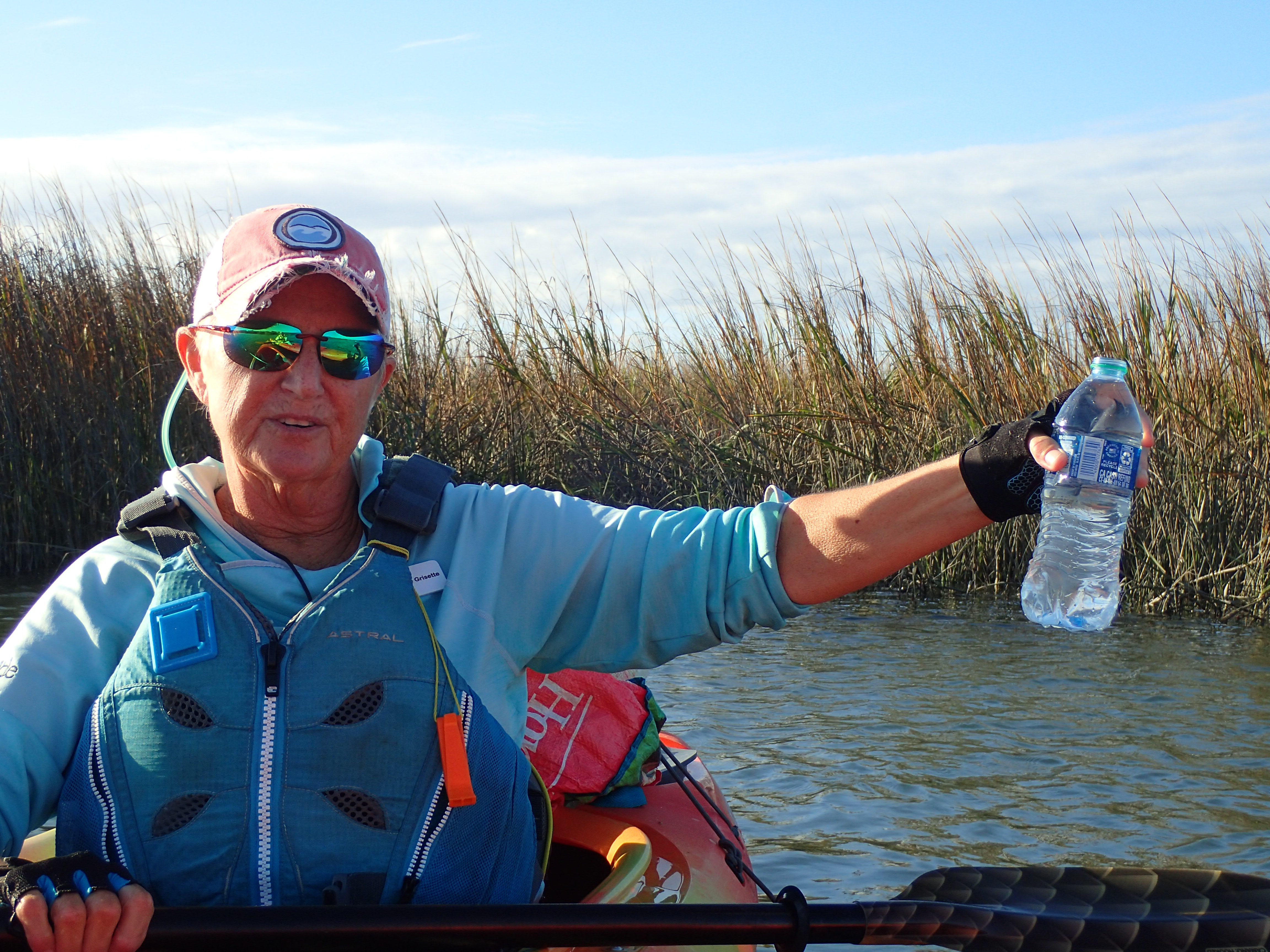
Clear water.
The biome is incredibly rich, and the water even though it looks muddy, is not. Grisette dips a plastic bottle into the water and holds it up: clear water. The highway bridge to the south, whose construction she protested because of fears of car fuel toxins polluting the water, has structures on the ends to catch run-off reducing the amount of gasoline entering Broad Creek.
Gullah used the “plough” or “pluff” mud, over which we paddle, to fertilize their gardens. Spartina marsh grass grows densely from rhizomes, the leaves die off and form deep levels of peat which trap mud. The marsh absorbs the force of water during storms, helping the surrounding real estate to survive.
Little fish hide in the oyster beds to avoid capture by dolphins or larger fish who avoid the razor sharp beds. The food chain moves richly up from there.
Birds we see include cormorants, Anhingas (snake-birds), ospreys, Lesser Yellow Legs, gulls as well as egrets and herons -“Jesus birds” Grisette calls them as they seem to walk on water. Most migrate through. Pelicans splash down, mullet jump. Overhead a Marine Corps helicopter flies over from Parris Island.
In summer, the Roseate Spoonbill occupies the “bird docks.” For insurance reasons many homeowners did not rebuild their docks destroyed by Hurricane Matthew, says my guide, and the birds hang out there now. Bottlenose dolphin are common, which you will see when the tide is lower.
The dolphins here use a rare technique called “strand feeding” where they drive schools of fish up onto the mud banks, lie on their side while they feed, then slide back into the water.
Any surprising nature encounters? Grisette has had shrimp jump into her kayak; a couple of osprey arguing over a fish above her dropped it into her boat; and she has been turned over by a manatee. (The manatees prefer 70-degree water farther south.)
After turning around, we pretty much sail back, even though we are going against the tide, pushed by the wind.
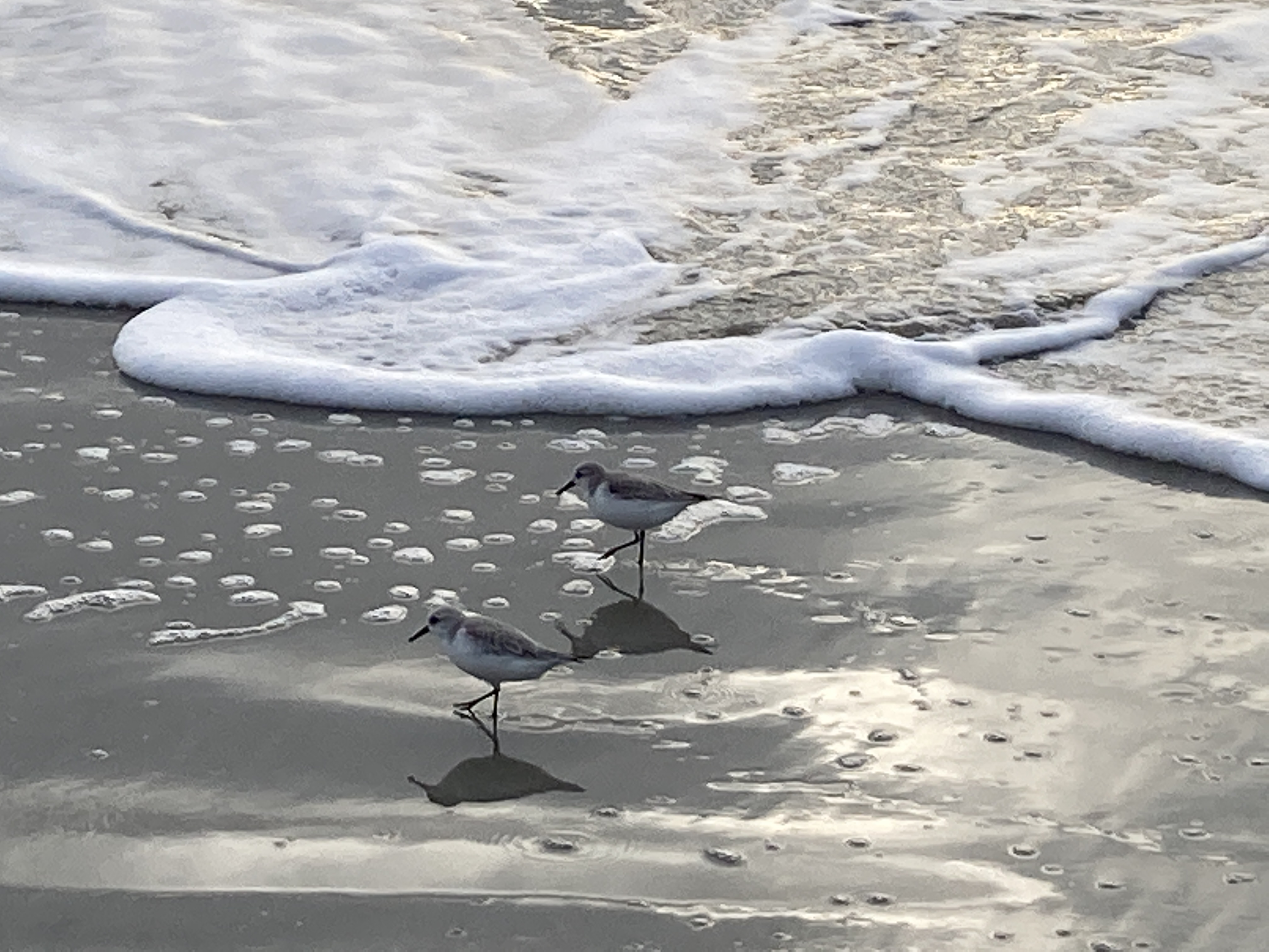
Sanderlings.
In the larger scheme, Hilton Head, only 20 miles northeast of Savannah, Ga., is shaped like a shoe, 12 miles long, five miles wide, with 12 miles of beachfront, good for surfing and sanderlings.
Twelve miles of beach.
Hilton Head was once a forgotten area inhabited mostly by the Gullah and their shacks. Land ownership dating back hundreds of years can still be a point of contention here. A handful of rich folks came in and bought thousands of acres, for hunting and fishing. Charles Fraser started the transformation of Hilton Head into a resort when he developed Sea Pines in 1956. Soon, other developments followed, imitating the design and layout.
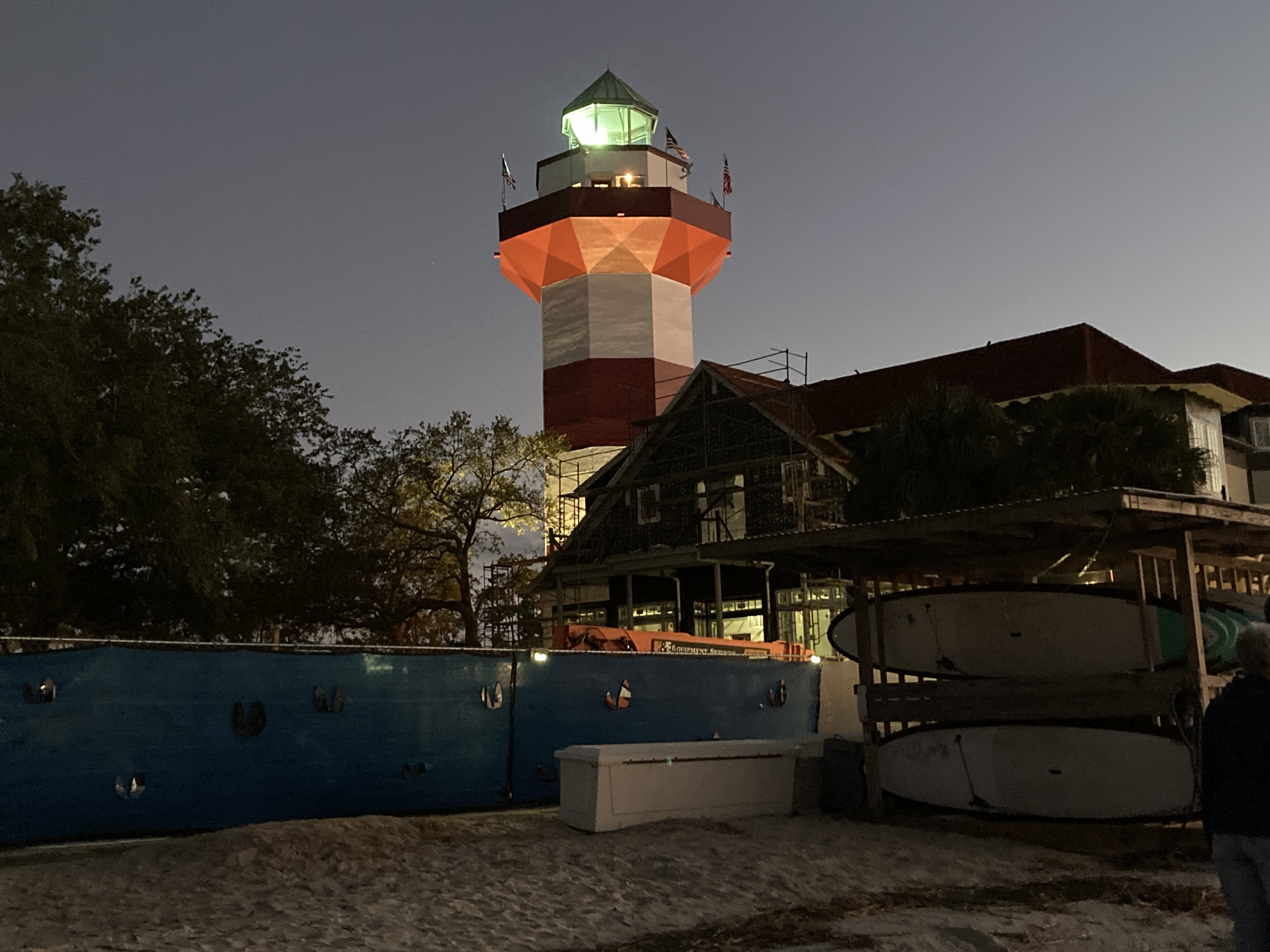
Harbour Town Lighthouse at Sea Pines.
Despite the development, there is plenty of room for a kayaker to find happiness. “The sea grass are the violins, the plough mud are the bass, the oysters the brass, the water the flutes, it’s a different full symphony every time you come out here,” says Grisette.
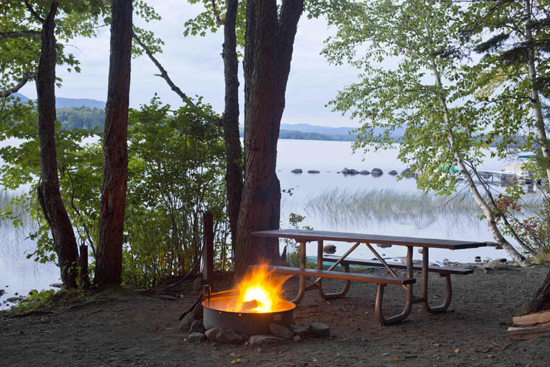
Our campsite 41 in clement weather. Après cela, le déluge.
By Tamsin Venn Photos by David Eden and Tamsin Venn
We arrived at this year’s Lake of October, Lake Umbagog (or Umbagog Lake — both placements are correct), before peak foliage season. The green-tinged ridges around the lake were smudged in orange and red, but the scarlet and yellow flames of maple and birch that line the stony shore had yet to light up this last week in September, possibly because of a warmer than normal summer and early autumn. (See Why Leaves Change Color).
As compensation, we had warm air and water temps, very welcome this far north at September’s end and a marked contrast to our shivery trip last year (ACK Vol. 29 #8, Nov-Dec 2020).
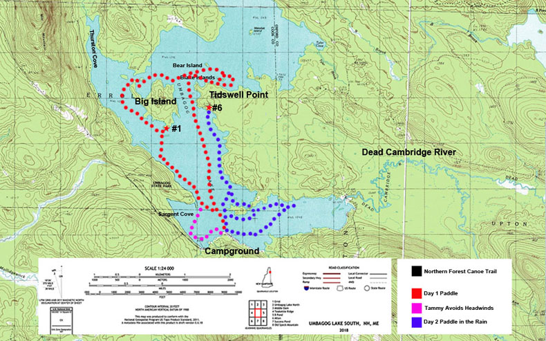
Um-BAY-gog (an Abenaki word for “clear water” or “shallow water”) is just 40 miles south of the Canadian border in Errol, N.H., in the Great North Woods. It’s the most downstream of the lakes in the Rangeley chain.
Originally, it was a series of three shallow lakes connected by marshes and swamps, but Errol Dam flooded the area in 1853 to form the lake here today. It is fed by the Magalloway, Rapid, and Dead Cambridge Rivers, and is the source of the Androscoggin River.
T: With the drop in water level, you can imagine what the valley filled by Lake Umbagog looked like before 1853.
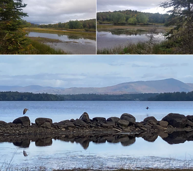
B: Great Blue Herons make use of a boulder reef, normally submerged, to eye for prey.
The lake is 10.4 miles long running north to south and 1.9 miles maximum width, with 50 miles of shoreline, an average 15-foot depth, and is mostly surrounded by dense forest, protected by several entities that have sought to convert lumber company tracts into wildlife protection area. Most development is on the lake’s southeast shore.
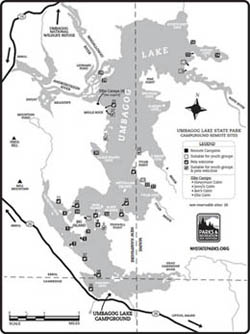
The Umbagog State Park campground provides good access. Located at the southern end, it has 27 campsites with electric, water, and hot showers; plus more than 30 remote campsites and four remote cabins (Ellis Camps) in isolated locations around the lake accessible only by boat. (You can park your car at the campground while you are away.) Most of the surrounding acreage beyond the shoreline is held by the U.S. Fish and Wildlife Service (USFWS). The area is undeveloped and wildlife abundant.
With a nudge from subscriber Paul Foster-Moore, we all planned to camp at a remote campsite at the lake’s north end. His crew wisely bailed when they heard the weather report — heavy rain — and for once the weather authorities were spot on.
Thanks to Foster-Moore, we reserved sites 13 and 18, at the north end of the lake (no dogs allowed; other sites do allow dogs). It is about a 7.5-mile paddle from the main campground.
You can also reach this area by launching in Errol, N.H., by the dam, paddling the Androscoggin, into the lake, cross it, go north, and land near the mouth of the Rapid River, which is known for its class III-IV whitewater. This river flows out of Lower Richardson Lake in the Rangeley Lakes in Maine. We were excited to explore this part of the lake and check out Sunday Cove. But iffy weather kept us anchored at the campground on the south end of the lake just off Route 26.
What a difference a year makes. As opposed to last pandemic fall, the place was hopping. Two White Mountain School groups launched on camping trips to Great Island. How their leaders take a possibly green group of teenagers off into the wilderness deserve a trophy engraved, “Kids, idle without social media on a remote island, four days, wind and rain included.” The girls missed most of the bad weather, but the boys, starting a couple of days later, set off just before they were deluged by pouring rain.
But what a great experience. I imagine the students returning to Umbagog 20 years from now to paddle and camp, the foundation laid. (“Or never go camping again,” grumped David.)
Also, something not evident last fall, the brisk business of campers being ferried out to the remote sites by pontoon boat, with gear, firewood, and canoes/paddleboards/kayaks, a regular service the campground provides for a fee. Stays are anywhere from two days to two weeks, Clem, the boat driver and general campground factotum, tells us. That allows boaters to get fairly far out to a site and then just paddle around without having to worry about schlepping all their gear.
Hmmm, there is something to this.
A group of WMS boys paddles out while Clem, the campground factotum, ferries in a party and their canoe from a remote site.
Many other camper/paddlers were hopping in kayaks and canoes and paddling here and there (the campground provides rentals). Also, motor boats launch from here. Non-campers can use the nearby public ramp.
One excellent narrative about life in the area near the northern end of the lake is Louise Dickinson Rich’s autobiographical book They Took to the Woods (1942). It is a witty account of the life she led in Forest Lodge, a remote family complex of cabins near Umbagog Lake in the 30s with her fly fishing fanatic (and guide) husband Ralph and young son, Rufus. The book made the best seller list and was selected for the Book of the Month Club and has been in print ever since. It may have appealed originally to an audience trying to make do during the depression. Her kerosene-lamp-lit cabin was on the Carry Road along the Rapid River, and cutting firewood was a major pastime.
Umbagog sits on the New Hampshire-Maine border, and it is very easy to paddle in and out of each state several times over a course of a day. Go for it.
Having abandoned the long-distance scramble to the top of the lake, we took to the south section. The lake has several “neighborhoods” worth exploring. The view from the campground is a broad lake stretching northward and intimidating looking if any wind is up, but on further exploration you find it has several areas to explore with islands and nooks and crannies to tuck into and wildlife to observe. Unfortunately, most of these features, including some largeish islands, are unnamed, so it is hard to describe where you have been. David says he can imagine an old New Hampshirite describing an island on Umbagog: “It’s thet one, ovah they-ah.”
Although the view from the southern shore is of a broadish lake receding into the distance, there are lots of little crinkly bits to explore.
The lake was extremely low in September, down eight feet by one count, due to a leak in the Androscoggin Dam and very low rainfall, according to the staff at the campground. (Despite record rains in southern New Hampshire, the North Country remains locked in a record drought, even after the downpours we were hit with.) My swim from the campground beach was a challenge, the swim area boundary cord lying on shore and slippery rocks of various sizes just beyond.
The pontoon service had been suspended to some sites and the sites closed because of boulders and other hazards exposed by the low water. Clem complained that he had had to take the engines in three times that season because of damage caused by collisions with the bottom. As ever, this is where kayaks come in. No problem landing for us.
The landing at Site #1 on Big Island. Although this site remains open, the shoreline is far bonier than it was last year. This is a good time to break out that aluminum canoe or roto-molded kayak for lake camping in northern New Hampshire.
Day 1 — Thursday, Sept 23.
We lolled around camp in the morning, rare, rare, rare. We set off early afternoon, with an eye on sunset at 6 p.m. Weather called for south/southeast breeze at 5-10, which meant the breeze would push us north and we would be fighting it on the way back… yup.
We set out from from our tent site #41 (me) and beach (David) and headed east and north to a rock-strewn shore of dense cedar, birch, pine, and hemlock. When you land you have a better sense of the range of textures and smells. We rounded Tidswell Point, which opened up some of the most scenic paddling on the lake, with coves and islands all about. We circled around the Blake Islands (#32 on West Blake — great campsite, but no dogs). Millie was getting restive, and we paddled over to Bear Island to see if we could let her run a bit there. It’s private, so Sorry, Millie.
The crossing between Tidswell Point and Big Island. The waves are just starting to build, although the breeze is freshening fast. The clouds rolling in do not bode well for dry paddling tomorrow.
We then headed west across the lake to the north end of Big Island. The wind was getting much stronger, and we knew that the west shore of Big Island would be wind protected. We crossed over the northen end, past the Thurston Cove, and down the west side of Big. At its southern tip, we stopped to check out Site #1, leaving Millie tied in the boat (no dogs on Big Island) and take the last dry photo of the trip.
Site #1 is located at a narrow part of Big Island, and you can access the lake from both sides.
We headed southwest at a slight angle back to the western shore, using the strong south wind and resulting waves helping to ferry us as they came from our port bows. As the lake is shallow, long and exposed, and surrounded by hills which accelerate the winds, you get a robust fetch. Gusts made it worse, plus Millie, the dog, constantly standing up to check out the waves and acting as a backing sail that pushed me sideways to the wind. The chant of “Millie, sit down!” came periodically from me and David.
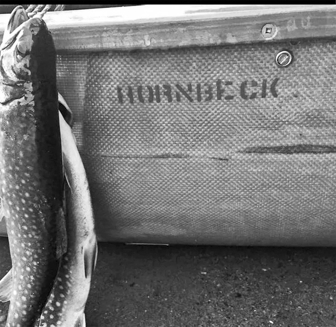
We are somewhat underboated in these conditions in our Hornbeck
lightweight canoes, even though they are very seaworthy. The ease and
light weight (17 and 24 pounds) are always hard to give up, but it would
be an iffy crossing fully loaded. Once we reached the point on the
northern end of Sargent Cove, I decided to take a less exposed route
slightly into the cove, while David, with and extra three feet of boat,
opted to bull straight ahead into the wind back to camp.
Distance/Time: 7.5 miles, three hours. Weather: Partly sunny. Winds south 10 mph, rising to 15 with higher gusts. Stops: Campsite #1 on Big Island.
What a difference a day makes when a cold front rumbles through. (David has not gained 30 lbs: There’s a PFD under the poncho.)
Day 2 — Friday, Sept 24.
As predicted, the next day poured rain, although no thunderstorms, and we debated whether to take down camp and flee. First, however, we went out for a paddle. It was magical. The warm rain drenched us, the horizon disappeared in a blur, raindrops pocked the lake’s still surface, windless and quiet. The only downside was having to keep bailing. We stopped at the lovely Campsite #6 (two tent platforms, picnic table, firepit), bailed some more, and left. We could see very heavy smoke on Big Island, probably the White Mountain School boys trying to maintain a fire in the downpour.
L: Random leaf fall and rain form a still life in the bottom of Tammy’s canoe. R: David pumps out a few gallons of rain water at Site #6 on the southwest tip of Tidswell Point.
The rain poured, then lightened, then poured, then the sun made a weak try, then the downpour again. It’s better to be in it, in my opinion, than watching the hourly reports and percentage of chance of rain and wondering whether to go paddling. Just go.
On our return, we were treated to the sight of not one, but four Bald Eagles. Our first sighting was an eagle in the distance crossing the lake. Our next view was much closer and far more interesting: A broad white tail flashing up from a beach on a narrow islet and escaping by flying low through the trees. We rounded the islet and there, on a muddy flat right in front of a house, hopped the same eagle, pecking at (presumably) the fresh water mussels that had been trapped on shore by the receding water. He took off again, stopped for a moment on a high branch to glare at us, then flew away across this larger “island.”
L: A haze of water forms on the surface, formed by the upsplashing of millions of pelting raindrops. R: A relatively narrow barrier of muck prevents a circumnavigation of the unnamed island.
We continued navigating the group of what should have been islands, but were now a series of very shallow flats and peninsulas. Our frustration at not getting through was somewhat eased by the sight of two more eagles soaring high, but not far off. We decided to go all around the “island” and touch the narrow bar of muck that blocked us, to check for more birds sightings and so we could claim a circumnavigation. On the way, we passed either side of the islet where we had first seen the eagle. David saw a small group of Least Sandpipers running over a line of fractured rocks on the northern shore of the islet. We joined up again and headed east on the long inlet formed by the sunken bed of the Dead Cambridge River. Running into what should have been a channel, but was now a neck connecting the island and the mainland, we startled a flock of Mergansers, who fled rapidly at our approach. They seemed especially shy, probably because this is hunting country.
As we turned back towards the camp, we caught our favorite bird sighting of the day: an apparent tangle of branchlets on a high pine turned out to be a thoroughly wet eagle sitting high in a dead tree, its wing feathers drooping soaked from the rain, looking like a very ratty national symbol. Was it our mussel-eater from the other side? “Nope!” said David. Let’s up our eagle count to four!”
Distance/Time: Six miles, 2.5 miles. Weather: Heavy rain. Calm to light southeast wind, rising as the cold front passed. Stops: Campsite #6 on Tidswell Point.
Situated in the southern range of the boreal forests and the northern range of the deciduous forests, Umbagog is a transition zone providing homes to species of both habitats, says the USFWS brochure.
Umbagog is an eBird Hotspot (an online citizen-scientist site for posting bird sitings). The well-known viewing areas here are the backwaters along the Magalloway and Androscoggin Rivers and in coves and marshes at the lake’s north end.
One needs to remember that starting in the 40s, no Bald Eagles lived here. They were totally absent in New Hampshire in the 1940s due to DDT but started making a comeback in 1989. “One male, released in New York in 1984, made his way to Umbagog Lake and in 1989 began nesting with a female eagle at Leonard Pond, at the north end of Umbagog Lake. This was the first bald eagle nest discovered in New Hampshire in 40 years, and it was built in the very same tree [white pine] that held the last successful nest in 1949.
Bald Eagles of the Umbagog Area
Throughout the 1980’s Massachusetts and New York released dozens of young, transplanted eagles into the wild (Martin, 2001). One male, released in New York in 1984, made his way to Umbagog Lake and in 1989 began nesting with a female eagle at Leonard Pond, at the north end of Umbagog Lake. This was the first bald eagle nest discovered in New Hampshire in 40 years, and it was built in the very same tree that held the last successful nest in 1949.
Initially, the eagles behaved as though they had young and biologists assumed there were one or more chicks in the nest. Then suddenly the behavior of the eagles changed, and it became clear that the chick(s) had not survived. Working quickly, biologists found a captive-raised chick to put in the nest. Placing a foster chick into a nest that already has a chick is not that uncommon. However, placing a foster chick into an empty nest was unusual and we anxiously awaited the results. The experiment worked and the eagles accepted and successfully raised the foster chick. During the next breeding season the adults fledged two young of their own.
The Leonard Pond territory has remained continuously active since 1989. Between1989 and 2001, the nest produced 16 young (including two foster chicks). The original banded female paired with several different males during that time. The original male of the pair died from suspected lead poisoning in 1994, and the female immediately paired with a second male. That second male disappeared after 1999 and the female paired with a new male. 2001 marks the last year that the original banded female (then 16 years old) was confirmed to have nested at Leonard Pond. In 2002, an unidentified pair of eagles occupied the Leonard Pond territory, but failed to lay any eggs. During 2003 through 2005, a new, unbanded pair occupied the territory but failed to successfully hatch any chicks. However, in 2006 the nest was successful and three healthy chicks were fledged.
Since the first eagle pair nested at Leonard Pond in 1989, two other nesting eagle territories have been established in the vicinity of Umbagog Lake. One of these, located east of the lake, has successfully fledged chicks each year since it was first observed in 2000. In 2005 a third eagle territory was established in Sweat Meadow, and in 2007 a nest was discovered in Rapid River.
Kate Maguire 7/1/2001, revised 11/2006. Umbagog National Wildlife Refuge Northeast Region
Click for full-size image
Click for full-size image
Click for full-size image
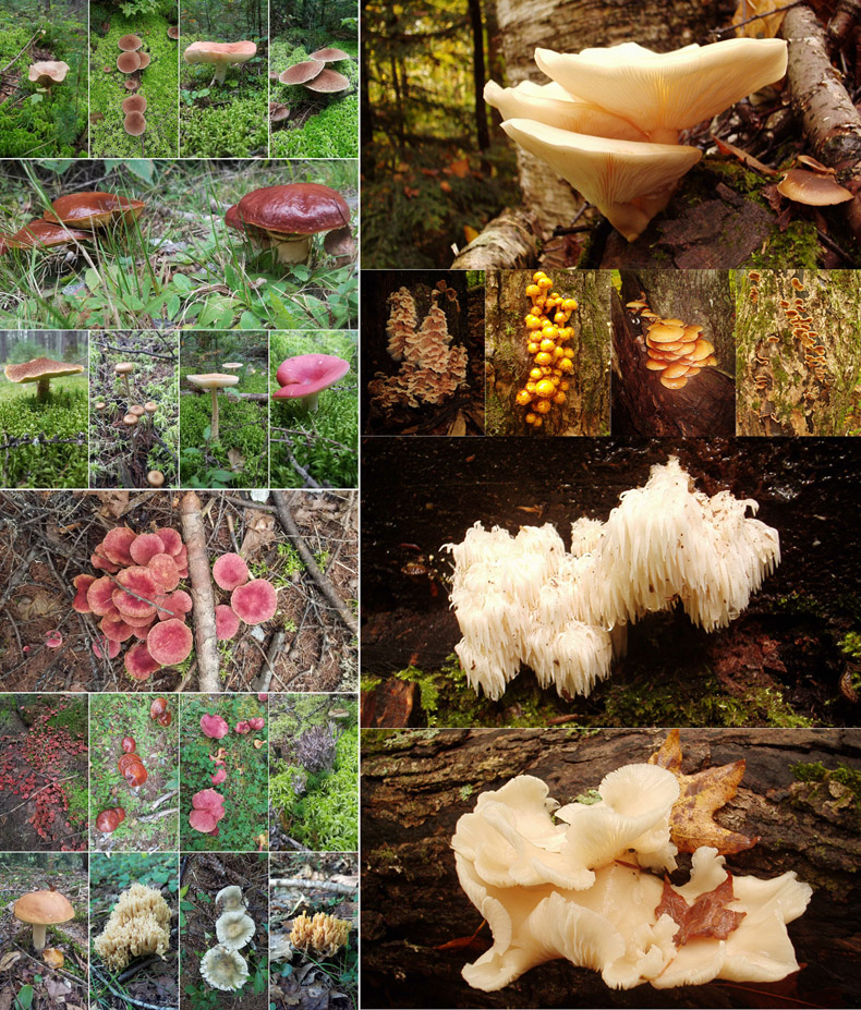
Our two best bird sightings — the Pileated Woodpecker and the bedraggled Bald Eagle. Note from David: I was going to try and ID these fungi using an on-line app. I found one that looked good and loaded up the picture in row 4 on the left. After watching the rotating egg timer for about three minutes, here’s the result: I think it’s: Tricholomopsis rutilans. Or perhaps Lacrymaria lacrymabunda, Tricholomopsis sp., Cortinarius bolaris, or Gymnopilus thiersii, or something totally different! So I leave the identification of these lovely growths as a fun exercise for you, our readers!
We’ve already experienced Hurricane Elsa, the fifth Atlantic hurricane so far this season. US Harbors has provided this “cheat sheet” to help you understand the conditions/warnings/advisories that NOAA and the U.S. Coast Guard might be sharing.
“Advisories”, issued by NOAA in case of possible impending, life-threatening weather and water conditions, are classified as “Watches” (issued 48 hours before expected in your area) and “Warnings” (issued 36 hours before expected in your area.) There are generally 4 types of conditions that trigger these advisories:
● Storm Surge — When there is a danger of life-threatening inundation from rising water moving inland from the shoreline somewhere within the specified area. If you are under a storm surge warning, check for evacuation orders from your local officials.
● Hurricane — When sustained winds of 74 mph or greater are expected somewhere within the specified area. NHC issues a hurricane warning 36 hours in advance of tropical storm-force winds to give you time to complete your preparations.
● Tropical storm — When sustained winds of 39 to 73 mph are expected within your area.
● Extreme Wind — For sustained winds of a major hurricane (115 mph or greater), usually associated with the eye wall. These warnings are issued when the winds are expected to begin within an hour. Take immediate shelter in the interior portion of a well-built structure.
LOCAL, STATE, and OTHER RESOURCES
● Your local TV and radio stations, as well as area news websites, all get their weather updates from NOAA.
● Your state and regional office of emergency management will have local details about evacuations routes, shelters, and other important planning information.
USCG PORT CONDITIONS
The US Coast Guard sets “Hurricane Port Conditions” for major ports when weather advisories indicate sustained gale force winds of 39-54mph/34-47 knots (or above) expected in the following time frames:
● WHISKEY = Predicted to make landfall at the port within 72 hours.
● X-RAY = Predicted to make landfall at the port within 48 hours.
● YANKEE = Predicted to make landfall at the port within 24 hours.
● ZULU = Predicted to make landfall at the port within 12 hours.
Whenever USCG sets a Port Condition, they advise you to:
● Stay off the water. The Coast Guard’s search and rescue capabilities degrade as storm conditions strengthen. This means help could be delayed. Boaters should heed weather watches, warnings and small craft advisories.
● Evacuate as necessary. If mandatory evacuations are set for an area, the public should evacuate without delay. Coast Guard personnel and other emergency responders may not be able to evacuate or rescue those in danger during the storm.
● Secure belongings. Owners of large boats are urged to move their vessels to inland marinas where they will be less vulnerable to breaking free of their moorings or to sustaining damage. Trailerable boats should be pulled from the water and stored in a place that is not prone to flooding. Those who are leaving their boats in the water are reminded to remove EPIRBs and to secure life rings, lifejackets and small boats. These items, if not properly secured, can break free and require valuable search and rescue resources be diverted to ensure people are not in distress.
● Stay clear of beaches. Wave heights and currents typically increase before a storm makes landfall. Even the best swimmers can fall victim to the strong waves and rip currents caused by hurricanes. Swimmers should stay clear of beaches until local lifeguards and law enforcement officials say the water is safe.
● Be prepared. Area residents should be prepared by developing a family plan, creating a disaster supply kit, having a place to go, securing their home and having a plan for pets. Information can be found at the National Hurricane Center’s webpage.
● Stay informed. The public should monitor the progress and strength of the storm through local television, radio and Internet. Boaters can monitor its progress on VHF radio channel 16. Information can also be obtained on small craft advisories and warnings on VHF radio channel 16.
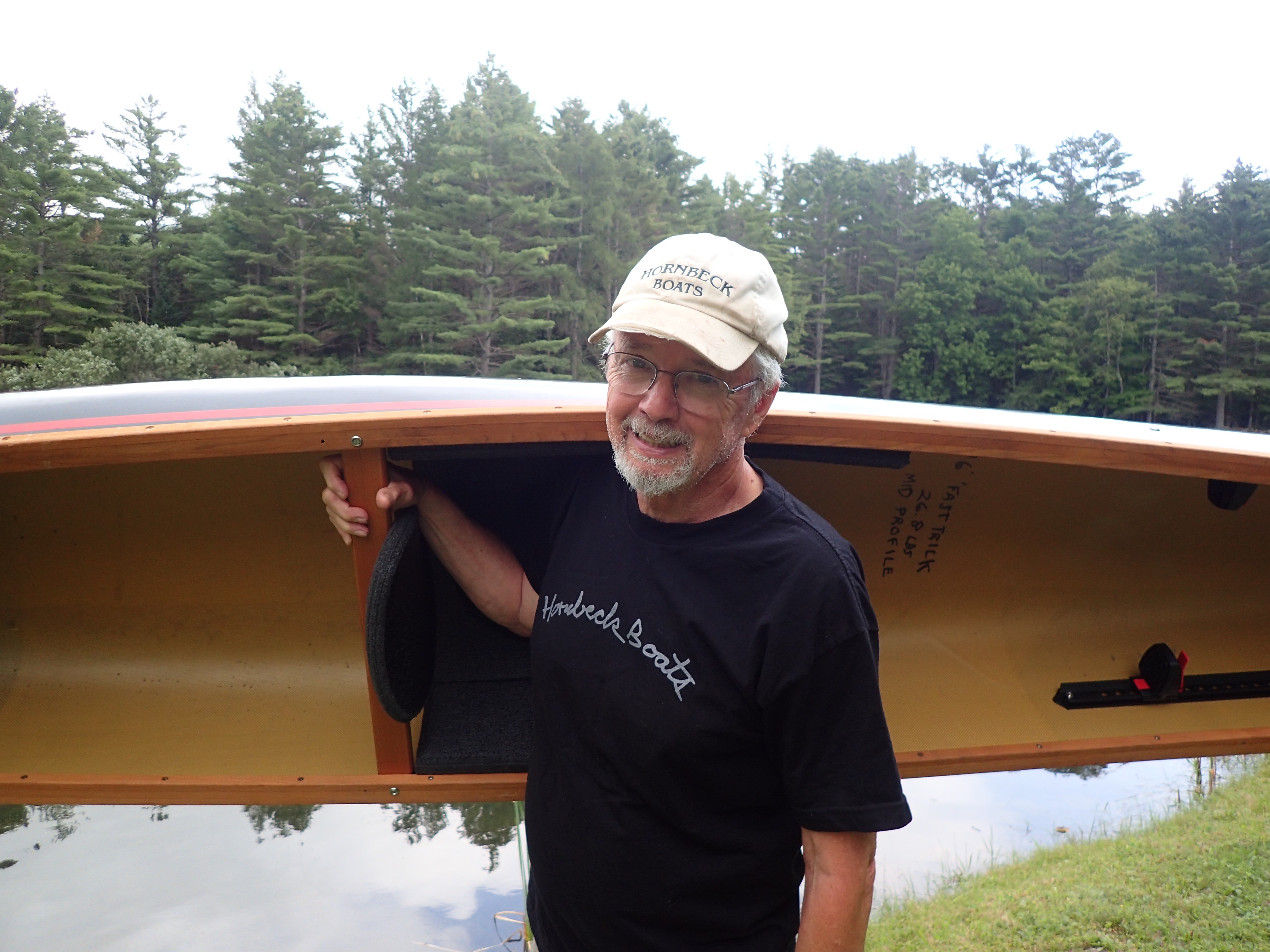
We lost a giant the day after Christmas. The only saving grace about his passing was that he wasn’t taken by the Covid virus. Like his knees, his heart wore out. He was on a hike with his kids and grandkids on a mountain in the Adirondacks… and then he was gone. Peter Hornbeck was very important to the development of our company (Adirondack Guideboat). Aside from being a source of inspiration and humor… tons of humor…. we also put him on our board of directors. No, this wasn’t an honorific position, on several occasions we needed a wise voice and Pete’s was it. He had been a school teacher for 20 years, then began building boats in his garage. That was 50 years ago. His wife, Ann, was also a schoolteacher. She finally got tired of the smell of resin in the house, and gave Pete her summer check and told him to build a building out back. Last time we were there, he’d built four or five out-buildings in which he and his crew built and stored boats. They’d hang the boats from hooks, like cow carcasses hanging from the ceiling. All winter long they’d build an inventory and then as the warm weather arrived, that inventory would shrink and shrink.
I’ve never taken a survey, but I bet if you did that you would find that Pete was, and is, the most beloved person in the Adirondacks. His distinctive small yellow boats could be seen on top of every fifth car during the summer (or so it seemed. But his personality glowed even brighter.
Every year I bet Pete gave away $20,000 worth of boats for fund-raising events. Due to the ridiculously light weight of his boats (some as low as 12lbs, less than a 12 pack of beer), they were very popular with women. And oldsters. Pete was also a painter, usually of his boats in wilderness settings. I think he gave them all away, likely to non-profits needing money.
One of Pete’s boats sits in the Adirondack Museum. It is his version of Rushton’s Sairy Gamp (named after a Dickens character who was known to “take no water.”) The original is so tiny and beautiful, Rushton said to George Washington Sears, the diminutive writer for Field and Stream, for whom it was made, “If I made it any smaller I’d have to deliver it to you in a soup spoon.”
Farewell, Pete, your kind only comes along once.
David Rosen is the former co-owner of Adirondack Guideboat.