James Island County Park to Host East Coast Paddlesports Symposium March 27-29

(CHARLESTON) – The East Coast’s premier paddling event is back in March at James Island County Park. Known as the East Coast Paddlesports Symposium, this three-day event welcomes paddling enthusiasts of all ages and skill levels from around the world. Registration is now open.

Held March 27 through 29 this year, the symposium is a three-day immersion in the history, technique, hands-on experience and fun of kayaking and other paddling-related topics. World-renowned instructors and coaches will offer presentations, on-water classes and other programs teaching everything from the basics to expert skills for paddling enthusiasts.

The 30th annual symposium modified its format last year to offer a more diverse and student-centered experience. After being matched with a small group of paddlers with similar skills and interests, participants will be assigned to a group leader and local instructor and work with a different seasoned coach each day. Groups will meet in the morning, then spend the day learning and traversing some of the area’s best waterways. This year’s coaches’ lineup will feature a variety of experts in the image005.jpgpaddling world.

Daily or full weekend registration is available. For further details on the East Coast Paddlesports Symposium or to register, visit CharlestonCountyParks.com.

In April, James Island County Park will offer the Charleston Outdoor Fest, which showcases and offers chances to try out a variety of outdoor recreational activities including canoeing, kayaking, stand up paddleboarding (SUP), mountain biking, slack lining, archery, climbing and disc golf. The Charleston Outdoor Fest is very beginner and family-friendly and will be held April 18-19.

For more information on these events and much more, visit CharlestonCountyParks.com or call 843-795-4386. This event is made possible by Coca-Cola and Charleston County Parks. Sponsorship opportunities are available for these events and more. For more information, visit CharlestonCountyParks.com.

2019 Schoodic Sea Kayaking Retreat

Sept. 15-21, 2019

This five day event features the East Coast’s finest sea kayaking and highlights a chance to try the amazing wooden kayaks by Nick Schade in the conditions they were designed for.  

Schoodic Point

We had a great time in 2018 so we are doing it again in 2019.

Sponsored by Chesapeake Light Craft

Sponsored By Chesapeake Light Craft

Hang a left down Route 1 from Ellsworth and the crowds dissipate, but you are navigating towards some of the finest kayaking on the east coast.

On the east side of Frenchman Bay, away from the bustle of Bar Harbor, lies a largely forgotten piece of Acadia National ParkSchoodic Point. Exposed to the open swell, with rugged rocky shorelines, steep storm racked cliffs and spectacular scenery, it is hard to imagine a finer body of water to explore in a sea kayak.

Under the expert leadership of experienced sea kayaking instructors and guides, you will discover why you love kayaking all over again. Nick Schade, Gerry Polinsky assisted by Barb Todd and Joey Schott, will lead you along amazing shore lines, across beautiful harbors and around spectacular islands where you can either bask in the glory of it all, or expand your skills, while exploring fantastic rock gardens, sea caves, slots and off shore ledges.  With the five-day format, all paddlers will have the opportunity to experience the renowned Sullivan Reversing Falls (aka white water for sea kayaks).

An aspect unique to this event and well received in 2018 is the non-paddling participant program. Friends and significant others are welcome and there is plenty of local adventure to keep them occupied while you are on the water including spectacular hiking, trail biking (rentable bikes), art galleriestaking a ferry over to explore Acadia Parkshop in Bar Harborand, most fun, throwing rocks at paddlers from the scenic cliffs around the Schoodic Peninsula.  There will be a good number of non-paddlers so it will be easy for them to find folks to adventure with.

This year’s event is a Monday to Friday affair.  Given all this spectacular area has to offer, there will be options to add day(s) at the institute before or after the event proper to allow for local exploration.

New for 2019

We’ve expanded from a three-day to a five-day format, allowing more time to build progressively and giving paddlers an opportunity to jump between groups as they wish and is appropriate.  

Off Water Activities

There will be more “off water” programming aimed at both paddlers and non-paddling participants featuring a night sky tutorial by Carl Tjerandsen, an avid amateur astronomer, and a Bar Harbor formal garden tour led by knowledgeable designer Eric Hansen – both participants at Schoodic Retreat 2018. Also, a naturalist presenting on the state’s bald eagle program and a casual step-by-step, super fun, art class where adult beverages meets the DIY world of art.

Joey will be running a rolling class that’s open to new rollers and those looking to refine their skills.  

Boat Swap

Nick and Gerry are most excited to hold a park-and-play day for the entire group, held in a quiet bay adjoining the reversing falls, featuring a chance for everyone to try out Nick’s Guillemot Kayaks boats. His designs are renowned for their open water performance and playful action.  This is a rare and unique opportunity to experience Nick’s boats’ exceptional capacity in their intended environment.

Sea Kayaking

The Schoodic Retreat allows paddlers of various experience levels, from advanced beginner to advanced open water paddlers, and guided exploration of the fantastic surroundings and, to the degree individuals are interested,  hone their rough water skills through individualized instruction.  Participants will have the opportunity to paddle with “pods” of similarly experienced kayakers.  

Pod 1 is geared to advanced beginners to open water paddling looking to play and explore in a fantastic setting. Skilled instructors will help you integrate your experiences into comfort on open water.


Pod 2 is for those that have more time in rough water.    This is your opportunity to push your boundaries and expand your skills under the watchful eye of experienced instructors.

Pod 3 is a long leash, hard-charging, play opportunity and “top tips” style coaching appropriate to your goals and needs. 

Our base of operations for the will be the Schoodic InstituteOriginally created by John D. Rockefeller Jr. for the Navy so they wouldn’t ruin his vacation over in Bar Harbor, the site served as a Naval radio station and security listening post from 1933 until 2002. Surrounded by water and with easy walks to amazing ocean views and beautiful hiking trails through the woods, the Institute has a mission to advance ecosystem science and learning.

The institute features comfortable apartments and a hearty food service on site. The campus itself is beautiful with a historic brick main building, log cabin cafeteria featuring individual great rooms for dining, meandering foot paths and easy walking access to Schoodic Point. After a day on the water you will be able to get back and relax with a nice meal, and maybe a beautiful sunset before hitting a warm bed.

It is our goal to provide an enriching experience. Our hope is you return home energized by what you see, learn and do at this retreat. With coaching staff to provide a safe and instructional time on the water, a free-form journey of exploring, skills learning, and active water play will be the itinerary each day. We will provide individualized instruction as desired to improve your ability to appreciate the experience. We work to allow you to use the skills you have, and develop new skills while sea kayaking in awesome surroundings. And at the end of the day, enjoy a relaxing debrief over a nice meal and drink. There will be suitable challenges available for all levels of kayakers from simply learning to navigate across a harbor to practicing seal landings in surging rock gardens. This will be super fun and fruitful break from routine in a magnificent setting.

Your Hosts:

Nick Schade

has been kayaking for over 40 years. He started designing and building high performance wooden sea kayaks over 30 years ago specifically to enjoy the waters and coastline of Frenchman Bay and Schoodic. Nick brings a rich knowledge of how kayaks work and how they interact with the natural environment.

Through his company Guillemot Kayaks, Nick has spread his passion for kayaking and making kayaks to thousands of boat builders worldwide. While beautiful, these kayaks are built to use. Over the years, he has found that he can make wooden kayaks that are lighter and stronger than standard production composite boats.

Nick will bring a selection of his high performance wooden kayaks for the weekend for people to test and abuse. This is a great opportunity to experience how a high performance wooden kayak handles in the exact environment they were designed for.

Nick is a largely self-taught kayaker who has been bringing paddlers of all levels out onto the water for decades. He has written articles on sea kayaking techniques for the late great Sea Kayaker Magazine. He is a registered Maine Guide because thats needed for this kind of thing, but he is doing this for the love of kayaking.

Gerry Polinsky

Coming from a background of winter mountaineering and guiding, Gerry embraces the high adventure potential in sea kayak coaching. He takes advantage of his local waters, frequently paddling in rocks, surf and races.


Gerry started Sea Sherpa Kayak in 2009 and has continued to focus on his own certifications which now include ACA L5 Advanced Open Water InstructorBCU 5 Star Leader (now Advanced Sea Kayak Leader) and is a registered Maine Guide. He has completed multi day tours including the Bay Of Fundy, Baja, the entire outer coast of Vancouver Island and much of the Maine from mid coast to the Canadian border. His traveling instructional tour de force includes working on symposium and courses, all over the Northeast, Tybee Island, San Francisco, Baja and the Pacific Northwest.


Gerry prides himself on his coaching in active open water conditions, most especially, the work he has done introducing paddlers to their first taste of active paddling. He creates a drama free zone through an individualized approach and keeps the chest pounding to a minimum.

The Gerry & Nick Story:

Nick and Gerry having been frequent paddling partners in crime for the last decade: Rocks gardening, shore surf and working tide races. Their backgrounds couldn’t be more different with Nick entirely (and uniquely) self-taught while Gerry is more “classically” trained by other coaches and following a certification progression. Their approaches, to both paddling and presentation are simultaneously contradictory and complimentary.


Co-Coaches

Gerry and Nick are very excited to have recruited some very able paddlers to assist, instruct, coach and lead with us during the retreat. 

Joey Schott

Joey Schott got his start kayaking nearly twenty years ago while on vacation in Bar Harbor. He loved it so much that he started building kayaks as a hobby. In 2009 he became Sales Manager at Chesapeake Light Craft. It was Nick who introduced him to Rough Water Sea Kayaking and he has not been the same since.

Chesapeake Light Craft Log

In 2014 he branched out on his own by opening his shop, Turning Point Boatworks, specializing in custom builds of small boats in both wood and composite. (He is developing a composite Petrel Play!) He currently holds an ACA L4 Coastal kayaking instructor certification along with a rolling endorsement. He still considers himself a student of the sport, always learning and pushing his limits. With his experience at Chesapeake Light Craft Joey is very knowledgeable about wood kayaks. He will be bringing several kayaks from the CLC stable as well as his own work from Turning Point for participants to test paddle.

Barb Todd

Barb Todd has been an active water paddler for over 15 years. Her kayak adventures have brought to Nova Scotia, Baja California, Wales UK and Iceland as well as many, many locations along the eastern seaboard from Florida through to the Canadian border.

As a coach, Barb has worked alongside some of the most highly accredited “water gods”. Events she has worked includes the Downeast Sea Kayak Symposium, the Mid Coast Rendezvous and the renowned Schoodic Retreat. She is a British Canoe Sea Kayak Leader, a Maine Guide – Sea Kayak and has taken discipline specific trainings in forward stroke, surf, rocks and ledges.

Barb is particularly good in leading sea kayakers in dynamic environments that they would otherwise find intimidating: Kind of a pied piper scenario. She loves paddling in active water and is happiest in current play.


Rockefeller Hall

Accommodations:

Schoodic Institute is located on Big Moose Island which forms the headlands of Schoodic Peninsula. This former Navy station had apartments for officers and families which now serve as comfortable accommodations for Institute guests. 

The chefs at the Institute strive to cook with fresh, locally sourced ingredients. Soups, dressings, sauces and baked goods are prepared from scratch daily. 

Special Dietary needs: The chefs are happy to accommodate the allergies and dietary restriction of the guests.

Cost:

Paddler: Four days of paddling (or five if you are hardcore) plus room and board at the Schoodic Institute.$1,350
Non-Paddler: Room and board at the Schoodic Institute in Acadia National Park plus access to off-the-water programming.$800

The price includes on the water instruction and guiding by Registered Maine Guides, 5 nights and 5 days stay at Schoodic Institute, meals provided (Monday breakfast through Saturday breakfast, bag lunches during the day and hearty dinner at night with a Deluxe Dinner one night:  option of lobster, steak or vegetarian). Arrive the afternoon of Sunday, September 15th to check in, on the water daily Monday through Friday and checking out Saturday the 21st. We can customize accomodations if desired, just ask.

More Information

For details about what you will need to enjoy the event, what kind of gear you will want, and more stuff about accomodations, please read our Schoodic Retreat Gear List and Other Information.

Registration & Deposit:

To register and reserve your space at the retreat we request a 50% deposit. (Paddler: $675, Non-Paddler: $400)

More Information:

If you would like to register, or would like to receive more information, please click here.

Northeast Coast Guard Searches for 31 Unmanned, Adrift Paddlecraft July 4 Weekend

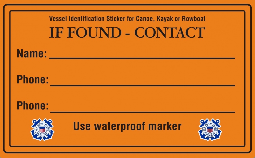
The Coast Guard offers owners of kayaks and standup paddleboards, and other unregistered watercraft a free “If Found” sticker for their boat to help reduce the number of unnecessary search and rescues. Stickers provide room for the owner’s name and two phone numbers, written in waterproof marker.


BOSTON — First Coast Guard District response crews, from Maine to the Jersey shore, responded to 31 separate reports of unmanned and adrift paddlecraft during July 4 weekend.

Sector Northern New England crews responded to eight cases; six of the cases were suspended due to lack of information and two were resolved because the owner was found.

Sector Boston crews responded to 12 cases; seven of the cases were suspended due to lack of information and five were resolved because the owner was found.

Sector Southeastern New England crews responded to five cases; one was suspended due to lack of information and four were resolved because the owner was found.

Sector Long Island Sound crews responded to six cases and all were suspended due to lack of information.

“We search every time there is an unmanned and adrift paddlecraft found because we just don’t know if someone is missing or not,” said Brian Fleming, a search and rescue watchstander at Sector Boston. “Help us confirm your loved ones are not in distress by labeling and securing your paddlecraft.”

Approximately, $428,300 and about 450 man-hours were spent searching for unconfirmed persons in the water.

The Coast Guard reminds boaters to take precautions while on the water:

Wear your life jacket, it can save your life.
Label your paddlecraft with contact information. You don’t need a sticker, just a permanent marker and some clear tape to protect the ink. Check to make sure it’s readable every time you go out.
When you are done for the day, secure your paddlecraft well above the waterline in cases of high tide and strong wings.
Tell someone where you are going and when you are going to return, so we have a good area to search if you go missing.
Have a light for night paddling.
Have a sound making device.
Know your limits; paddle in safe areas under safe conditions.
Planning and safe boating practices save lives, reduces responder fatigue, and minimizes the waste of tax-payer dollar on unnecessary searches.
-USCG-

2019 MITA Guidebook is Here

Reviewed by Peter Jones

Each spring, the Maine Island Trail Association (MITA) issues its annual updated guide to the Maine Island Trail, a 375-mile coastal waterway that spans the entire coast of Maine extending from Portsmouth Harbor in the south to Cobscook Bay on the Canadian border. Self-described as a “water trail created, protected, and enjoyed by people who love the coast of Maine” and modeled loosely on land trails like the Appalachian Trail, the Trail was conceived in the late 1970s and is the pre-eminent water trail of its type. It has since has become a poster child for other water trails in the United States.

There are over 3,000 islands off the Maine coast, as well as thousands of rocky ledges which are exposed at low tide, and the Maine Island Trail connects over 200 of these islands as well as mainland sites which are available for day visits or overnight camping. The Guide provides a comprehensive description of all the sites as well as critical information on safe and responsible boating practices. Incidentally, nearly all the islands on the Maine Island Trail are wild and undeveloped.

The Guide is very much a “living’ book.” New sites are added or removed each year, conservation practices and usage guidelines can and do change, so MITA recommends that boaters refer to the most recent version of the Guide. The book divides the Maine coast into ten distinct geographic regions. For each region there’s an overview locator page that describes its general character, followed by one or more maps showing MITA sites and resources found within the region – for example in the Cobscook Bay region there are now eight sites. You can use the locator pages to identify where each trail site is in relation to other trail sites, launch sites, points of interest, etc. Following each locator page for that region are maps and detailed site descriptions that outline specific site usage guidelines such as where best to land a boat at low tide, where to place your tent and for how many campers, whether you might expect, for example, to see raccoons, mosquitos or a bald eagle.

At the front of the Guide are sections on Stewardship and Safety, topics which can often be dry and easily skimmed over, but a MITA publication is different. Obvious care has been taken to provide the information that you need but no more, and I for one, as a “summer kayaker” read these sections as a refresher each spring for “things you need to know” when taking small boats into coastal waters. MITA emphasizes both “low impact practices” to protect the natural integrity of the islands and also safety practices to reduce risks to boaters in a fun but high risk environment. What to do if you go overboard, how to interact with a seal you see on a rock ledge (don’t!), how to recognize plant species which are invasive in Maine – topics which are all succinctly covered here.

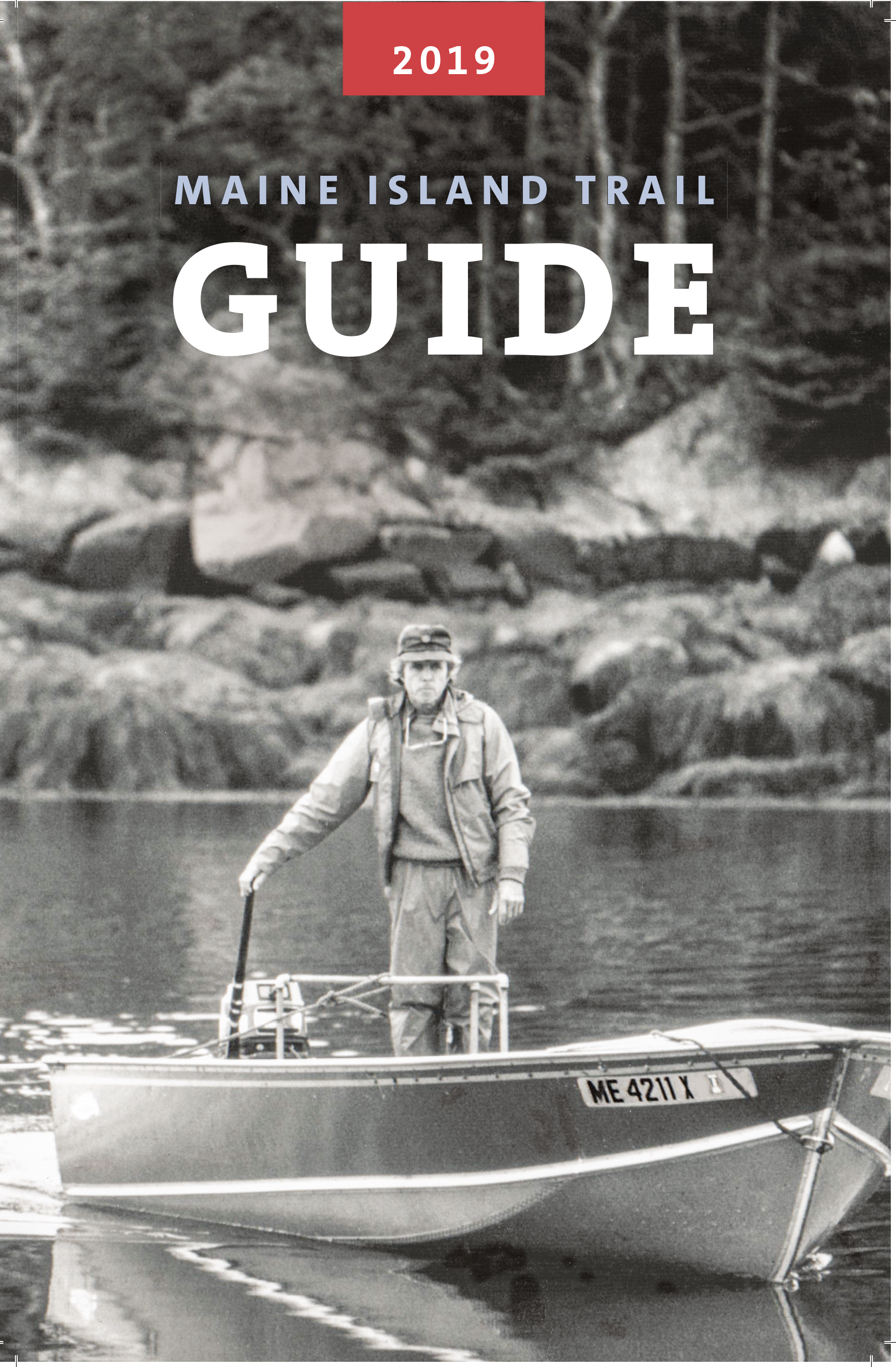
This year’s Guide is dedicated to the late Dave Getchell Sr., small boat captain, outdoor recreation writer, editor and cofounder of MITA and features a photo of Mr. Getchell on the front cover in the early days of the Maine Island trail. Also this year are two examples of newly added sites which illustrate the range of environments on the trail: Little Whaleboat Island in Casco Bay and Rodgers Island in Cobscook Bay. Little Whaleboat, “a cluster of islands linked by mud, sand and ledge” is owned by a Family Limited Partnership and is listed as having two camping sites for ten people in total. “Campfires permitted below high tide line…pets allowed on leash only.” About 200 miles to the northeast of Little Whaleboat, Rodgers was “bequeathed to the town of Lubec and…consists of two forested islands connected by a gravel bar. The bar is exposed at lower tides creating a single, slender island measuring roughly a half mile long. On the island one can often find songbirds and shorebirds and spot ospreys and eagles perched in the trees. Cobscook Bay has the highest density of nesting bald eagles in the northeastern United States…follow careful, low impact guidelines to minimize the potential for disturbance of birds and other wildlife. Please leave pets at home.”

MITA’s goal is to encourage conservationists and users of Maine’s coast to actively support the Trail and the Association through membership and the complete guide is therefore available to members of MITA but not to the general public in local bookstores or online. However, the members-only mobile app which contains everything found in the hardcover guide and then some is available, in a more limited version, to the general public.

The Maine Island Trail Guide is an indispensable and inspirational guidebook for all recreational paddlers, sailors, rowers and those moving under power in small boats on the Maine coast and coastal islands. And not just that – it makes for great bedside reading!

Peter Jones is the owner and principle guide at Driftwood Kayak and leads one-day and multi-day trips out of Stonington, Maine. Peter spent his childhood in Wales where he built his first kayak at his high school “canoe club.” He is a registered Maine Guide, a former American Canoe Assn. Instructor and a certified Wilderness First Responder. Peter and his wife, Christine, a children’s author, live in Gloucester, Mass., and Deer Isle, Maine. You can reach Peter at www.driftwoodkayak.com.

Go Far, Go Light

By Tamsin Venn

Many of us older kayakers are having various senior setbacks. But we all love kayaking and won’t let those stop us. We know the benefits: low impact; connect with others; get out in nature; intellectual stimulation involving navigation skills and tide charts.

Here are ten tips worth reconsidering to make kayaking easy on us.

1. Go light. Lifting a kayak on and off cars or the beach can strain your back. Light kayaks made of carbon fiberglass material can be well worth the investment. More kayak manufacturers, recognizing the needs of the older paddler, are reducing weight using various materials. Aim for a boat 35 pounds or less. Consider a wood kayak, which is light, durable, lively, and lovely to look at.

2. Invest in a good paddle for ease of swing weight. Again carbon light materials can be expensive but well worth the price, and wood is a good option. Consider a Greenland paddle. It has a longer and narrower blade that lessens the upload on your arms and shoulders.

3. Lifting your kayak on and off a car, especially as a solo paddler, can be onerous. Thule makes something called a Hullavator, a mobile rack that allows you to load the kayak at waist level on the side of the car, then lifts it onto a rack on top of the car. A strut device eases most of the kayak’s weight.

4. Most kayak accidents occur on land, on rocky shores where you may slip on seaweed. Always step in between the rocks, not on top of them.

5. A kayak cart removes the need to haul on your shoulders. You can even rig up a cart to a bike to get your boat to the water. If you ever go to the Adirondacks, where portaging from one pond to another is de rigeur, you will see seniors everywhere using kayak carts. Strap them to the back of your kayak when not in use, or stow them in the rear hatch. Nothing says portage better than kayak cart.

6. The usual kayak safety planning is even more important as you get older. File a float plan with a family member or friend. That indicates your proposed route, time of return, and a description of your kayak. Other useful (and in some cases mandatory) items: a weather radio to indicate wind force and direction; cell phone in waterproof case or hand-held VHF; a pfd (personal flotation device); whistle; and a wetsuit or drysuit if you are paddling in cold water. Hypothermia from cold water immersion is one of the kayaker’s biggest challenges.

7. Carry a tow rope, so you can tow the grandkids in their kayaks back to shore if they get tired, or so they can tow you! Towing is a remarkably easy way to assist someone back to shore.

8. In the off season, lift light weights to keep shoulders and arms strong. Or check out the spring training session in our April issue.

9. Do yoga to assist in balance and flexibility, especially key for getting in and out of your kayak.

10. It’s best to venture out in less traffic. Avoid busy summer weekends when motorboat and Jet Ski traffic is at its most frantic… and noisy. Go early in the morning, when the water is tranquil, and the world is yours.

Happy Spring Paddling!

Films to Inspire Your Paddling Adventures

Metrophobia is the winner of Best Sea Kayaking Film for 2019.

The Paddling Film Festival is now underway at a local kayak shop near you. It presents some of the best paddling films made throughout the world and includes rivers, lakes, oceans, risk takers, wanderers, lifestyle, wild places, adventure, from Greenland to Nepal to Alaska.
Rapid Media, a Canadian paddlesports publishing outfit based in Ontario, has presented the Festival since 2006, inspired by the Banff Festival of Mountain Films. The Film Festival committee has selected a shortlist of 26 films to be shown. Contact the retailers below for times.
Next viewing is March 19 at the Kayak Centre in Wickford, R.I. at 7 p.m. Admission is $12 online/$15 at the show, sponsored by the Northern Forest Canoe Trail (NFCT). Here’s the schedule for the Atlantic Coast:
March 20: Buffalo Paddleworks, Buffalo, N.Y.
March 30: Cross Currents Sea Kayaking, Baltimore, MD
March 30: Recreation and Leisure Studies Dept. Ithaca College, N.Y.
March 31: The Villages Canoe & Kayak Club, The Villages, Fla.
April 3: Mountainman Outdoor Supply, Saratoga Springs, N.Y.
April 6: Headwaters Outfitters, Brevard, N.C.
April 9: Rivanna River Co., Charlottesville, Va.
April 11: Conn. Sea Kayakers Assn. (ConnYak), Branford, Ct.
April 11: Epic Sports, Bangor, Maine hosted by NFCT
April 11: REI, Framingham, Mass., hosted by NFCT
April 13: Susquehanna Greenway Partnership, Williamsport, Penn.
April 17: Contoocook River Canoe Co., Concord, Mass. Hosted by NFTC
April 25: St. Lawrence Valley Paddlers, Canton, N.Y.
April 25: Outdoor Gear Exchange, Burlington, Vt.
April 27: Outcast Paddlers, Pittsburgh, Penn.
April 27: Northern Forest Canoe Trail, Lake Placid, N.Y.
April 28: Westbrook Supply Co./Narcisse & Assocs., Sandy Springs, Ga.
April 28: The Don CeSar, Saint Pete Beach, Fla.
April 28: Get: Outdoors Paddlesports, Greensboro, N.C.
May 1: Waynesboro Parks and Recreation, Waynesboro, Va.
May 3: TenneSEA Kids 4 Clean Water and Tennessee Valley Canoe Club, Chattanooga, Tenn.
May 31: LL Bean, Freeport, Maine
June 29: Wilderness Voyageurs with the Yough Riverkeeper, Ohiopyel, Penn.
Aug. 18: Wander North Georgia, Clayton, Ga.
Go to www.paddlingfilmfestival.com for more information.

Gear Checklist

If you’re like us, your net bag contains many items that may or may not be useful for that day’s paddle, but you keep everything in there just to cover your bases. But, whenever you’re getting ready to go paddling, there are a handful of things you can do and bring to make your trip safer and more fun. Watch this video to see a simple checklist that every experienced kayaker runs through every time and you should too, say ACA-certified sea kayak instructors Paul and Kate Kuthe. Thanks to paddling.com for letting us know about this useful reminder series.

Paddle Florida Trips Announced for 2018-19 Season


Paddle Florida’s line-up for next season is posted now and registration is open. Here is a great opportunity to paddle some of Florida’s most scenic waters in good company. Click on trip links at Paddle Florida for more details on each event. New next season is the Flori-Bama Expedition on the Perido River. Forming the border between Alabama and Florida, this stream meanders past extensive woodlands of pine, cypress, and juniper cedar with many sandbars along the journey to Perdido Bay and barrier islands in the Gulf of Mexico. The ever popular Florida Keys Challenge will be making a come-back next season in an altered form which will showcase beautiful Bahia Honda State Park and surrounding islands. Rivers, springs, lakes, coastal waters – Paddle Florida will explore them all next season! Sign up soon if you’re interested. Registration opened June 1, and some trips fill quickly.

Upcoming Trips

Suwannee River Wilderness Trail
October 19-24, 2018
Celebrate Florida’s version of autumn on its most famous river. The trip spans 65 miles of the scenic Suwannee and a portion of the (northern) Withlacoochee, from Madison Blue Spring to Branford. This section features dozens of clear blue springs perfect for swimming and snorkeling.
Register by: October 5

Flagler Coastal Wildlife Experience
November 1-4, 2018
Paddle with dolphins, meet rescued sea turtles, and float by historic forts as you immerse yourself in the rich cultural history and natural beauty of Florida’s northeast coast.
Register by: October 18

Ocklawaha Odyssey
Nov 30-Dec 4, 2018
Float over Florida’s most famed first magnitude spring and see monkeys dangling from cypress branches, a rich diversity of birds, while exploring an Old Florida land- and waterscape on this 48-mile paddle down the Silver and Ocklawaha Rivers.
Register by: November 16

Wild, Wonderful Withlacoochee
January 17-22, 2019
Beginning at Lake Panasoffkee, paddlers will thread their way through hardwood swamps and tannic streams on a 60-mile journey to the Gulf of Mexico. The adventure includes a side trip to the colorful Rainbow River and its world class first magnitude spring.
Register by: January 4

Florida Keys Challenge
February 9-15, 2019
Paddle the azure coastal waters of the Middle Florida Keys, including the length of the famed 7-Mile Bridge, explore mangrove tunnels, and watch sea turtle surface beside your kayak, and enjoy a snorkeling trip out to Looe Key.
Register by: January 26

Flori-Bama Expedition on the Perdido River
March 10-15, 2019
Paddling the Florida/Alabama border, enjoy beach camping along a cozy meandering river to the more open waters of Perdido Bay as we explore the most diverse set of ecosystems of the season.
Register by: February 24

Suwannee River Paddling Festival
April 5-7, 2019
With camping atop the bluff overlooking two beautiful rivers, our season-capping festival takes place at Suwannee River State Park near Live Oak. The weekend will offer supported 8-12 mile paddling options on both the Suwannee and Withlacoochee Rivers, a concert featuring Paddle Florida’s favorite musicians, and educational presentations from regional waterway experts.
Register by: March 22

Today is the 30th Anniversary of the Maine Island Trail

Today is the 30th anniversary of the Maine Island Trail — the day in 1988 when 12 citizens met to form the Maine Island Trail Association and create “an outstanding waterway for small boats” along the coast of Maine. Since then, more than 33,000 coastal explorers and stewards have helped ensure that over 200 wild islands on the Trail remain pristine and accessible.  

The Maine Island Trail is a grassroots effort launched by citizens seeking to visit and steward the wild, uninhabited islands of Maine. While friends groups exist for many public parks, there are few if any others where a simple handshake agreement between 100 disparate landowners and thousands of users and volunteers has created a nationally known recreational entity.

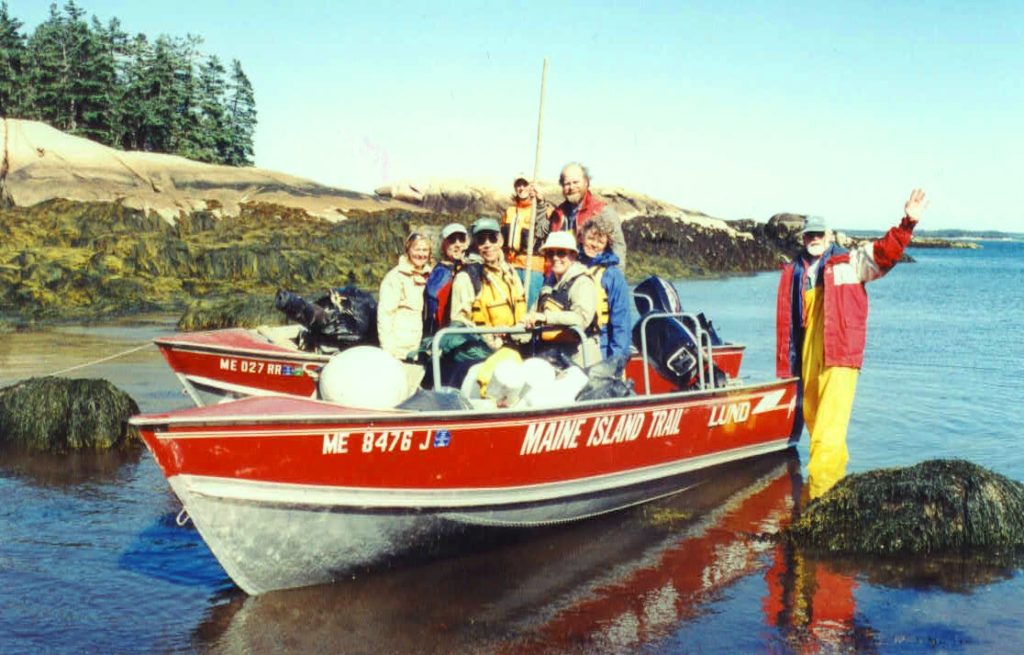
Downeast Cleanup

The idea of a coastal water trail in Maine was born in the late 1970s following a land survey conducted by the State of Maine of the uninhabited coastal islands. The survey determined that the State held title to some 1,300 unclaimed islands, rocks, ledges, and low-water bars along the coast. In the mid-1980s, the State collaborated with the Island Institute, a nonprofit organization serving the islands and communities of the Gulf of Maine, to evaluate the recreational potential of these properties. As part of this evaluation, Dave Getchell, Sr., a founder of MITA, explored the length of the coast and identified some 40 public islands suitable for recreational use. These public properties eventually formed the nucleus of the original Maine Island Trail.

In the fall of 1987, Dave declared in an editorial column in Small Boat Journal that “In studying this bounty [of islands], it occurred to me that here was a rare chance to develop an outstanding waterway for small boats that would use the state-owned islands for overnight stops, similar to the way hikers use pathways like the Appalachian Trail.” This was the inception of what recreational boaters today call a water trail – a concept replicated over 500 times in North America.

In that same editorial, Dave asked readers who were interested in the concept to write him and attend a meeting to discuss it. Twelve people attended the initial meeting. Amusingly, that first assembly felt sufficient determination to establish a member numbering system, drawing lots for those first dozen member numbers. (That numbering system operated continuously until 2013 when it exceeded 25,000 and required a new database, but many of MITA’s founders can proudly tell you their member number to this day.)

During this early contemplation of the Maine Island Trail, a concern was expressed that widespread and unchecked visitation could damage the natural integrity of the fragile coastal islands. Dave therefore wrote a proposal to the Maine Bureau of Parks & Lands and L.L.Bean for modest seed money to create a “Maine Island Trail Association” that would be charged with caring for the trail islands to ensure the integrity of their wilderness character. The proposal was funded, establishing a partnership between the Island Institute and the Maine Bureau of Parks and Lands that L.L.Bean has supported ever since. The Maine Island Trail Association (soon dubbed MITA) was now official.

With the Trail’s growing popularity, MITA’s significance grew, as did its divergence from the core mission of the Island Institute. In a difficult decision, MITA became an independent nonprofit entity in 1993. It moved its office from Rockland to the Portland waterfront and gradually grew to a staff of eight. Among other innovations, it partnered with Rising Tide Brewing Company to launch an award-winning beer (Maine Island Trail Ale) in 2013 and with Chimani to launch a very successful smartphone app in 2014.

The Trail itself has steadily grown to encompass the entire coast of Maine – from New Hampshire to Canada – and to include well over 200 islands and mainland sites. Island owners recognize that MITA’s simple handshake deal works: through a set of stewardship programs, MITA and its members keep Trail islands in better physical shape than they would be if left off the Trail. And while the original Trail islands were public property, private islands were soon added and eventually eclipsed the number of public islands. By 2010, the most frequent additions to the Trail came from private land trusts.

Thirty years old in 2018, the Maine Island Trail has been dubbed by National Geographic one of the “50 Best American Adventures.“ With over 5,700 active members, MITA is the largest water trail association in North America and a model for other trails across the country.

Watch this video featuring Dave Getchell, founder of the trail: https://vimeo.com/240724482

Lake Tanganyika

Lake Tanganyika

I’m proud to report that I’ve completed the second lake on my African trifecta, Lake Tanganyika. Lake Tanganyika is the longest lake in the world, the second largest by volume, the second deepest, and is known for its diversity of fish species.
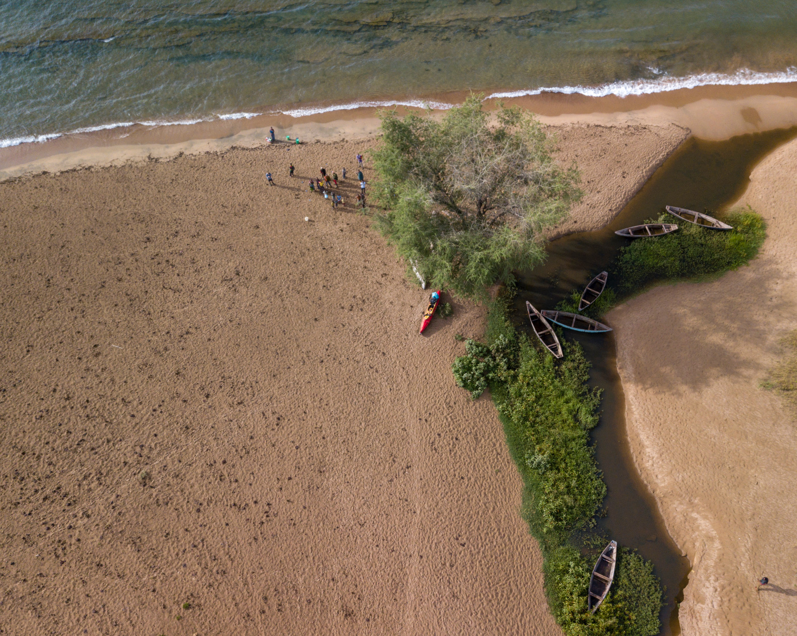
Before I go on about this leg of the expedition, I’d like to give an update on expedition ethics. When I came up with the idea of this trip, I decided that I wanted to do it in the best style possible. To me, that meant solo, human powered, and without a support team. I intended to carry all of my equipment along with me, resulting in no reliance on others – truly unsupported.

Unfortunately, I found that the weight of my equipment made it impossible to bicycle between lakes considering the topography along my route. So, begrudgingly, I made the decision to send the kayak ahead to Lake Tanganyika where I met up with it after about a week of bicycling. I’m still going strong on the other aspects that I am striving for: solo, human powered, and without a support team. But I can’t claim entirely unsupported anymore. Perhaps someone will come along in the future and improve on my style.

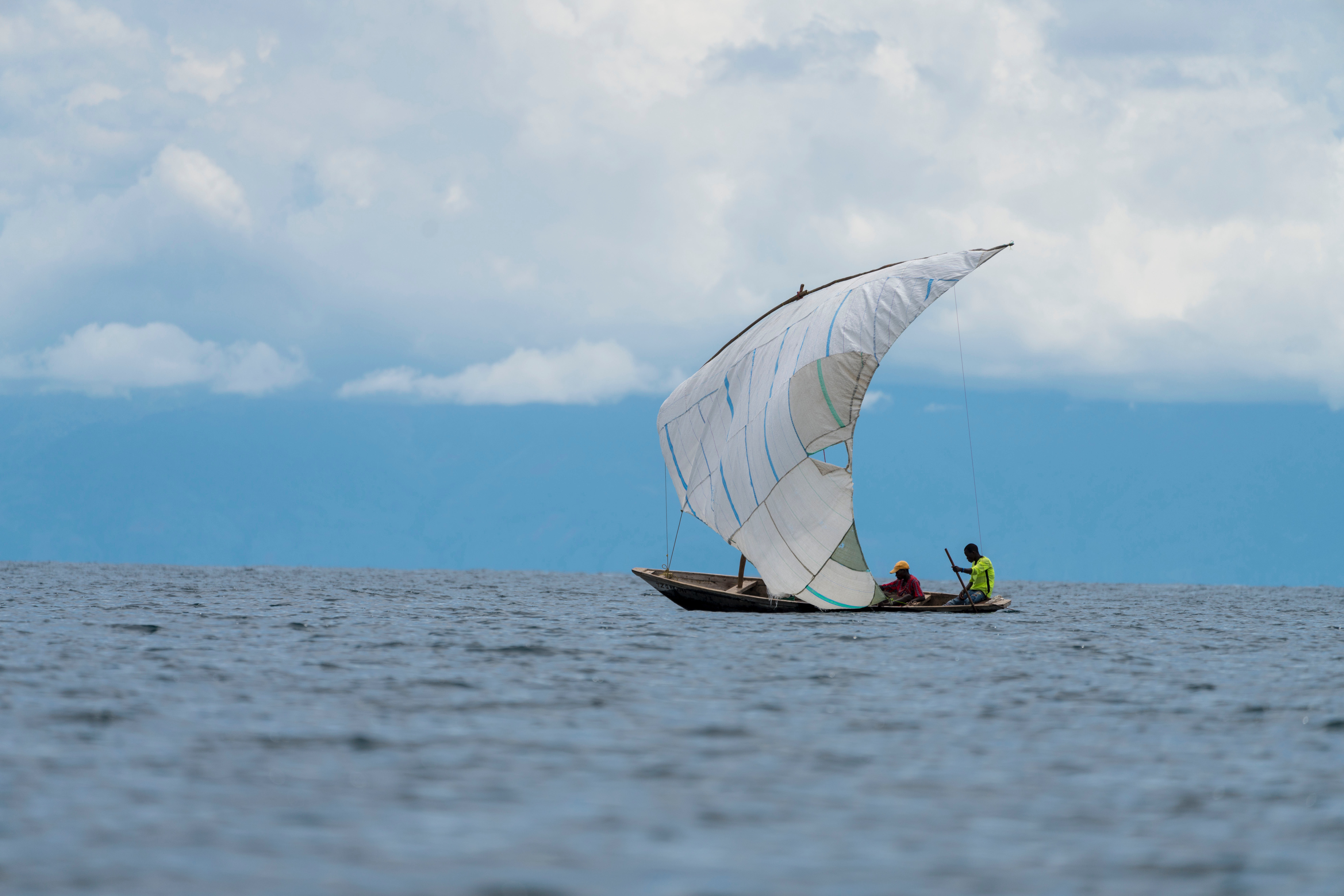
I started Lake Tanganyika at Kasanga, near the Tanzanian border with Zambia. From there, the lake stretches out as far as you can see to the north. It’s rather narrow there though, so you can see across to Zambia and the DRC.

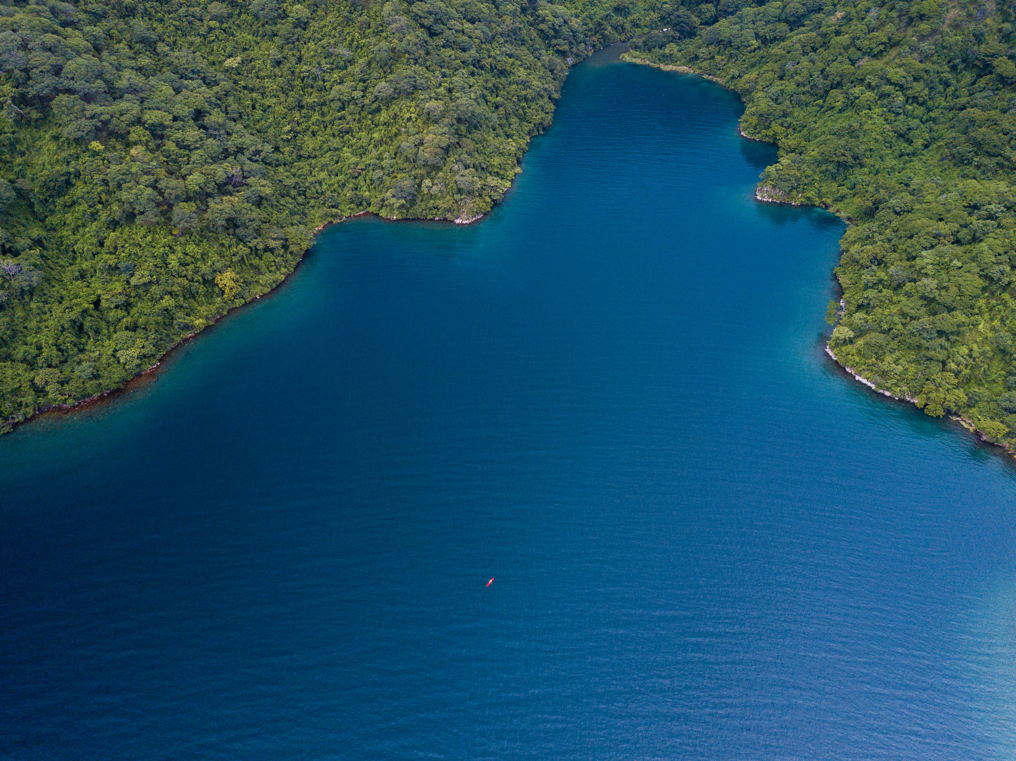
The southern portion of the lake, between Kasanga and Kipili is extraordinarily beautiful. The lake is deep, with clear, blue water and a dramatic shoreline of mountains and large boulders – many larger than a house. With the exception of one day, the weather was calm and I made good time of about 25 miles a day.

This area is not very populated, so I split my time between “bush” camping on wild beaches and staying in small fishing villages. Staying in the fishing villages was a similar experience to Lake Malawi, except that very few people in this region speak English, so communication was more difficult.
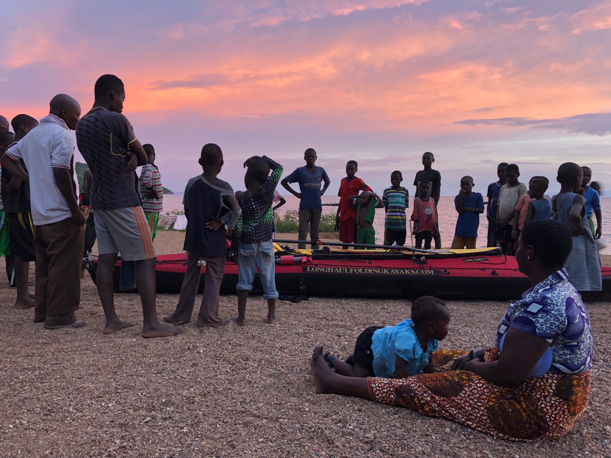
With the benefit of having experienced two full lakes, I can confidently say that this southern section, as well as Mahale Mountain National Park, are the most beautiful paddling segments so far. I think that any paddler would find Kasanga to Kipili to be extraordinarily rewarding, and worthy of consideration as a world class sea kayaking destination.

This section ended at Lake Shore Lodge in Kipili. It’s a really cool place that must feel like the end of the Earth to most guests arriving there, but to me it felt more like going back into civilization. The two South African owners, Louise and Chris, hosted me and provided luxuries that I had grown unaccustomed to on the water. They have vast experience on the lake, including long sea kayaking trips and a fleet of boats (even equipped with a compressor for SCUBA), so I greatly enjoyed sharing my experiences with them and soliciting as much advice as possible.

I headed out from Kipili feeling good, and completely unaware of the challenge that I was going to face.

If you had asked me before this lake what I was most concerned about, I would’ve probably said crocodiles or hippos or maybe getting sick in such a remote area. As it turns out, something called Rukuga was going to be my biggest obstacle.

That first day out of Kipili, I enjoyed calm weather until late afternoon. At that point, a strong north wind started blowing and I headed to a beach to see if it would stop. After about an hour, I decided to spend the night there. The beach was only about 10 feet wide and before a steep sand bank went up about another ten feet. I set up my tent up on the bank, but something seemed ominous about my boat below, so I decided that I needed to bring it up also.

This wasn’t so easy because I’m paddling a tandem Long Haul Folding Kayak – a capable, but not light, boat. What I ended up doing was flipping it several times, basically rolling it up the hill. It worked, and I made dinner and went to bed.

In the night, an extremely powerful storm came through. It was one of those storms that pulls the tent stakes out of the ground immediately and makes you sit up and brace the tent for fear that the poles will snap.

In the morning, much to my surprise, the beach below was completely gone and there were only jagged rocks present. The waves from the storm has pounded the beach and removed all of the sand. The lake itself seemed angry, with serious wind chop and about a 15 knot north wind. Still, I felt that it would likely pass by midday and I might as well head out.

I paddled north and made very poor progress due to the north wind. It formed rolling waves of 6-9 feet and required power to overcome. In 10 hours of paddling, I managed a measly 19 miles. That certainly didn’t match the effort that I had expended.

I stopped in a village for the night. Here, I was actually able to connect to the Internet and look at the weather forecast. It’s hard to explain how it felt to see that the forecast called for 10-15 knot north winds for at least the next week. It seemed that there was a point, basically the northern terminus of Mahale Mountain National Park, where a west wind from the Congo would split north and south. It was about 100 miles away, and I didn’t see any alternative to just forcing my way through it, as unappealing as that seemed. I certainly couldn’t wait for a week and hope that it would stop.

I’d later find out that this wind is called Rukuga, and it’s a seasonal north wind that brings rain. It usually only lasts 2-3 days, but occasionally lasts longer. In this case, it seemed like I’d need to pass it myself rather than wait for it to end.

The next few days were difficult. I’d paddle for about 10 hours and only manage 17-20 miles a day. The topography of the shoreline didn’t give me much shelter, and because of the strength of the wind, I was forced to paddle consistently for fear of being blown backwards and losing ground.

Eventually, I made it to where the land mass juts out into the lake and forms Mahale Mountain National Park. I planned on paddling around a point and then camping just outside the southern boundary of the park. From there, I’d have to cover 30 miles on the following day to make it to a lodge, Greystoke Camp, where I would spend the night. Although I had been averaging under 20 miles a day, I was still hopeful that I could make it to Greystoke in one day. This was especially true because Mahale has a large hippo and crocodile population and poor beaches for landing and camping safely.

As I paddled out to the point, I was still heading into the wind. I wasn’t sure if it was wrapping around the land, or truly blowing from the west, but when I turned the corner it was extremely rough and the wind was blowing furiously from the north. Although the waves were close to 10 feet, they were rolling waves and weren’t dangerous to me, but I quickly realized that I couldn’t make progress in those conditions so I turned back around for the shelter of the point.

I went back out twice more, but found that the conditions hadn’t improved and realized that I would need to camp there for the night. This was a low point, as I was 6 miles south of the park boundary and certainly 36 miles made Greystoke out of reach. I assumed that I’d need two days of struggling against headwinds to make it to camp, which meant a night alone in the National Park.

In the morning I paddled out and, shockingly, found a south wind! By 1230, I reached the best looking landing site from the satellite maps and had to make a decision – stop here for the day or push on to Greystoke. If I went forward, I probably had to make it because it didn’t seem like there were any other good places to pull out in the next 15 miles.

But it was only 12:30, and despite an uneasy feeling that the wind would turn, I headed north. Amazingly, the wind did not turn, and after a week of brutal north winds, on the day that I really needed help, the winds completely changed direction and helped me paddle my new one day record, 36 miles.
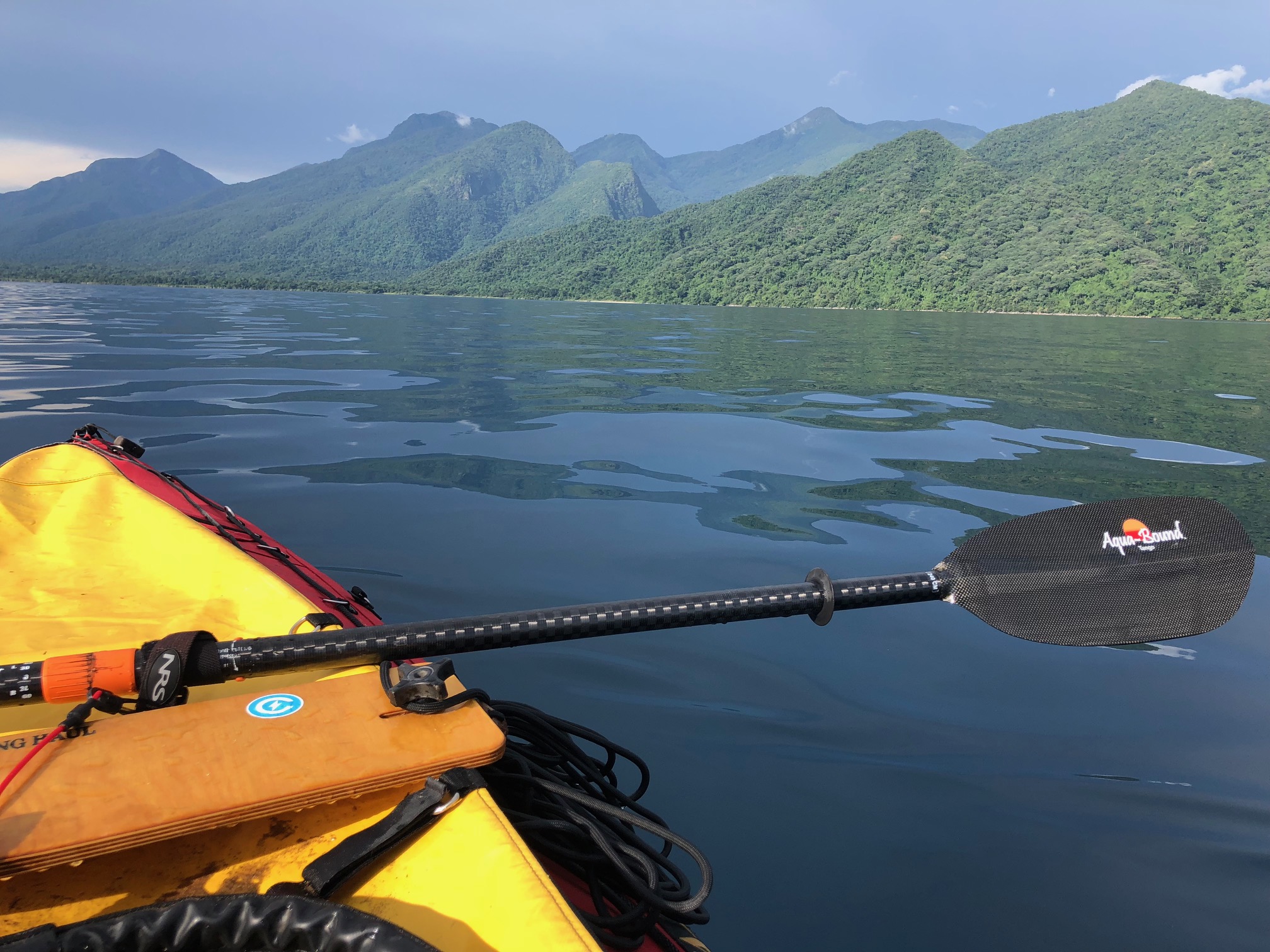
Mahale Mountain National Park is an incredible landscape of several thousand foot mountains, covered in thick tropical jungle, abruptly falling down into the blue lake below. When I was paddling south of Greystoke, I started to hear this loud series of noises emanating from the forest above. There was no question what it was: a community of chimpanzees were warning about my presence.

Arriving at Greystoke was such a remarkable feeling. I felt proud to arrived there in the manner that I had and so grateful for their warm welcome. Greystoke is a remote, luxury camp which rivals any camp in Africa. It’s only accessible by water and air, and has direct access to semi-habituated communities of chimpanzees.

The architecture of the main building immediately signaled what this place was like: open air, constructed of natural and local materials, but exquisite and immaculate. That night I had dinner with the other guests and the managers, Fabio and Barbara, and regaled them stories of my current expedition, as well as some older classics. I told my Amazon pirate story, as I do whenever it seems marginally relevant. I went to sleep happy.

The company and hospitality of everyone at Greystoke, the creature comforts of the camp, and the knowledge that I had made it to within a stone’s throw of the dividing line of the Rukuga wind, only a few miles to my north, had resulted in a foundational change in my attitude. My faith that I would succeed on this lake was renewed.

The next day was a blur of pleasure. I went out and observed a group of chimpanzees, 14 in total including multiple babies. Although Mahale Mountain National Park’s sister park, Gombe Stream National Park is perhaps more famous due to the fact that it was the location of Jane Goodall’s work, Mahale is larger, wilder, and contains many times more chimpanzees. It has also hosted researchers since the 1960s. This has resulted in communities of semi-habituated chimpanzees that will allow you to observe them at close range without aggression. At times, I was within a few feet of them. Without overly anthropomorphizing our close relatives, they really did seem to have interesting, human like behaviors. At times there were disputes within the group and they would make noises and scatter. Then they would draw back in to a tighter unit. Mothers cared for the babies, who played and explored. It was magical.

The next morning I was of course sad to go, but my psyche was entirely different than it had been before Mahale and Greystoke. I enthusiastically paddled north out of the park and towards my last scheduled stop on the lake: The Nature Conservancy’s (TNC) Tuungane Project office in Buhingu.

In Buhingu, I met with TNC resident experts who were working at the Buhingu office. They graciously allowed me to spend 2 nights there, and observe some of the work that they were doing. Just by chance, I was there during a training session of people from the different communities. Each of the 16 villages had sent their two best people to be trained on climate smart agriculture by their instructor, Apollinaire Williams. In the morning there was a classroom session, and in the afternoon we went out to the field, where Apollinaire instructed them on how to collect field data, identify suitable agricultural areas, and appropriate planning for sustainable agriculture. I think that TNC is unique in that it has the capacity and expertise to train people to contribute to the project.

After that, I went and met with Jeremiah Daffa, who is the Governance and Gender Officer at the Buhingu office. We attended a practice of the Mahale Youth Drummer Group, who have been organized under the Tuungane Project’s “model household” initiative. The members of the group were educated on family planning, gender equity, and environmental sustainability, and then they have written their own songs which they perform in different villages to educate other people. Jeremiah’s other work include initiatives to prevent early pregnancies, address the problem of girls not reaching secondary school, preventing the production of bush charcoal (a job predominantly carried out by women), and working to make sure that there are beneficial relationships between the Tuungane Project and other stakeholder, partner, and related organizations, such as the local, regional, and national governments, Pathfinder International, the Jane Goodall Institute, and the Frankfurt Zoological Society.

Again, I left there in high spirits. The Tuungane is doing good work, and their Population, Health, and Environment approach to conservation has me very optimistic about the region.

The remaining portion of the lake was unremarkable. The weather was good and I was able to make swift progress, paddling 75 miles in my final 2 days. I did start to meet Congolese and Burundian people, who had come to Tanzania to escape the turmoil of their own countries. The population closer to Kigoma is larger and the lake is more obviously impacted.

I reached Kigoma, the most remote large town in Tanzania, about 3 weeks after I set out from Kasanga. Despite the challenges, my time on Tanganyika was incredibly special, and I urge others to go visit. It’s world class.

Right now I’m biking between Lake Tanganyika and Lake Victoria, and I’ll check back in with updates soon.